.mw-parser-output .hidden-begin{box-sizing:border-box;width:100%;padding:5px;border:none;font-size:95%}.mw-parser-output .hidden-title{font-weight:bold;line-height:1.6;text-align:left}.mw-parser-output .hidden-content{text-align:left}@media all and (max-width:500px){.mw-parser-output .hidden-begin{width:auto!important;clear:none!important;float:none!important))You can help expand this article with text translated from the corresponding article in German. (December 2009) Click [show] for important translation instructions.
View a machine-translated version of the German article.
Machine translation, like DeepL or Google Translate, is a useful starting point for translations, but translators must revise errors as necessary and confirm that the translation is accurate, rather than simply copy-pasting machine-translated text into the English Wikipedia.
Consider adding a topic to this template: there are already 9,152 articles in the main category, and specifying|topic= will aid in categorization.
Do not translate text that appears unreliable or low-quality. If possible, verify the text with references provided in the foreign-language article.
You must provide copyright attribution in the edit summary accompanying your translation by providing an interlanguage link to the source of your translation. A model attribution edit summary is Content in this edit is translated from the existing German Wikipedia article at [[:de:Atzgersdorf]]; see its history for attribution.
You may also add the template ((Translated|de|Atzgersdorf)) to the talk page.
For more guidance, see Wikipedia:Translation.
| Atzgersdorf | |
|---|---|
| Emblem | Map |
 |
 |
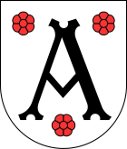
Atzgersdorf (German pronunciation: [ˈat͡sɡɐsˌdɔʁf] ; Central Bavarian: Atzgasduaf) is a former municipality in Lower Austria that is now a part of the 23rd Viennese district Liesing. A small part of the former municipality today is part of the 12th Viennese district Meidling.
Today, the cadastral commune Atzgersdorf has an area of 411,42 hectares. The part that belongs to Meidling has an area of 35 hectares.