• Basse Casamance National Park
  • Parc National de la Basse Casamance
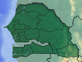
Map showing the location of Basse Casamance National Park Parc National de la Basse Casamance
Senegal
LocationZiguinchor
Nearest cityOussouye
Coordinates12°23′45″N 16°35′40″W / 12.39583°N 16.59444°W / 12.39583; -16.59444
Area50 km²
Established1970
Official website of the Ministry of Environment and Sustainable Development of Senegal (archived)

Basse Casamance National Park (French: Parc National de la Basse Casamance), located near Oussouye in Ziguinchor, is one of six national parks in Senegal. It is currently closed.[when?]
History

The park was created in 1970.

Characteristics

It encompasses an area of 5,000 hectares (12,000 acres).

The main biotopes are Guinean forests and savannah woodlands.

Fauna

There are 200 species of birds and fifty species of mammals, including African forest buffalo, African leopard, Campbell's mona monkey, Prince Demidoff's bushbaby and western red colobus.

Tourism

The site is located 20 kilometres (12 mi) from Cap Skirring Airport.

Because of the Casamance conflict, the park, possibly contaminated with land mines, has been closed to visitors for several years.[timeframe?]

See also

References