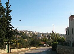
Beit Safafa (Arabic: بيت صفافا, Hebrew: בית צפאפא) is an Arab neighborhood in south Jerusalem midway between the Jerusalem neighborhoods of Patt and Gilo, on the outskirts of Bethlehem.[1] Beit Safafa had a population of 5,463 in 2000. It covers an area of 1,577 dunams.[2]
History
In 1596, Beit Safafa appeared in Ottoman tax registers as being in the Nahiya of Quds of the Liwa of Quds. It had a population of 41 Muslim households and paid taxes on wheat, barley, olives, grapes or fruit trees, and goats or beehives.[3]
In the wake of the 1948 Arab-Israeli War, the neighborhood was divided - with half in no man's land and the other half in the Jordanian-occupied West Bank. In 1967, after Israel's victory in the Six-Day War, the two parts of Beit Safafa were reunited. [4] The Palestinian residents of eastern Beit Safafa hold Jerusalem ID cards and the residents of the western part hold Israeli citizenship. This has created a unique and challenging situation where Palestinians in one neighborhood hold different residency statuses.
Education
Beit Safafa has three schools: Beit Safafa Elementary School, Beit Safafa High School and al-Salam School, a school for special needs children. Beit Safafa schools follow both the Israeli Bagrut curriculum and the Palestinian Tawjihi curriculum. In 1997, the Hand in Hand School for Bilingual Education was founded in Beit Safafa. The school, supported by the Israeli Ministry of Education and the Jerusalem Municipality, offers a bilingual curriculum in Hebrew and Arabic, with joint classes for Jewish and Arab children. The student population in 2007-2008 was 410, half Jewish and half Arab.[5]
References
- ^ New architecture in Beit Safafa New York Times
- ^ Foundation for Middle East Peace - Population in East Jerusalem, 2000
- ^ Wolf-Dieter Hütteroth and Kamal Abdulfattah (1977). Historical Geography of Palestine, Transjordan and Southern Syria in the Late 16th Century. Erlanger Geographische Arbeiten, Sonderband 5. Erlangen, Germany: Vorstand der Fränkischen Geographischen Gesellschaft. p. 116.
- ^ Fence is gone, there is still partition, Jordan Times
- ^ The Jerusalem Foundation
External links
31°44′37.96″N 35°12′20.19″E / 31.7438778°N 35.2056083°E