Size of this preview: 706 × 599 pixels. Other resolutions: 283 × 240 pixels | 566 × 480 pixels | 760 × 645 pixels.
Original file (760 × 645 pixels, file size: 190 KB, MIME type: image/png)
| This is a file from the Wikimedia Commons. Information from its description page there is shown below. Commons is a freely licensed media file repository. You can help. |
Summary
| Description |
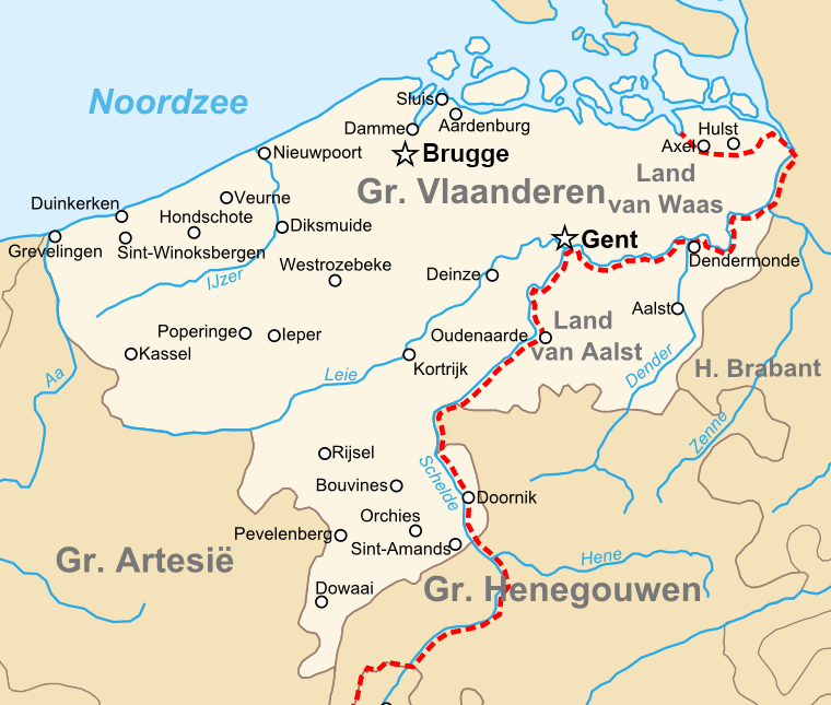
English: Map of the en:County of Flanders in the late 14th centry.
Nederlands: Kaart van het nl:Graafschap Vlaanderen in de Tweede helft van de 14e eeuw. |
| Date | 10 June 2008 (upload date) |
| Source | Own work |
| Author | Sir Iain |
Licensing
| I, the copyright holder of this work, release this work into the public domain. This applies worldwide. In some countries this may not be legally possible; if so: I grant anyone the right to use this work for any purpose, without any conditions, unless such conditions are required by law. |
| Annotations | This image is annotated: View the annotations at Commons |

.png)