Fontenay-aux-Roses | |
|---|---|
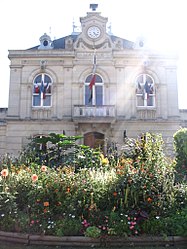
 The city hall | |
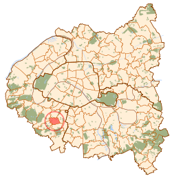
 Paris and inner ring départements | |
| Coordinates: 48°47′22″N 2°17′20″E / 48.78932°N 2.28877°E | |
| Country | France |
| Region | Île-de-France |
| Department | Hauts-de-Seine |
| Arrondissement | Antony |
| Canton | Châtillon |
| Intercommunality | Métropole du Grand Paris |
| Government | |
| • Mayor (2020–2026) | Laurent Vastel[1] |
| Area 1 | 2.51 km2 (0.97 sq mi) |
| Population (2021)[2] | 24,772 |
| • Density | 9,900/km2 (26,000/sq mi) |
| Time zone | UTC+01:00 (CET) |
| • Summer (DST) | UTC+02:00 (CEST) |
| INSEE/Postal code | 92032 /92260 |
| Elevation | 60–160 m (200–520 ft) |
| 1 French Land Register data, which excludes lakes, ponds, glaciers > 1 km2 (0.386 sq mi or 247 acres) and river estuaries. | |
Fontenay-aux-Roses (French pronunciation: [fɔ̃tnɛ o ʁoz] ⓘ) is a commune in the southwestern suburbs of Paris, France. It is located 8.6 km (5.3 mi) from the center of Paris.
In 1880, a girls school École Normale Supérieure was opened in the town. It was one of the most prestigious of Paris and even of whole France in term of scientific research. It became a mixed school in 1986, and was relocated to Lyon in 2000.
Fontenay is the location of the Commissariat à l'énergie atomique, and former location of the first French nuclear reactor, Zoé, and the first French tokamak fusion experiment, TFR.
The commune name originates from a local spring-fed stream (Latin fons, French fontaine) in the hillside descending from the Châtillon plateau, with "of roses" added to distinguish this commune from numerous French communes named Fontenay.
The climate of Fontenay-aux-Roses is oceanic gradient. The observation stations used for the weather in Fontenay are at Orly and the airport of Velizy-Villacoublay, municipalities located not far from Fontenay. The climate is characterised by sunshine and fairly low rainfall. The average rainfall is about 650 mm per year, spread over 111 rainy days on average, including 16 days of heavy rainfall (10 mm). Temperatures are mild; the coldest month is January with an average temperature of 4.7° C and the hottest months are July and August with a mean temperature of 20° C.
Severe weather conditions are sometimes recorded:
| Climate data for Fontenay-aux-Roses (1981–2010 normals, extremes 1981–2009) | |||||||||||||
|---|---|---|---|---|---|---|---|---|---|---|---|---|---|
| Month | Jan | Feb | Mar | Apr | May | Jun | Jul | Aug | Sep | Oct | Nov | Dec | Year |
| Record high °C (°F) | 16.5 (61.7) |
20.0 (68.0) |
25.0 (77.0) |
31.0 (87.8) |
32.0 (89.6) |
36.5 (97.7) |
37.5 (99.5) |
40.0 (104.0) |
34.0 (93.2) |
29.0 (84.2) |
21.0 (69.8) |
16.5 (61.7) |
40.0 (104.0) |
| Mean daily maximum °C (°F) | 7.0 (44.6) |
8.2 (46.8) |
12.2 (54.0) |
15.6 (60.1) |
19.8 (67.6) |
23.1 (73.6) |
25.7 (78.3) |
25.6 (78.1) |
21.4 (70.5) |
16.5 (61.7) |
10.8 (51.4) |
7.6 (45.7) |
16.2 (61.2) |
| Daily mean °C (°F) | 4.4 (39.9) |
5.1 (41.2) |
8.3 (46.9) |
11.0 (51.8) |
14.9 (58.8) |
18.0 (64.4) |
20.3 (68.5) |
20.1 (68.2) |
16.6 (61.9) |
12.6 (54.7) |
7.7 (45.9) |
5.2 (41.4) |
12.1 (53.8) |
| Mean daily minimum °C (°F) | 1.8 (35.2) |
2.1 (35.8) |
4.4 (39.9) |
6.4 (43.5) |
10.1 (50.2) |
12.9 (55.2) |
14.9 (58.8) |
14.7 (58.5) |
11.9 (53.4) |
8.7 (47.7) |
4.7 (40.5) |
2.6 (36.7) |
8.0 (46.4) |
| Record low °C (°F) | −16.0 (3.2) |
−11.0 (12.2) |
−7.5 (18.5) |
−2.0 (28.4) |
1.5 (34.7) |
5.0 (41.0) |
6.5 (43.7) |
6.0 (42.8) |
5.0 (41.0) |
−1.0 (30.2) |
−7.0 (19.4) |
−9.5 (14.9) |
−16.0 (3.2) |
| Average precipitation mm (inches) | 55.7 (2.19) |
46.2 (1.82) |
49.3 (1.94) |
53.3 (2.10) |
60.0 (2.36) |
48.5 (1.91) |
58.7 (2.31) |
55.3 (2.18) |
51.1 (2.01) |
63.7 (2.51) |
50.9 (2.00) |
60.3 (2.37) |
653.0 (25.71) |
| Average precipitation days (≥ 1.0 mm) | 11.5 | 9.9 | 11.2 | 10.3 | 10.6 | 8.7 | 8.6 | 7.7 | 8.5 | 10.6 | 10.8 | 11.6 | 120.0 |
| Source: Météo-France[3] | |||||||||||||
Fontenay-aux-Roses is served by Fontenay-aux-Roses station on Paris RER line B and Tram line 6 from Chatillon Montrouge metro to Viroflay. In addition, several bus lines 194, 294, 394, 390, 162, 195... cross the city to Paris and other suburban cities.
|
| ||||||||||||||||||||||||||||||||||||||||||||||||||||||||||||||||||||||||||||||||||||||||||||||||||||||||||||||||||
Graphs are unavailable due to technical issues. There is more info on Phabricator and on MediaWiki.org. | |||||||||||||||||||||||||||||||||||||||||||||||||||||||||||||||||||||||||||||||||||||||||||||||||||||||||||||||||||
| Source: EHESS[4] and INSEE (1968–2017)[5] | |||||||||||||||||||||||||||||||||||||||||||||||||||||||||||||||||||||||||||||||||||||||||||||||||||||||||||||||||||
Primary schools in the commune:[6]
There is a public junior high school, Collège les Ormeaux.[7]
Lycée professionnel privé Saint François d'Assise, a private vocational high school, is in the commune.[8]
Links between Wiesloch and Fontenay-aux-Roses are very strong. Indeed, many school projects are organized each year.