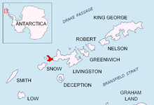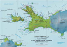


Sevar Point (Bulgarian: нос Севар, ‘Nos Sevar’ \'nos se-'var\) is a point on the south coast of Byers Peninsula on Livingston Island in the South Shetland Islands, Antarctica situated 1.9 km east-southeast of Devils Point, 2.71 km west of Nikopol Point, and 2.97 km northeast of Long Rock in Morton Strait. It is surmounted by Wasp Hill on the north-northeast, Sealer Hill on the east-northeast, and forms the east side of the entrance to Raskuporis Cove.
The point is named after Khan Sevar of Bulgaria, 738-754 AD.