No higher resolution available.
Karta_FP_Tuamotus_isl.PNG (800 × 550 pixels, file size: 12 KB, MIME type: image/png)
| This is a file from the Wikimedia Commons. Information from its description page there is shown below. Commons is a freely licensed media file repository. You can help. |
Summary
| Description |
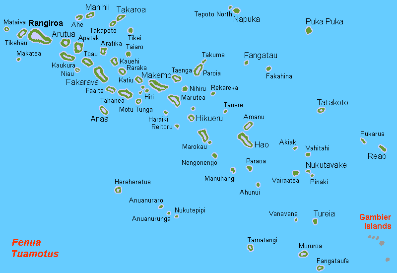
Deutsch: Karte der Tuamotusinseln, Französisch Polynesien
English: Map (rough) of the Tuamotus Islands, French Polynesia, own work composed from various mapreferences
Svenska: Karta över Tuamotusöarna, FP |
| Date | |
| Source | Own work |
| Author | Hobe / Holger Behr |
| Other versions |
Derivative works of this file: |
Licensing
| I, the copyright holder of this work, release this work into the public domain. This applies worldwide. In some countries this may not be legally possible; if so: I grant anyone the right to use this work for any purpose, without any conditions, unless such conditions are required by law. |


