Karta_ID_RajaAmpat_Isl.PNG (450 × 600 pixels, file size: 19 KB, MIME type: image/png)
| This is a file from the Wikimedia Commons. Information from its description page there is shown below. Commons is a freely licensed media file repository. You can help. |
| Description |
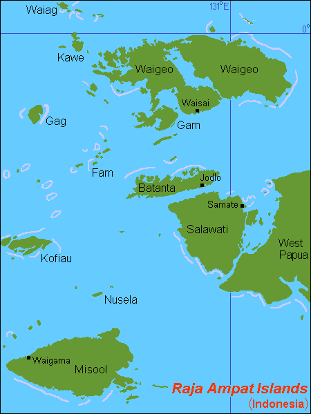
English: Map (rough) of Raja Ampat islands, Indonesia, own work composed from various mapreferences |
| Date | |
| Source | Own work |
| Author | Hobe / Holger Behr |
| This work has been released into the public domain by its author, I, Hobe. This applies worldwide. In some countries this may not be legally possible; if so: I, Hobe grants anyone the right to use this work for any purpose, without any conditions, unless such conditions are required by law. |
Click on a date/time to view the file as it appeared at that time.
| Date/Time | Thumbnail | Dimensions | User | Comment | |
|---|---|---|---|---|---|
| current | 11:01, 19 June 2023 | | 450 × 600 (19 KB) | Hobe | higher accuracy |
| 18:00, 8 July 2007 |  | 450 × 600 (21 KB) | Hobe | ((Information |Description=map Raja Ampat islands, Indonesia |Source=self-made, composed from various mapreferences |Date=2007-07-07 |Author= Hobe Category:Maps of Indonesia )) |
The following other wikis use this file:
View more global usage of this file.