Historical 1

Portal:Maps/Maps/Historical/1

World map from the Theatrum Orbis Terrarum
World map from the first modern atlas by Ortelius - Theatrum Orbis Terrarum, 1570

Historical 2

Portal:Maps/Maps/Historical/2

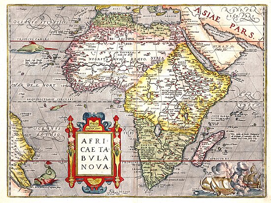
Africae tabula nova, 1570
Africae tabula nova, 1570.

Historical 3

Portal:Maps/Maps/Historical/3

Europe at the death of Charlemagne in 814
Europe at the death of Charlemagne in 814.

Historical 4

Portal:Maps/Maps/Historical/4

Worldmap from the Portolan Atlas by Battista Agnese, 1544
Worldmap from a portolan atlas showing the route that Magellan took around the world and the route from Cadiz, Spain, to Peru, 1544.

Historical 5

Portal:Maps/Maps/Historical/5

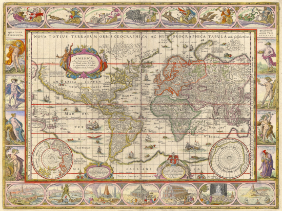
Nova totius terrarum orbis geographica ac hydrographica tabula, 1635
Credit: Willem Blaeu
Nova totius terrarum orbis geographica ac hydrographica tabula, from Atlas Novus, 1635.

Historical 6

Portal:Maps/Maps/Historical/6

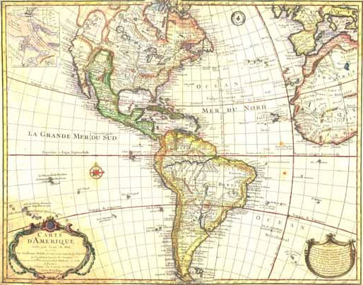
Carte d'Amérique, 1774
Carte d'Amérique, 1774.

Historical 7

Portal:Maps/Maps/Historical/7

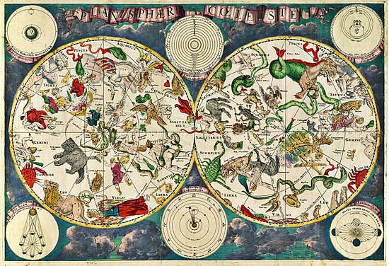
Celestial map from the 17th century
Credit: Frederik de Wit
Celestial map from the 17th century.

Historical 8

Portal:Maps/Maps/Historical/8

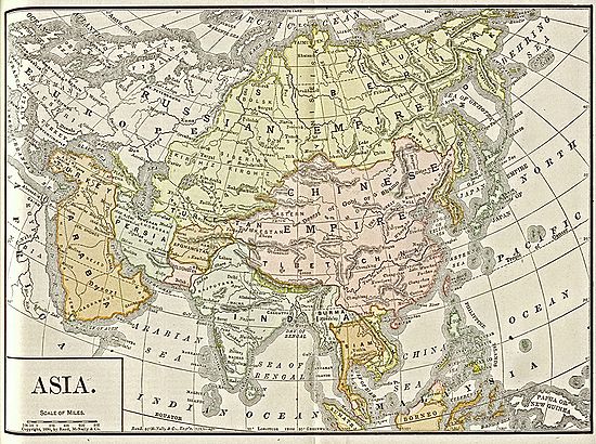
Map of Asia, 1892
Map of Asia, 1892
Map of Asia, 1892.

Historical 9

Portal:Maps/Maps/Historical/9

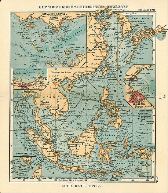
South China Sea, 1906
Map of the South China Sea, including inset maps of the Singapore Strait, Jokohama, Batavia and the Sunda Strait, 1906.

Historical 10

Portal:Maps/Maps/Historical/10
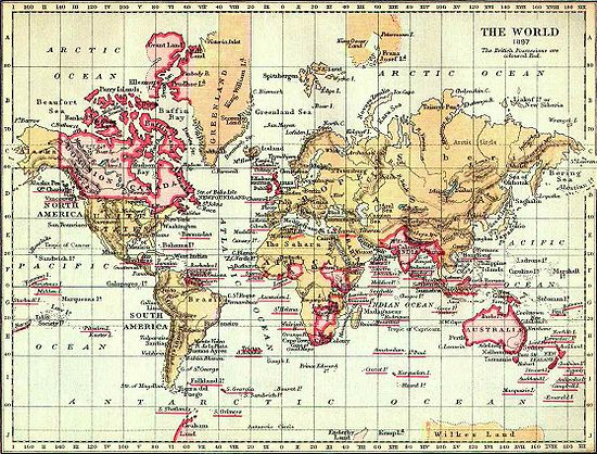
The British Empire, 1897
Credit: Nickshanks
Map of the world from 1897. The British Empire (marked in pink) was the superpower of the 19th century.

Historical 11

Portal:Maps/Maps/Historical/11

Ursa Major
Ursa Major
Astronomical chart showing a bear forming the constellation Ursa Major, 1825.

Historical 12

Portal:Maps/Maps/Historical/12

Early map of North America
Credit: Claude Bernou, David.Monniaux
Map of North America during the 17th century.