Ruta 510 | ||||
Route information | ||||
Maintained by Puerto Rico DTPW | ||||
Length | 10.3 km[1][2] (6.4 mi) | |||
Major junctions | ||||
South end | ![]() | |||
| ||||
North end | ![]() | |||
Location | ||||
Country | United States | |||
Territory | Puerto Rico | |||
Municipalities | Ponce, Juana Díaz | |||
Highway system | ||||
| ||||
|
Puerto Rico Highway 510 (PR-510) is a tertiary[3] highway in southern Puerto Rico. The road runs north to south in a general south-southwestern direction. The road connects PR-1 in Barrio Capitanejo, Ponce, to PR-14 in the town of Juana Díaz. Portions of the Juana Díaz portion of the road were damaged in September 2017 by Hurricane Maria.[4]
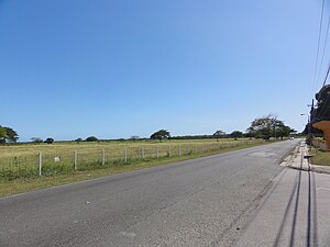
Municipality | Location | km[1][2] | mi | Destinations | Notes |
---|---|---|---|---|---|
Ponce | Capitanejo | 0.0 | 0.0 | ![]() | Southern terminus of PR-510 |
Juana Díaz | Sabana Llana | 1.1– 1.2 | 0.68– 0.75 | ![]() | |
2.3– 2.4 | 1.4– 1.5 | ![]() | |||
Amuelas | 5.3 68.3[a] | 3.3 42.4 | ![]() | Northern terminus of PR-149 concurrency | |
68.5[a] 5.4 | 42.6 3.4 | ![]() | Southern terminus of PR-149 concurrency | ||
9.5 | 5.9 | ![]() | |||
Tijeras | 10.3 | 6.4 | ![]() | Northern terminus of PR-510 | |
1.000 mi = 1.609 km; 1.000 km = 0.621 mi
|
Location | Ponce – Juana Díaz |
---|---|
Length | 1.4 km[5] (0.87 mi) |
Puerto Rico Highway 5510 (PR-5510) is a spur route located in between Ponce and Juana Díaz. It begins at PR-1 in Barrio Capitanejo and ends at its junction with PR-510 in Barrio Sabana Llana.[6]
Municipality | Location | km[5] | mi | Destinations | Notes |
---|---|---|---|---|---|
Ponce | Capitanejo | 0.0 | 0.0 | ![]() | Southern terminus of PR-5510 |
Juana Díaz | Sabana Llana | 1.4 | 0.87 | ![]() | Northern terminus of PR-5510 |
1.000 mi = 1.609 km; 1.000 km = 0.621 mi |