Highway 873 | ||||
|---|---|---|---|---|
| Ruta 873 | ||||
| Route information | ||||
| Maintained by Puerto Rico DTPW | ||||
| Length | 1.7 km[1] (1.1 mi) | |||
| Major junctions | ||||
| South end | ||||
| North end | ||||
| Location | ||||
| Country | United States | |||
| Territory | Puerto Rico | |||
| Municipalities | San Juan, Guaynabo | |||
| Highway system | ||||
| ||||

Puerto Rico Highway 873 (PR-873) is a north–south road located between the municipalities of San Juan and Guaynabo, Puerto Rico,[2] and it corresponds to an original segment of the historic Carretera Central.[3] The General Norzagaray Bridge is located on this route.[3]
-
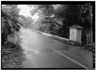 General Norzagaray Bridge looking south
 -
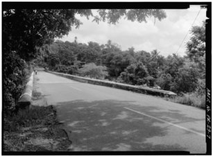 General Norzagaray Bridge looking north