.mw-parser-output .hidden-begin{box-sizing:border-box;width:100%;padding:5px;border:none;font-size:95%}.mw-parser-output .hidden-title{font-weight:bold;line-height:1.6;text-align:left}.mw-parser-output .hidden-content{text-align:left}@media all and (max-width:500px){.mw-parser-output .hidden-begin{width:auto!important;clear:none!important;float:none!important))You can help expand this article with text translated from the corresponding article in Dutch. (March 2010) Click [show] for important translation instructions.
View a machine-translated version of the Dutch article.
Machine translation, like DeepL or Google Translate, is a useful starting point for translations, but translators must revise errors as necessary and confirm that the translation is accurate, rather than simply copy-pasting machine-translated text into the English Wikipedia.
Do not translate text that appears unreliable or low-quality. If possible, verify the text with references provided in the foreign-language article.
You must provide copyright attribution in the edit summary accompanying your translation by providing an interlanguage link to the source of your translation. A model attribution edit summary is Content in this edit is translated from the existing Dutch Wikipedia article at [[:nl:Raadhuisstraat]]; see its history for attribution.
You should also add the template ((Translated|nl|Raadhuisstraat)) to the talk page.
For more guidance, see Wikipedia:Translation.


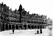
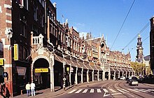
Raadhuisstraat is a street in Downtown Amsterdam, in the Netherlands. It is located between Nieuwezijds Voorburgwal and Prinsengracht. The street is named after the former City Hall or Town Hall, now the Royal Palace and it contains the gallery. It is the main thoroughfare into Old Centre.[1]
Raadhuisstraat was built in 1895.[2] Streets off of Raadhuisstraat are named after the many tanneries that used to be in the area. The street is noted for its shopping, a shopping area called the "Nine Streets," where vendors sell goods varying from handmade chocolates, high end personal goods and home decorum.[1] A tramline was later introduced.