| Stanton Formation | |
|---|---|
| Stratigraphic range: Late Pennsylvanian | |
| Type | Formation |
| Unit of | Lansing Group |
| Sub-units | Captain Creek Limestone, Eudora Shale, Rock Lake Shale, Stoner Limestone, Tyro Oolite |
| Underlies | Weston Shale Member of the Stranger Formation |
| Overlies | Vilas Shale |
| Lithology | |
| Primary | Limestone, shale |
| Other | Mudstone |
| Location | |
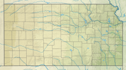
| Coordinates | 38°18′N 95°18′W / 38.3°N 95.3°W |
| Approximate paleocoordinates | 3°36′S 28°30′W / 3.6°S 28.5°W |
| Region | Nebraska, Iowa, Missouri & Kansas |
| Country | |
| Type section | |
| Named for | Stanton |

The Stanton Formation is a geologic formation of limestone in Iowa, Nebraska, Missouri and Kansas. It preserves fossils dating back to the Carboniferous period. It is in the Upper Pennsylvanian series, forming the top of the Lansing Group.[1]

