| Quartermain Mountains | |||
| fjellkjede | |||
| Land | |||
|---|---|---|---|
| Stad | Victoria Land | ||
| - koordinatar | 77°51′S 160°45′E / 77.850°S 160.750°E | ||
| Administrert under | Antarktistraktaten | ||
 Quartermain Mountains 77°51′S 160°45′E / 77.85°S 160.75°E | |||
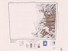
Quartermain Mountains er ei gruppe eksponerte fjell i Antarktis, som strekkjer seg over 30 km ved McMurdo Dry Valleys i Victoria Land, sør for Taylorbreen ved Finger Mountain, Mount Detdsley, Mount Feather og Tabular Mountain. Andre fjell i fjellkjeda er Knobhead, Terra Cotta Mountain, New Mountain, Beacon Heights, Pyramid Mountain, Arena Valley, Kennar Valley, Turnabout Valley og fleire dalar og ryggar i Beacon Valley.[1]
Fjella vart vitja av dei britiske ekspedisjonane leia av Robert Falcon Scott (1901-04 og 1910-13) og Ernest Shackleton (1907-09), som gav fleire namn til området. Denne fjellkjeda vart namngjeven av New Zealand Antarctic Place-Names Committee (NZ-APC) i 1977 etter Lester Bowden Quartermain, ein antarktisk historikar frå New Zealand.[1]
Fjell
[endre | endre wikiteksten]- Mount Benninghoff er eit stort sett isfritt fjell (1965 moh), 2,8 km søraust for Terra Cotta Mountain. Ho vart namngjeven av Advisory Committee on Antarctic Names (US-ACAN) i 1993 etter William S. Benninghoff (1918-93), som var botanikkprofessor ved University of Michigan, 1957-88, og som vitja Antarktis fleire gonger i 1968, 1976, 1977 og 1989. Han var sidan medlemm av Polar Research Board under National Academy of Sciences, 1966-86.[2]
- Mount Feather er eit massivt fjell, 3010 moh, med ein vid, flat topp, heilt sør i Quartermain Mountains. Det er kalla opp etter Thomas A. Feather, sm var båtsmann på «Discovery» i løpet av Discovery-ekspedisjonen (1901-04), som var med Scott på reisa hans vestover i området i 1903.[3]
- Finger Mountain er eit langstrekt fjell på 1920 moh på nordsida av Turnabout Valley. Det fekk dette namnet av Discovery-ekspedisjonen (1901-04) fordi ei lang tunge med doleritt mellom eit sandsteinlag som såg ut som ein finger.[4]
- Pyramid Mountain er eit fjell som ser ut som ein pyramide, på 2120 moh, mellom Turnabout Valley og munningen av Beacon Valley. Namnet dukka først opp på kart etter Terra Nova-ekspedisjonen (R.F. Scott), 1910-13, men fjellet vart nesten garantert oppdaga under den første ekspedisjonen til Scott, 1901-04.[5]
- Tabular Mountain er ei breitt fjell med flat topp, 2740 moh, kring 10 km nord-nordvest for Mount Feather. Det skildrande namnet vart gjeve av Discovery-ekspedisjonen, 1901-04.[6]
- Terra Cotta Mountain er eit fjell mellom Windy Gully og Knobhead, på sørsida av Taylorbreen. Det skildrande namnet vart nytta av Discovery-ekspedisjonen, 1901-04.[7]
Kjelder
[endre | endre wikiteksten]- Denne artikkelen bygger på «Quartermain Mountains» frå Wikipedia på engelsk, den 27. februar 2013.
- Wikipedia på engelsk oppgav desse kjeldene:
- ↑ 1,0 1,1 «Quartermain Mountains». Geographic Names Information System. United States Geological Survey, United States Department of the Interior. Henta 27. februar 2013.
- ↑ «Mount Benninghoff». Geographic Names Information System. United States Geological Survey, United States Department of the Interior. Henta 27. februar 2013.
- ↑ «Mount Feather». Geographic Names Information System. United States Geological Survey, United States Department of the Interior. Henta 27. februar 2013.
- ↑ «Finger Mountain». Geographic Names Information System. United States Geological Survey, United States Department of the Interior. Henta 27. februar 2013.
- ↑ «Pyramid Mountain». Geographic Names Information System. United States Geological Survey, United States Department of the Interior. Henta 27. februar 2013.
- ↑ «Tabular Mountain». Geographic Names Information System. United States Geological Survey, United States Department of the Interior. Henta 27. februar 2013.
- ↑ «Terra Cotta». Geographic Names Information System. United States Geological Survey, United States Department of the Interior. Henta 27. februar 2013.
![]() Denne artikkelen inneheld stoff som er offentleg eige frå United States Geological Survey-artikkelen «Quartermain Mountains» (innhald frå Geographic Names Information System).
Denne artikkelen inneheld stoff som er offentleg eige frå United States Geological Survey-artikkelen «Quartermain Mountains» (innhald frå Geographic Names Information System).

