Haskell County | |
---|---|
Haskell County Court House in Sublette (2010) | |
![]() Location within the U.S. state of Kansas | |
![]() Kansas's location within the U.S. | |
Coordinates: 37°34′00″N 100°52′01″W / 37.5667°N 100.867°W | |
Country | ![]() |
State | ![]() |
Founded | March 23, 1887 |
Named for | Dudley Haskell |
Seat | Sublette |
Largest city | Sublette |
Area | |
• Total | 578 sq mi (1,500 km2) |
• Land | 578 sq mi (1,500 km2) |
• Water | 0.4 sq mi (1 km2) 0.06% |
Population | |
• Total | 3,780 |
• Density | 6.5/sq mi (2.5/km2) |
Time zone | UTC−6 (Central) |
• Summer (DST) | UTC−5 (CDT) |
Congressional district | 1st |
Website | HaskellCounty.org |
Haskell County (county code HS) is a county in the U.S. state of Kansas. In 2020, 3,780 people lived there.[1] Its county seat is Sublette. Sublette is also the biggest city in Haskell County.[2]
Haskell County was created in 1887.[3] It was named for Dudley C. Haskell, a former member of Congress.[4]
John M. Barry concluded that Haskell County was the where the first case of the 1918 flu pandemic (nicknamed "Spanish flu") happened, which killed between 21 and 100 million people.[5]
The railroad and the development of oil and gas fields in the 1930s helped the economy of the area a lot. This helped overcome the "dust bowl" of that period.[6] Haskell County was one of the hardest hit counties in the Midwest during the drought of 1930-1937.
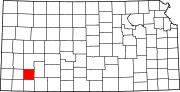
The U.S. Census Bureau says that the county has a total area of 578 square miles (1,500 km2). Of that, 578 square miles (1,500 km2) is land and 0.4 square miles (1.0 km2) (0.06%) is water.[7]
Haskell County is the flattest county in Kansas.[8]
Historical population | |||
---|---|---|---|
Census | Pop. | %± | |
1890 | 1,077 | — | |
1900 | 457 | −57.6% | |
1910 | 993 | 117.3% | |
1920 | 1,455 | 46.5% | |
1930 | 2,805 | 92.8% | |
1940 | 2,088 | −25.6% | |
1950 | 2,606 | 24.8% | |
1960 | 2,990 | 14.7% | |
1970 | 3,672 | 22.8% | |
1980 | 3,814 | 3.9% | |
1990 | 3,886 | 1.9% | |
2000 | 4,307 | 10.8% | |
2010 | 4,256 | −1.2% | |
2020 | 3,780 | −11.2% | |
U.S. Decennial Census[9] 1790-1960[10] 1900-1990[11] 1990-2000[12] 2010-2020[1] |
Haskell County is very Republican. However, in 2016, the Democratic candidate (Hillary Clinton) got a higher share of the county's vote than Barack Obama did in 2012. The last time Haskell County was won by a Democratic candidate was 1964 by Lyndon B. Johnson.
Year | Republican | Democratic | Third Parties |
---|---|---|---|
2020 | 79.6% 1,122 | 19.0% 268 | 1.4% 20 |
2016 | 76.8% 1,040 | 18.1% 245 | 5.1% 69 |
2012 | 83.0% 1,159 | 15.4% 215 | 1.6% 22 |
2008 | 81.3% 1,277 | 17.7% 278 | 1.0% 15 |
2004 | 84.8% 1,356 | 14.2% 227 | 1.0% 16 |
2000 | 81.9% 1,323 | 16.3% 263 | 1.9% 30 |
1996 | 73.6% 1,143 | 19.6% 304 | 6.9% 107 |
1992 | 56.0% 1,023 | 18.4% 336 | 25.6% 467 |
1988 | 67.4% 964 | 29.9% 427 | 2.7% 39 |
1984 | 79.3% 1,152 | 19.5% 283 | 1.2% 17 |
1980 | 67.7% 1,014 | 25.0% 374 | 7.4% 111 |
1976 | 52.0% 761 | 46.2% 676 | 1.8% 27 |
1972 | 71.6% 1,036 | 26.5% 383 | 2.0% 29 |
1968 | 54.2% 762 | 33.8% 476 | 12.0% 169 |
1964 | 40.5% 570 | 58.2% 820 | 1.4% 19 |
1960 | 64.2% 853 | 35.5% 471 | 0.3% 4 |
1956 | 70.5% 829 | 29.0% 341 | 0.5% 6 |
1952 | 74.3% 870 | 24.2% 283 | 1.5% 18 |
1948 | 54.7% 592 | 43.0% 466 | 2.3% 25 |
1944 | 59.9% 520 | 39.4% 342 | 0.7% 6 |
1940 | 58.5% 607 | 40.9% 425 | 0.6% 6 |
1936 | 41.4% 442 | 58.6% 626 | 0.1% 1 |
1932 | 40.5% 456 | 56.8% 639 | 2.8% 31 |
1928 | 73.4% 646 | 25.2% 222 | 1.4% 12 |
1924 | 65.1% 493 | 22.1% 167 | 12.8% 97 |
1920 | 69.6% 444 | 23.5% 150 | 6.9% 44 |
1916 | 36.2% 248 | 51.0% 349 | 12.9% 88 |
1912 | 25.4% 61 | 41.7% 100 | 32.9% 79 |
1908 | 48.7% 172 | 39.4% 139 | 11.9% 42 |
1904 | 69.8% 120 | 26.7% 46 | 3.5% 6 |
1900 | 64.2% 79 | 35.8% 44 | 0.0% 0 |
1896 | 58.7% 81 | 39.1% 54 | 2.2% 3 |
1892 | 61.5% 177 | 38.5% 111 | |
1888 | 55.0% 291 | 37.2% 197 | 7.8% 41 |