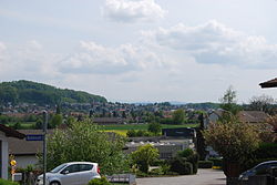
Kappel | |
|---|---|
| Coordinates: 47°20′N 7°51′E / 47.333°N 7.850°E | |
| Country | Switzerland |
| Canton | Solothurn |
| District | Olten |
| Area | |
| • Total | 5.09 km2 (1.97 sq mi) |
| Elevation | 425 m (1,394 ft) |
| Population (31 December 2018)[2] | |
| • Total | 3,237 |
| • Density | 640/km2 (1,600/sq mi) |
| Time zone | UTC+01:00 (Central European Time) |
| • Summer (DST) | UTC+02:00 (Central European Summer Time) |
| Postal code(s) | 4616 |
| SFOS number | 2580 |
| Surrounded by | Boningen, Gunzgen, Hägendorf, Olten, Rickenbach, Wangen bei Olten |
| Website | www SFSO statistics |
Kappel is a municipality in the district Olten in the canton of Solothurn in Switzerland.


