| River Dee Afon Dyfrdwy (Welsh) | |
|---|---|
 River Dee at Llangollen | |
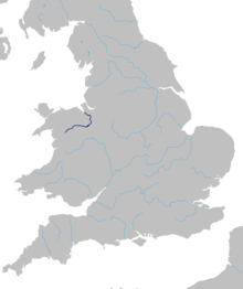
 Map of the route of the River Dee in Wales and England | |
| Location | |
| Country | Wales, England |
| Cities | Chester |
| Physical characteristics | |
| Source | |
| - location | slopes of Dduallt above Llanuwchllyn, Snowdonia, Wales |
| - coordinates | 52°49′56″N 3°45′56″W / 52.8322°N 3.7656°W |
| - elevation | 450 m (1,480 ft) |
| Mouth | Dee Estuary |
| - coordinates | 53°21′14″N 3°13′33″W / 53.3539°N 3.2258°W |
| - elevation | 0 m (0 ft) |
| Length | 113 km (70 mi) |
| Basin size | 1,816.8 km2 (701.5 sq mi) |
| Discharge | |
| - location | Chester Weir |
| - average | 29.71 m3/s (1,049 cu ft/s) |
| Discharge | |
| - location | Manley Hall |
| - average | 31.03 m3/s (1,096 cu ft/s) |
| Discharge | |
| - location | Bala Lake |
| - average | 13.06 m3/s (461 cu ft/s) |
| Basin features | |
| Tributaries | |
| - left | Tryweryn, Alwen, Clywedog, Alyn |
| - right | Ceiriog, Wych Brook |
The River Dee (Welsh: Afon Dyfrdwy, Latin: Deva Fluvius) is a river in the United Kingdom. It flows through parts of Wales and England.