Archer, Nebraska | |
|---|---|
 | |
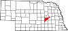
 Archer Location within the state of Nebraska | |
| Coordinates: 41°10′00″N 98°08′20″W / 41.16667°N 98.13889°W | |
| Country | United States |
| State | Nebraska |
| County | Merrick |
| Area | |
| • Total | 1.00 sq mi (2.60 km2) |
| • Land | 1.00 sq mi (2.60 km2) |
| • Water | 0.00 sq mi (0.00 km2) |
| Elevation | 1,745 ft (532 m) |
| Population (2020) | |
| • Total | 68 |
| • Density | 67.86/sq mi (26.19/km2) |
| Time zone | UTC-6 (Central (CST)) |
| • Summer (DST) | UTC-5 (CDT) |
| ZIP code | 68816 |
| FIPS code | 31-01920 |
| GNIS feature ID | 2583872[2] |
Archer is an unincorporated rural small town in northwestern Merrick County, Nebraska, United States. It lies along local roads south of Nebraska Highway 92, northwest of the city of Central City, the county seat of Merrick County.[3] Archer comprises the bulk of a census-designated place which bears its name, as well as of Zip Code 68816, the post office for which is based there. In addition to the post office, there is a credit union, a grainery and other businesses and services, as well as homes, at Archer. Despite all this, Google Maps has never bothered to image Archer.