Bourneville, Ohio
Looking east on Main Street (US Highway 50) in Bourneville
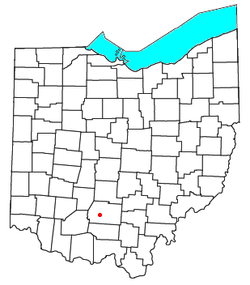
Location of Bourneville, Ohio
Coordinates: 39°16′55″N 83°09′24″W / 39.28194°N 83.15667°W / 39.28194; -83.15667
CountryUnited States
StateOhio
CountyRoss
TownshipTwin
Population
 • Total241
Time zoneUTC-5 (Eastern (EST))
 • Summer (DST)UTC-4 (EDT)
ZIP
45617

Bourneville is a census-designated place in central Twin Township, Ross County, Ohio, United States.[2] It has a post office with the ZIP code 45617.[3] It lies along U.S. Route 50. The population of the CPD was 241 at the 2020 census.

History

The first permanent settlement at Bourneville was made in the 1790s.[4] Bourneville was platted in 1832 by Colonel Bourne, and named for him.[5] A post office has been in operation at Bourneville since 1832.[6]

As of 1847, an Indian stone work was located near Bourneville. It was surveyed by Ephraim George Squier and Edwin Hamilton Davis and was featured in their book, Ancient Monuments of the Mississippi Valley, which was published in 1848.[7]

Gallery

Notable person

References

  1. ^ "Bourneville CPD, Ohio - Census Bureau Profile". United States Census Bureau. Retrieved August 12, 2023.
  2. ^ U.S. Geological Survey Geographic Names Information System: Bourneville, Ohio
  3. ^ USPS – Cities by ZIP Code Archived October 10, 2007, at the Wayback Machine
  4. ^ Federal Writers' Project (1938). Chillicothe and Ross County. Works Progress Administration. p. 76.
  5. ^ Bennett, Henry Holcomb (1902). The County of Ross: A History of Ross County, Ohio, from the Earliest Days. Selwyn A. Brant. p. 305.
  6. ^ "Ross County". Jim Forte Postal History. Retrieved January 3, 2016.
  7. ^ Squier, E.G. (1848). Ancient Monuments of the Mississippi Valley. Washington, D.C.: Smithsonian Institution. p. 67.
  8. ^ 'Philip Caldwell is Dead at 93; First Nonfamily member to head Ford,' New York Times, Patrick J. Lyons, July 11, 2013