The topic of this article may not meet Wikipedia's notability guideline for geographic features. Please help to demonstrate the notability of the topic by citing reliable secondary sources that are independent of the topic and provide significant coverage of it beyond a mere trivial mention. If notability cannot be shown, the article is likely to be merged, redirected, or deleted.Find sources: "Bronco Student Center" – news · newspapers · books · scholar · JSTOR (July 2023) (Learn how and when to remove this template message)
| Bronco Student Center | |
|---|---|
 Bronco Student Center | |
 | |
| General information | |
| Type | Student union |
| Town or city | Pomona, California |
| Country | United States |
| Construction started | May, 2000 |
| Completed | April, 2003 |
| Inaugurated | October, 2003 |
| Cost | $18.3 million USD[1] |
| Client | California State Polytechnic University, Pomona (Cal Poly Pomona) |
| Owner | Cal Poly Pomona Associated Students |
| Technical details | |
| Floor count | 2 |
| Floor area | 56,700 square feet[2] |
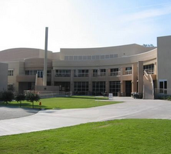
The Bronco Student Center is a student activity center for meetings, conferences, meals, recreation, and shopping for students and alumni on the campus of Cal Poly Pomona in Pomona, California. The building houses Cal Poly Pomona Associated Students government offices, as well as other student-run departments. The original building was built in 1976 and was designed by architecture instructor James Pulliam.

