.mw-parser-output .hidden-begin{box-sizing:border-box;width:100%;padding:5px;border:none;font-size:95%}.mw-parser-output .hidden-title{font-weight:bold;line-height:1.6;text-align:left}.mw-parser-output .hidden-content{text-align:left}@media all and (max-width:500px){.mw-parser-output .hidden-begin{width:auto!important;clear:none!important;float:none!important))You can help expand this article with text translated from the corresponding article in German. (February 2009) Click [show] for important translation instructions.
View a machine-translated version of the German article.
Machine translation, like DeepL or Google Translate, is a useful starting point for translations, but translators must revise errors as necessary and confirm that the translation is accurate, rather than simply copy-pasting machine-translated text into the English Wikipedia.
Do not translate text that appears unreliable or low-quality. If possible, verify the text with references provided in the foreign-language article.
You must provide copyright attribution in the edit summary accompanying your translation by providing an interlanguage link to the source of your translation. A model attribution edit summary is Content in this edit is translated from the existing German Wikipedia article at [[:de:Hegau]]; see its history for attribution.
You should also add the template ((Translated|de|Hegau)) to the talk page.
For more guidance, see Wikipedia:Translation.

The Hegau is an extinct volcanic landscape in southern Germany extending around the industrial city of Singen (Hohentwiel), between Lake Constance in the east, the Rhine River in the south, the Danube River in the north and the Randen—as the southwestern mountains of the Swabian Jura are called—in the west. It was first mentioned in A.D. 787 in the Latinised form in pago Egauinsse.[1]

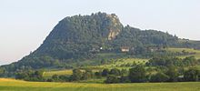
The most famous[citation needed] sight of the Hegau is the Hohentwiel, a volcanic stub. On top of the mountain lies the Hohentwiel fortress.
The Hohentwiel is the southernmost of a row of volcanic stubs in the Hegau, including the Hohenkrähen, the Hohenstoffeln, and the Hohenhewen.