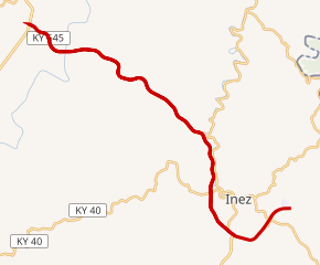
KY 645 highlighted in red | ||||
Route information | ||||
Maintained by KYTC | ||||
Length | 14.692 mi[2][3] (23.644 km) | |||
Existed | 1984[1]–present | |||
Major junctions | ||||
West end | ![]() | |||
East end | Dead end near Inez | |||
Location | ||||
Country | United States | |||
State | Kentucky | |||
Counties | Lawrence, Martin | |||
Highway system | ||||
| ||||
|
Kentucky Route 645 (KY 645) is a 14.692-mile-long (23.644 km) state highway in eastern Kentucky that runs from U.S. Route 23 (US 23) northeast of Ulysses to, temporarily, a dead end east of KY 40 southeast of Inez.
KY 645 was designated on March 22, 1984.
The original KY 645 ran from US 460 in Sideview west via Chiles Highway to Donaldson Road. The road was given to Montgomery County by September 26, 1980.
An extension of the highway is planned east of KY 40 to Warfield. While previous information indicated the KY 40 designation for the new highway, the mileage for KY 645 continues past KY 40.[4]
County | Location | mi[2][5] | km | Destinations | Notes |
---|---|---|---|---|---|
Lawrence | | 0.000 | 0.000 | ![]() | Western terminus |
| 1.595 | 2.567 | ![]() | ||
| 2.588 | 4.165 | ![]() | ||
Martin | | 6.222 | 10.013 | ![]() | |
| 7.718 | 12.421 | ![]() ![]() | Northern terminus of KY 3411 | |
| 9.887 | 15.912 | ![]() | ||
| 11.310 | 18.202 | ![]() ![]() ![]() ![]() | West end of KY 3 overlap; eastern terminus of KY 3412 | |
| 11.620 | 18.701 | ![]() ![]() | East end of KY 3 overlap; partial interchange | |
| 12.7– 13.177 | 20.4– 21.206 | ![]() ![]() ![]() ![]() ![]() | No direct access from KY 645 west to KY 908 south or from KY 908 north to KY 645 west | |
| 14.692 | 23.644 | Dead end | Temporary eastern terminus | |
1.000 mi = 1.609 km; 1.000 km = 0.621 mi
|