This article relies largely or entirely on a single source. Relevant discussion may be found on the talk page. Please help improve this article by introducing citations to additional sources.Find sources: "Khoonkhwuttunne, California" – news · newspapers · books · scholar · JSTOR (April 2021)
41°56′54″N 124°12′11″W / 41.94833°N 124.20306°W
Khoonkhwuttunne | |
|---|---|
Former settlement | |
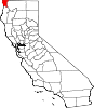
 Khoonkhwuttunne Location in California | |
| Coordinates: 41°56′54″N 124°12′11″W / 41.94833°N 124.20306°W | |
| Country | United States |
| State | California |
| County | Del Norte County |
| Elevation | 33 ft (10 m) |
Khoonkhwuttunne (also, Qo-on-qwut-tunne) is a former Tolowa settlement in Del Norte County, California, located at the mouth of the Smith River. It lay at an elevation of 33 feet (10 m).