List
The Western Australian State Register of Heritage Places, as of 2024[update], lists the following 26 state registered places within the Shire of Mundaring:
| Place name | Place # | Location | Suburb or town | Co-ordinates | Built | Stateregistered | Notes | Photo |
|---|---|---|---|---|---|---|---|---|
| Belle View | 3836 | 1100 Katharine Street | Bellevue | 31°54′14″S 116°01′31″E / 31.90389°S 116.02528°E | 1887 | 2 June 1998 |
|
|
| Government Quarries (former) | 16788 | Hudman Road | Boya | 31°55′24″S 116°04′03″E / 31.92333°S 116.06750°E | 1901 | 7 September 2006 |
|

|
| Lake Leschenaultia | 8568 | 2135 Rosedale Road | Chidlow | 31°51′15″S 116°15′02″E / 31.85417°S 116.25056°E | 1898 | 3 June 2005 |
|

|
| Holmesdale | 1688 | Darlington Road | Darlington | 31°54′49″S 116°04′21″E / 31.91361°S 116.07250°E | 1890 | 22 November 2005 |
|
|
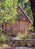
| St Cuthbert's Anglican Church | 1685 | Corner Hillsden & Darlington Road | Darlington | 31°54′57″S 116°04′31″E / 31.91583°S 116.07528°E | 1925 | 3 June 2005 |
|

|
| Leithdale | 8554 | 5–7 Lukin Avenue | Darlington | 31°55′27″S 116°05′05″E / 31.92417°S 116.08472°E | 1898 | 17 February 2006 |
|
|
| Glen Forrest Hall | 1691 | 52 McGlew Road | Glen Forrest | 31°54′35″S 116°05′59″E / 31.90972°S 116.09972°E | 1897 | 14 December 2001 |
|

|
| John Forrest National Park | 8561 | Great Eastern Highway | Greenmount | 31°52′55″S 116°04′26″E / 31.88194°S 116.07389°E | 1900 | 17 December 2004 |
|

|
| Blackboy Hill Memorial | 4479 | Innamincka Road | Greenmount | 31°53′49″S 116°02′44″E / 31.89694°S 116.04556°E | 1914 | 31 March 2006 |
|

|
| Katharine Susannah Prichard's House | 1681 | 11 Old York Road | Greenmount | 31°53′58″S 116°03′15″E / 31.89944°S 116.05417°E | 1896 | 28 February 1995 |
|
|
| Clayton Farm | 3839 | Clayton Road | Helena Valley | 31°55′05″S 116°02′29″E / 31.91806°S 116.04139°E | 1861 | 14 March 2008 |
|
|
| Eastern Railway – Three Bridges | 2663 | Lot 10159 Great Eastern Highway | Hovea | 31°52′48″S 116°06′02″E / 31.88000°S 116.10056°E | 1882 | 24 July 1992 |
|
|
| Eastern Railway Deviation | 2660 | Lot 10159 Great Eastern Highway | Hovea | 31°52′56″S 116°04′16″E / 31.88222°S 116.07111°E | 1894 | 14 February 2002 |
|

|
| Mahogany Inn | 1693 | 4260 Great Eastern Highway | Mahogany Creek | 31°54′03″S 116°08′06″E / 31.90083°S 116.13500°E | 1854 | 9 September 2003 |
|

|
| Mundaring Sculpture Park | 8577 | Jacoby Street | Mundaring | 31°54′16″S 116°09′57″E / 31.90444°S 116.16583°E | 1898 | 28 November 2003 |
|

|
| Mundaring Station Master's House | 8531 | Jacoby Street | Mundaring | 31°54′14″S 116°09′55″E / 31.90389°S 116.16528°E | 1902 |
|

| |
| Faversham | 4546 | 2075 Jacoby Street | Mundaring | 31°54′18″S 116°09′17″E / 31.90500°S 116.15472°E | 1911 | 7 September 2007 |
|
|
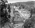
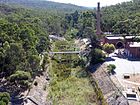
| Goldfields Water Supply Scheme | 16610 | Listed under the Coolgardie, Cunderdin, Kellerberrin, Kalgoorlie–Boulder, Merredin, Mundaring, Northam, Tammin and Yilgarn State Heritage lists | 1898 | 8 December 2022 | 
| |||
| Mundaring Weir Hotel | 1675 | Lot 502 Hall Road | Mundaring Weir | 31°57′08″S 116°10′01″E / 31.95222°S 116.16694°E | 1898 | 20 April 2004 |
|

|
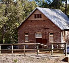
| No 1 Pumping Station Museum | 1677 | Mundaring Weir Road | Mundaring Weir | 31°57′21″S 116°09′47″E / 31.95583°S 116.16306°E | 1902 | 4 May 2001 |
|

|
| No 2 Pumping Station - Site of | 8539 | 1240 Mundaring Weir Road | Mundaring | 31°59′00″S 116°10′48″E / 31.9833°S 116.1800°E | 1902 |
|
||
| Mundaring Weir Hall | 1676 | Weir Village Road | Mundaring Weir | 31°57′07″S 116°10′04″E / 31.95194°S 116.16778°E | 1908 | 22 January 2002 |
| |
| Parkerville Children's Home & Cemetery | 8546 | Corner Roland & Beacon Roads, nearr corner Wilson Road | Parkerville | 31°52′23″S 116°08′15″E / 31.87306°S 116.13750°E | 1903 | 24 November 2000 |
|

|
| Hillston Boys Farm (former) | 4038 | 900 Woodlands Road | Stoneville | 31°51′20″S 116°09′40″E / 31.85556°S 116.16111°E | 1955 | 1 October 1999 |
|
|
| Wooroloo Sanatorium (former) | 8566 | Linley Valley Road | Wooroloo | 31°48′33″S 116°19′40″E / 31.80917°S 116.32778°E | 1915 | 30 August 2002 |
|
|
| Wooroloo Cemetery | 8571 | Off Linley Valley Road | Wooroloo | 31°48′33″S 116°19′40″E / 31.80917°S 116.32778°E | 1906 | 30 August 2002 |
|
