Lowemont, Kansas
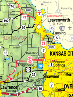
KDOT map of Leavenworth County (legend)
Lowemont is located in Kansas
Lowemont
Lowemont
Lowemont is located in the United States
Lowemont
Lowemont
Coordinates: 39°22′49.99″N 95°3′20.88″W / 39.3805528°N 95.0558000°W / 39.3805528; -95.0558000[1]
CountryUnited States
StateKansas
CountyLeavenworth
Founded1887
Elevation1,109 ft (338 m)
Time zoneUTC-6 (CST)
 • Summer (DST)UTC-5 (CDT)
Area code913
FIPS code20-43125 [1]
GNIS ID478266 [1]

Lowemont is an unincorporated community in Leavenworth County, Kansas, United States.[1] It is part of the Kansas City metropolitan area.[2] It is located northwest of Leavenworth along U.S. Route 73 highway.

History

Early Beginnings (1887)

Growth and Prosperity (Late 19th & Early 20th Centuries)

Decline and Transformation (Mid-20th Century Onwards)

References

  1. ^ a b c d e "Lowemont, Kansas", Geographic Names Information System, United States Geological Survey, United States Department of the Interior
  2. ^ "Population Data and Maps | MARC".
  3. ^ a b "Kansas Post Offices, 1828-1961 (archived)". Kansas Historical Society. Archived from the original on October 9, 2013. Retrieved June 12, 2014.

Further reading