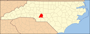
This list includes properties and districts listed on the National Register of Historic Places in Stanly County, North Carolina. Click the "Map of all coordinates" link to the right to view an online map of all properties and districts with latitude and longitude coordinates in the table below.[1]
This National Park Service list is complete through NPS recent listings posted March 29, 2024.[2]
[3] | Name on the Register[4] | Image | Date listed[5] | Location | City or town | Description |
---|---|---|---|---|---|---|
1 | Albemarle Graded School-Central Elementary School | ![]() |
December 2, 2014 (#14000991) |
219 E. North St. 35°21′11″N 80°11′45″W / 35.3531°N 80.1958°W | Albemarle | |
2 | Badin Historic District | ![]() |
October 12, 1983 (#83004000) |
Roughly bounded by NC 740, Pine St., and the country club property line 35°24′13″N 80°06′45″W / 35.4036°N 80.1125°W | Badin | |
3 | Thomas Marcellus Denning House | ![]() |
January 24, 2011 (#10001177) |
415 N. Second St. 35°21′22″N 80°11′53″W / 35.3561°N 80.1981°W | Albemarle | |
4 | Downtown Albemarle Historic District | ![]() |
March 28, 2002 (#02000275) |
Portions of S. 2nd, W. Main and N. and S. 1st Sts. 35°21′00″N 80°11′58″W / 35.35°N 80.1994°W | Albemarle | |
5 | Five Points Historic District | ![]() |
October 16, 2002 (#02001179) |
Junction of E. Main St., Pee Dee Ave., and 4th St. 35°21′01″N 80°11′41″W / 35.3503°N 80.1947°W | Albemarle | |
6 | Julius Clegg Hall House and Grounds | April 22, 2021 (#100006453) |
343 North Second St. 35°21′20″N 80°11′52″W / 35.3556°N 80.1978°W | Albemarle | ||
7 | Hardaway Site (31ST4) | ![]() |
March 1, 1984 (#84002529) |
By Badin Lake, west of the Badin Dam[6] 35°25′08″N 80°06′02″W / 35.4189°N 80.1006°W | Badin | |
8 | Narrows Dam and Power Plant Complex | ![]() |
October 12, 1983 (#83004001) |
Yadkin River and SR 1704 35°25′07″N 80°05′33″W / 35.4186°N 80.0925°W | Badin | |
9 | Opera House-Starnes Jewelers Building | ![]() |
March 9, 1995 (#95000180) |
127-133 W. Main St. 35°21′01″N 80°11′56″W / 35.3503°N 80.1989°W | Albemarle | |
10 | Pee Dee Avenue Historic District | ![]() |
January 7, 1998 (#97001612) |
Along Pee Dee Ave., roughly from Arey Ave. to Miller St. 35°21′12″N 80°11′13″W / 35.3533°N 80.1869°W | Albemarle | |
11 | Pfeiffer Junior College Historic District | ![]() |
April 28, 1999 (#99000480) |
U.S. Route 52, 1.0 mile north of its junction with NC 49 35°29′05″N 80°17′04″W / 35.4847°N 80.2844°W | Misenheimer | |
12 | Randle House | ![]() |
September 8, 1992 (#92001172) |
Southern side of NC 1802 at its junction with NC 1743 35°15′45″N 80°06′15″W / 35.2625°N 80.1042°W | Norwood | |
13 | Richfield Milling Company | September 19, 2016 (#16000647) |
303 S. Main St. 35°27′57″N 80°15′40″W / 35.4658°N 80.2610°W | Richfield | ||
14 | Second Street Historic District | ![]() |
April 6, 2005 (#05000266) |
Portions of the 100 and 200 blocks of N. Second St. and the 100 block of W. North St. 35°21′08″N 80°11′54″W / 35.3522°N 80.1983°W | Albemarle | |
15 | Isaiah Wilson Snugs House | ![]() |
March 9, 1995 (#95000190) |
112 N. Third St. 35°21′03″N 80°11′46″W / 35.3508°N 80.1961°W | Albemarle | |
16 | West Badin Historic District | ![]() |
October 12, 1983 (#83004002) |
Roughly bounded by Sims, Lincoln, Marion, and Lee Sts. 35°24′35″N 80°07′28″W / 35.4097°N 80.1244°W | Badin |