Oswego, Montana
Abandoned house in Owsego Montana
Oswego, Montana is located in Montana
Oswego, Montana
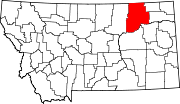
Oswego, Montana
Location within the state of Montana
Coordinates: 48°3′31″N 105°52′52″W / 48.05861°N 105.88111°W / 48.05861; -105.88111
CountryUnited States
StateMontana
CountyValley
Elevation2,028 ft (618 m)
Time zoneUTC-7 (Mountain (MST))
 • Summer (DST)UTC-6 (MDT)
GNIS feature ID774988[1]

Oswego /ɒsˈwɡ/ is an unincorporated community in Valley County, Montana, United States.[1] It is located along U.S. Route 2 between the cities of Frazer and Wolf Point. Oswego is located on the Fort Peck Indian Reservation.

History

Steps to a house in Oswego Montana probably burned down in 1971 in a prairie fire, never rebuilt

Settled sometime in the 1890s, the village was named after Oswego, New York, the hometown of some early-day settlers.[2] A post office was located there from 1896 until 1971.[citation needed] On September 11, 1971 one of the worst prairie fires in northeastern Montana destroyed much of Oswego, leaving only 4 homes untouched. The entire population of Oswego was forced to evacuate, and of those 75 residents only about 40 of them returned to live and rebuild.[citation needed]

References

  1. ^ a b c U.S. Geological Survey Geographic Names Information System: Oswego, Montana