Raheb Rural District
Persian: دهستان راهب
Raheb Rural District is located in Iran
Raheb Rural District
Coordinates: 35°18′37″N 48°38′54″E / 35.31028°N 48.64833°E / 35.31028; 48.64833[1]
Country Iran
ProvinceHamadan
CountyKabudarahang
DistrictCentral
Population
 (2016)[2]
 • Total18,659
Time zoneUTC+3:30 (IRST)

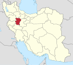
Raheb Rural District (Persian: دهستان راهب) is in the Central District of Kabudarahang County, Hamadan province, Iran.

At the National Census of 2006, its population was 22,626 in 5,780 households.[3] There were 24,488 inhabitants in 6,178 households at the following census of 2011.[4] At the most recent census of 2016, the population of the rural district was 18,659 in 5,471 households. The largest of its seven villages was Hamadan Airbase, with 5,098 people.[2]

References

  1. ^ OpenStreetMap contributors (17 October 2023). "Raheb Rural District (Kabudarahang County)" (Map). OpenStreetMap. Retrieved 17 October 2023.
  2. ^ a b "Census of the Islamic Republic of Iran, 1395 (2016)". AMAR (in Persian). The Statistical Center of Iran. p. 13. Archived from the original (Excel) on 21 April 2021. Retrieved 19 December 2022.
  3. ^ "Census of the Islamic Republic of Iran, 1385 (2006)". AMAR (in Persian). The Statistical Center of Iran. p. 13. Archived from the original (Excel) on 20 September 2011. Retrieved 25 September 2022.
  4. ^ "Census of the Islamic Republic of Iran, 1390 (2011)" (Excel). Iran Data Portal (in Persian). The Statistical Center of Iran. p. 13. Retrieved 19 December 2022.