.mw-parser-output .hidden-begin{box-sizing:border-box;width:100%;padding:5px;border:none;font-size:95%}.mw-parser-output .hidden-title{font-weight:bold;line-height:1.6;text-align:left}.mw-parser-output .hidden-content{text-align:left}@media all and (max-width:500px){.mw-parser-output .hidden-begin{width:auto!important;clear:none!important;float:none!important))You can help expand this article with text translated from
the corresponding article in German. (August 2011) Click [show] for important translation instructions.
View a machine-translated version of the German article.
Machine translation, like
DeepL or
Google Translate, is a useful starting point for translations, but translators must revise errors as necessary and confirm that the translation is accurate, rather than simply copy-pasting machine-translated text into the English Wikipedia.
Do not translate text that appears unreliable or low-quality. If possible, verify the text with references provided in the foreign-language article.
You must provide
copyright attribution in the
edit summary accompanying your translation by providing an
interlanguage link to the source of your translation. A model attribution edit summary is Content in this edit is translated from the existing German Wikipedia article at [[:de:Santa Ana del Yacuma]]; see its history for attribution.
You should also add the template ((Translated|de|Santa Ana del Yacuma)) to the
talk page.
For more guidance, see
Wikipedia:Translation.
Town and municipality in Beni Department, Bolivia
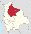
Santa Ana del Yacuma (also Santa Ana) is a town in the Beni Department in north-eastern Bolivia.
History
The Jesuit mission of Santa Ana was founded in 1719.[1] Movima Indians resided at the mission.[2] Today, the Movima language is still spoken in and around the town.[3]: 807
Location
Santa Ana is the capital of the Yacuma Province and the Santa Ana del Yacuma Municipality, located at an elevation of 144 m above sea level, where the Yacuma River meets the Mamoré River. Santa Ana is located 150 Kilometer north-west of Trinidad, the department's capital.
The city has an Airport, the Santa Ana del Yacuma Airport, which is located just outside the city.
Population
The town population has decreased from 14,788 (census 1992) to 12,944 (census 2001) and 12,783 (2008 estimate).[4]
Climate
The yearly precipitation of the region is 1,700 mm, with a distinct dry season from May to September. Monthly average temperatures vary from 24 °C und 29 °C over the year. According to the Köppen classification system Santa Ana del Yacuma has a Tropical savanna climate, abbreviated "Aw", bordering on a Tropical monsoon climate.
| Climate data for Santa Ana del Yacuma
|
| Month
|
Jan
|
Feb
|
Mar
|
Apr
|
May
|
Jun
|
Jul
|
Aug
|
Sep
|
Oct
|
Nov
|
Dec
|
Year
|
| Mean daily maximum °C (°F)
|
33
(92)
|
34
(93)
|
34
(94)
|
33
(92)
|
31
(88)
|
34
(93)
|
34
(93)
|
35
(95)
|
36
(97)
|
36
(96)
|
33
(92)
|
33
(91)
|
34
(93)
|
| Mean daily minimum °C (°F)
|
22
(72)
|
22
(72)
|
22
(72)
|
22
(72)
|
18
(65)
|
19
(67)
|
18
(65)
|
18
(64)
|
20
(68)
|
21
(70)
|
22
(71)
|
23
(73)
|
21
(69)
|
| Average precipitation mm (inches)
|
276.7
(10.89)
|
269.4
(10.61)
|
208.7
(8.22)
|
133.6
(5.26)
|
68.3
(2.69)
|
29.8
(1.17)
|
24.9
(0.98)
|
28.8
(1.13)
|
86.7
(3.41)
|
142.5
(5.61)
|
202.3
(7.96)
|
241.0
(9.49)
|
1,712.6
(67.43)
|
| Source: Weatherbase [5]
|


