Ura-Guba
Ура-Губа
Location of Ura-Guba
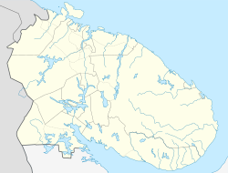
Map
Ura-Guba is located in Russia
Ura-Guba
Ura-Guba
Location of Ura-Guba
Ura-Guba is located in Murmansk Oblast
Ura-Guba
Ura-Guba
Ura-Guba (Murmansk Oblast)
Coordinates: 69°17′16″N 32°47′59″E / 69.28778°N 32.79972°E / 69.28778; 32.79972
CountryRussia
Federal subjectMurmansk Oblast[1]
Administrative districtKolsky District[1]
Territorial okrugUragubsky Territorial Okrug
Founded1860s[2]
Population
 • Total517
 • Municipal districtKolsky Municipal District[4]
 • Rural settlementUra-Guba Rural Settlement[4]
Time zoneUTC+3 (MSK Edit this on Wikidata[5])
Postal code(s)[6]
184371
Dialing code(s)+7 81553
OKTMO ID47605407101

Ura-Guba (Russian: Ура́-Губа́), also known as Ura (Ура),[7] is a rural locality (a selo) in Kolsky District of Murmansk Oblast, Russia,[1] located beyond the Arctic Circle at a height of 1 meter (3 ft 3 in) above sea level. Population: 517 (2010 Census).[3]

History

It was founded in the 1860s—the decade when the Murman Coast was actively being settled.[2]

By the April 20, 1921 Decision of the Plenary Session of Murmansky Uyezd Executive Committee, Ura-Guba was transferred from Novozerskaya to Alexandrovskaya Volost and became the administrative center of Ursky (Ura-Gubsky) Selsoviet.[7]

On September 11, 1938, Ura-Guba was made the administrative center of Polyarny District by the Decree of the Presidium of the Supreme Soviet of the Russian SFSR.[8] When Polyarny District was abolished on July 9, 1960,[9] Ura-Guba became a part of Kolsky District.

References

Notes

  1. ^ a b c d e Государственный комитет Российской Федерации по статистике. Комитет Российской Федерации по стандартизации, метрологии и сертификации. №ОК 019-95 1 января 1997 г. «Общероссийский классификатор объектов административно-территориального деления. Код 47 205 000 021», в ред. изменения №278/2015 от 1 января 2016 г.. (State Statistics Committee of the Russian Federation. Committee of the Russian Federation on Standardization, Metrology, and Certification. #OK 019-95 January 1, 1997 Russian Classification of Objects of Administrative Division (OKATO). Code 47 205 000 021, as amended by the Amendment #278/2015 of January 1, 2016. ).
  2. ^ a b Administrative-Territorial Division of Murmansk Oblast, p. 23
  3. ^ a b Федеральная служба государственной статистики. Территориальный орган федеральной службы государственной статистики по Мурманской области (Мурманскстат) (Federal State Statistics Service. Territorial Branch of the Federal Statistics Service in Murmansk Oblast (Murmanskstat)) (2012). "2010. Статистический сборник "Численность, размещение и возрастно-половой состав населения Мурманской области. Итоги Всероссийской переписи населения". Том 1" [2010 Statistical Digest "Size, Distribution, and the Age and Gender Characteristics of the Population of Murmansk Oblast. Results of the All-Russian Population Census] (in Russian). Federal State Statistics Service. Archived from the original on December 22, 2012. Retrieved September 10, 2012.
  4. ^ a b Law #577-01-ZMO
  5. ^ "Об исчислении времени". Официальный интернет-портал правовой информации (in Russian). 3 June 2011. Retrieved 19 January 2019.
  6. ^ Почта России. Информационно-вычислительный центр ОАСУ РПО. (Russian Post). Поиск объектов почтовой связи (Postal Objects Search) (in Russian)
  7. ^ a b Administrative-Territorial Division of Murmansk Oblast, p. 67
  8. ^ Administrative-Territorial Division of Murmansk Oblast, p. 62
  9. ^ Decree #741/18

Sources