Zwickau | |
|---|---|
 Flag  Coat of arms | |
 | |
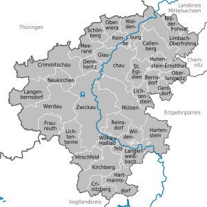
| Country | Germany |
| State | Saxony |
| Capital | Zwickau |
| Area | |
| • Total | 949 km2 (366 sq mi) |
| Population (31 December 2021)[1] | |
| • Total | 309,621 |
| • Density | 330/km2 (850/sq mi) |
| Time zone | UTC+01:00 (CET) |
| • Summer (DST) | UTC+02:00 (CEST) |
| Vehicle registration | Z, GC, HOT, WDA |
| Website | landkreis-zwickau |
Zwickau (German: Landkreis Zwickau) is a district (Kreis) in the Free State of Saxony, Germany.