Glauchau | |
|---|---|
 Market | |
 Coat of arms | |
Location of Glauchau within Zwickau district 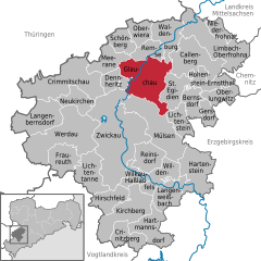 | |
 Glauchau  Glauchau | |
| Coordinates: 50°49′24″N 12°32′40″E / 50.82333°N 12.54444°E | |
| Country | Germany |
| State | Saxony |
| District | Zwickau |
| Subdivisions | 7 |
| Government | |
| • Mayor (2022–29) | Marcus Steinhart[1] (CDU) |
| Area | |
| • Total | 51.49 km2 (19.88 sq mi) |
| Elevation | 266 m (873 ft) |
| Population (2022-12-31)[2] | |
| • Total | 21,951 |
| • Density | 430/km2 (1,100/sq mi) |
| Time zone | UTC+01:00 (CET) |
| • Summer (DST) | UTC+02:00 (CEST) |
| Postal codes | 08371 |
| Dialling codes | 03763 |
| Vehicle registration | Z, GC |
| Website | www.glauchau.de |
Glauchau (German pronunciation: [ˈɡlaʊxaʊ] ; Upper Sorbian: Hłuchow, pronounced [ˈhwuxɔf]) is a town in the German federal state of Saxony, on the right bank of the Mulde, 7 miles north of Zwickau and 17 miles west of Chemnitz by rail (its train station is on the Dresden–Werdau line). It is part of the Zwickau district.


.JPG)