Zhenyuan County
镇沅县 · Ceiqyiq xeif
镇沅彝族哈尼族拉祜族自治县
Ceiqyiq Haqhholssaq Haqniqssaq Lalhuqcuq Ziiqziifxeif

Zhenyuan Yi, Hani and Lahu Autonomous County
Location of Zhenyuan County (pink) and Pu'er City (yellow) within Yunnan
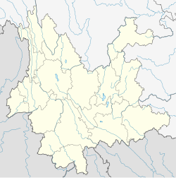
Zhenyuan is located in Yunnan
Zhenyuan
Zhenyuan
Location of the seat in Yunnan
Coordinates: 24°00′14″N 101°06′32″E / 24.004°N 101.109°E / 24.004; 101.109
CountryChina
ProvinceYunnan
Prefecture-level cityPu'er
GB/T 2260 CODE[1]530825
County seatEnle
Area
 • Total4,223 km2 (1,631 sq mi)
Elevation
1,741 m (5,712 ft)
Population
 (2020 census)[2]
 • Total179,503
 • Density43/km2 (110/sq mi)
Time zoneUTC+8 (China Standard Time)
Postal code
666500[3]
Area code0879[3]
Websitewww.pezhenyuan.gov.cn
1Yunnan Statistics Bureau [1]
2Puer Gov. [2]
3Yunnan Portal [3]

Zhenyuan Yi, Hani and Lahu Autonomous County (simplified Chinese: 镇沅彝族哈尼族拉祜族自治县; traditional Chinese: 鎮沅彝族哈尼族拉祜族自治縣; pinyin: Zhènyuán Yízú Hānízú Lāhùzú Zìzhìxiàn; Hani: Ceiqyiq Haqhholssaq Haqniqssaq Lalhuqcuq Ziiqziifxeif) is an autonomous county under the jurisdiction of Pu'er City, in the west central part of Yunnan Province, China.
Administrative divisions

In the present, Zhenyuan Yi, Hani and Lahu Autonomous County has 8 towns and 1 township.

8 towns
  • Enle (恩乐镇)
  • Anban (按板镇)
  • Mengda (勐大镇)
  • Zhedong (者东镇)
  • Jiujia (九甲镇)
  • Gucheng (古城镇)
  • Zhentai (振太镇)
  • Heping (和平镇)
1 township

Ethnic groups

The Zhenyuan County Gazetteer (1995:74-79) lists the following ethnic groups and locations. All population statistics, given in parentheses, are as of 1988.

Climate

Climate data for Zhenyuan (2000–2020 normals, extremes 1981–2010)
Month Jan Feb Mar Apr May Jun Jul Aug Sep Oct Nov Dec Year
Record high °C (°F) 28.9
(84.0)
31.5
(88.7)
35.4
(95.7)
37.0
(98.6)
38.2
(100.8)
35.7
(96.3)
35.3
(95.5)
35.5
(95.9)
35.2
(95.4)
32.6
(90.7)
31.1
(88.0)
27.0
(80.6)
38.2
(100.8)
Mean daily maximum °C (°F) 22.6
(72.7)
25.6
(78.1)
28.3
(82.9)
30.5
(86.9)
30.9
(87.6)
30.6
(87.1)
29.6
(85.3)
30.0
(86.0)
29.0
(84.2)
26.8
(80.2)
24.7
(76.5)
22.1
(71.8)
27.6
(81.6)
Daily mean °C (°F) 12.8
(55.0)
15.0
(59.0)
18.1
(64.6)
21.0
(69.8)
23.3
(73.9)
24.5
(76.1)
24.0
(75.2)
23.8
(74.8)
22.7
(72.9)
20.5
(68.9)
16.6
(61.9)
13.6
(56.5)
19.7
(67.4)
Mean daily minimum °C (°F) 7.5
(45.5)
7.8
(46.0)
10.7
(51.3)
14.1
(57.4)
17.9
(64.2)
20.9
(69.6)
21.0
(69.8)
20.7
(69.3)
19.8
(67.6)
17.4
(63.3)
12.7
(54.9)
9.6
(49.3)
15.0
(59.0)
Record low °C (°F) 2.9
(37.2)
2.6
(36.7)
5.5
(41.9)
9.2
(48.6)
11.1
(52.0)
16.1
(61.0)
18.5
(65.3)
15.7
(60.3)
12.4
(54.3)
10.5
(50.9)
6.6
(43.9)
4.1
(39.4)
2.6
(36.7)
Average precipitation mm (inches) 31.6
(1.24)
12.6
(0.50)
22.7
(0.89)
44.6
(1.76)
102.4
(4.03)
162.3
(6.39)
269.6
(10.61)
249.0
(9.80)
135.9
(5.35)
137.2
(5.40)
40.2
(1.58)
15.7
(0.62)
1,223.8
(48.17)
Average precipitation days (≥ 0.1 mm) 4.6 3.0 5.4 8.5 11.5 18.8 23.5 21.4 17.3 15.1 6.1 4.2 139.4
Average relative humidity (%) 78 69 63 64 69 78 84 84 84 84 83 82 77
Mean monthly sunshine hours 183.2 207.9 225.1 219.7 195.1 131.4 120.0 141.3 124.7 129.9 156.0 155.6 1,989.9
Percent possible sunshine 55 65 60 57 47 32 29 36 34 37 48 47 46
Source: China Meteorological Administration[24][25]

References

  1. ^ "Home". stats.net. Retrieved January 29, 2009.[dead link]
  2. ^ "2404954人!普洱市发布第七次全国人口普查主要数据公报" (in Chinese). The Paper. 2021-06-04.
  3. ^ a b "Area Code and Postal Code in Yunnan Province". China Philatelic Information Network. Archived from the original on November 7, 2007.
  4. ^ "Maidi Village". ynszxc.net (in Chinese). Archived from the original on December 30, 2018.
  5. ^ "Ma Deng Village". ynszxc.net (in Chinese). Archived from the original on December 30, 2018.
  6. ^ "Santai Village". ynszxc.net (in Chinese). Archived from the original on December 30, 2018.
  7. ^ "Guoji Village". ynszxc.net (in Chinese). Archived from the original on December 30, 2018.
  8. ^ "Jiujia Village". ynszxc.net (in Chinese). Archived from the original on December 30, 2018.
  9. ^ "Mahe Village". ynszxc.net (in Chinese). Archived from the original on December 30, 2018.
  10. ^ "Hetaohe Village". ynszxc.net (in Chinese). Archived from the original on December 30, 2018.
  11. ^ "Wenduo Village". ynszxc.net (in Chinese). Archived from the original on December 30, 2018.
  12. ^ "Wenlai Village". ynszxc.net (in Chinese). Archived from the original on December 30, 2018.
  13. ^ "Taitou Village". ynszxc.net (in Chinese). Archived from the original on December 30, 2018.
  14. ^ a b c "Yakou Village". ynszxc.net (in Chinese). Archived from the original on December 30, 2018.
  15. ^ a b "Zhangpen Village". ynszxc.net (in Chinese). Archived from the original on December 30, 2018.
  16. ^ "Tianba Village". ynszxc.net (in Chinese). Archived from the original on December 30, 2018.
  17. ^ "Sanhe Village". ynszxc.net (in Chinese). Archived from the original on December 30, 2018.
  18. ^ "Lianhe Village". ynszxc.net (in Chinese). Archived from the original on December 30, 2018.
  19. ^ "Minqiang Village". ynszxc.net (in Chinese). Archived from the original on December 30, 2018.
  20. ^ "Meiziqing Village". ynszxc.net (in Chinese). Archived from the original on December 30, 2018.
  21. ^ "Naka Village". ynszxc.net (in Chinese). Archived from the original on December 30, 2018.
  22. ^ "Xinguang Village". ynszxc.net (in Chinese). Archived from the original on December 30, 2018.
  23. ^ "Banghai Village". ynszxc.net (in Chinese). Archived from the original on December 30, 2018.
  24. ^ 中国气象数据网 – WeatherBk Data (in Simplified Chinese). China Meteorological Administration. Retrieved 10 April 2023.
  25. ^ 中国气象数据网 (in Simplified Chinese). China Meteorological Administration. Retrieved 10 April 2023.