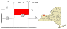
Town in New York, United States
Gaines is a town in Orleans County,[3] New York,[4] United States. The population was 3,378 at the 2010 census. The town is named after General Edmund P. Gaines,[5] who defended the area during the War of 1812.
The Town of Gaines[6] is in the north-central part of the county and contains part of the Village of Albion,[7] the county seat. The current supervisor of Gaines is Tyler James Allport.
History
The Town of Gaines[6] was established in 1816 from a partition of the Town of Ridgeway[8][9][10][11] before Orleans County[3] was established.
In 1890, the population of Gaines was 2,070.
Geography
According to the United States Census Bureau,[12] the town has a total area of 34.4 square miles (89 km2), of which 34.4 square miles (89 km2) is land and 0.04 square miles (0.10 km2) (0.12%) is water.
The Erie Canal[13] touches the southern boundary of the town at Gaines Basin, and the Oak Orchard River[14] flows through the northwest part of the town entering the Town of Carlton.[15] The northernmost point on the Erie Canal is located in Gaines.
New York State Route 104[16] (Ridge Road) is an east–west highway across the town. New York State Route 98[17] (Oak Orchard Road) is a north–south highway, intersecting NY-104 north of the village of Albion at Childs. New York State Route 279[18] (Gaines Waterport Road) is a north–south highway intersecting NY-104 at Gaines village.
Demographics
Historical population
| Census | Pop. | Note | %± |
|---|
| 1820 | 1,134 | | — |
|---|
| 1830 | 2,121 | | 87.0% |
|---|
| 1840 | 2,268 | | 6.9% |
|---|
| 1850 | 2,722 | | 20.0% |
|---|
| 1860 | 2,542 | | −6.6% |
|---|
| 1870 | 2,196 | | −13.6% |
|---|
| 1880 | 2,338 | | 6.5% |
|---|
| 1890 | 2,070 | | −11.5% |
|---|
| 1900 | 1,889 | | −8.7% |
|---|
| 1910 | 1,946 | | 3.0% |
|---|
| 1920 | 1,669 | | −14.2% |
|---|
| 1930 | 1,702 | | 2.0% |
|---|
| 1940 | 1,667 | | −2.1% |
|---|
| 1950 | 1,812 | | 8.7% |
|---|
| 1960 | 2,090 | | 15.3% |
|---|
| 1970 | 2,385 | | 14.1% |
|---|
| 1980 | 2,692 | | 12.9% |
|---|
| 1990 | 3,025 | | 12.4% |
|---|
| 2000 | 3,740 | | 23.6% |
|---|
| 2010 | 3,378 | | −9.7% |
|---|
| 2016 (est.) | 3,227 | [2] | −4.5% |
|---|
|
As of the census[20] of 2000, there were 3,740 people, 1,474 households, and 986 families residing in the town. The population density was 108.8 inhabitants per square mile (42.0/km2). There were 1,609 housing units at an average density of 46.8 per square mile (18.1/km2). The racial makeup of the town was 91.63% White, 4.41% African American, 0.32% Native American, 0.13% Asian, 2.19% from other races, and 1.31% from two or more races. Hispanic or Latino of any race were 4.14% of the population.
There were 1,474 households, out of which 32.0% had children under the age of 18 living with them, 50.0% were married couples living together, 11.5% had a female householder with no husband present, and 33.1% were non-families. 27.2% of all households were made up of individuals, and 16.8% had someone living alone who was 65 years of age or older. The average household size was 2.54 and the average family size was 3.06.
In the town, the population was spread out, with 26.4% under the age of 18, 7.9% from 18 to 24, 28.0% from 25 to 44, 21.9% from 45 to 64, and 15.8% who were 65 years of age or older. The median age was 38 years. For every 100 females, there were 92.6 males. For every 100 females age 18 and over, there were 86.8 males.
The median income for a household in the town was $32,604, and the median income for a family was $38,523. Males had a median income of $30,709 versus $21,917 for females. The per capita income for the town was $16,823. About 7.9% of families and 10.3% of the population were below the poverty line, including 20.4% of those under age 18 and 7.0% of those age 65 or over.


