This article uses bare URLs, which are uninformative and vulnerable to link rot. Please consider converting them to full citations to ensure the article remains verifiable and maintains a consistent citation style. Several templates and tools are available to assist in formatting, such as reFill (documentation) and Citation bot (documentation). (September 2022) (Learn how and when to remove this template message)
Morrow | |
|---|---|
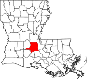
 Morrow Location within the state of Louisiana | |
| Coordinates: 30°49′51.0″N 92°5′4.68″W / 30.830833°N 92.0846333°W | |
| Country | United States |
| State | Louisiana |
| Parish | St. Landry |
| Population (2000) | |
| • Total | 149 |
| Time zone | UTC-6 (Central (CST)) |
| • Summer (DST) | UTC-5 (CDT) |
| ZIP codes | 71356 |
| Area code | 318 |
Morrow is an unincorporated community and census-designated place (CDP)[1] in St. Landry Parish, Louisiana, United States, located just east of U.S. Route 71. It was first listed as a CDP in the 2020 census with a population of 149.[2]
A post office[3] has existed in this community since 1883.[1]
Public school students in Morrow attended Morrow Elementary School (under the supervision of the St. Landry Parish School Board) until the school was closed due to dwindling school population and a federal desegregation order in 2009.[4][5][6]
Morrow is served by St. Landry Parish Fire Protection District #7.[7]