Ozone, Arkansas | |
|---|---|
 Ozone  Ozone | |
| Coordinates: 35°38′07″N 93°26′42″W / 35.63528°N 93.44500°W | |
| Country | United States |
| State | Arkansas |
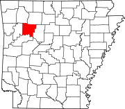
| County | Johnson |
| Elevation | 1,880 ft (570 m) |
| Population (2020) | |
| • Total | 92 |
| Time zone | UTC-6 (Central (CST)) |
| • Summer (DST) | UTC-5 (CDT) |
| ZIP code | 72854 |
| Area code | 479 |
| GNIS feature ID | 2805673[1] |
Ozone is an unincorporated community and census-designated place (CDP) in Johnson County, Arkansas, United States. Ozone is located on Arkansas Highway 21, 11.5 miles (18.5 km) north of Clarksville. It was first listed as a CDP in the 2020 census with a population of 92.[2] Ozone has a post office with ZIP code 72854.[3]