This article needs additional citations for verification. Please help improve this article by adding citations to reliable sources. Unsourced material may be challenged and removed.Find sources: "Rangkasbitung" – news · newspapers · books · scholar · JSTOR (March 2014) (Learn how and when to remove this template message)
This article has an unclear citation style. The references used may be made clearer with a different or consistent style of citation and footnoting. (April 2012) (Learn how and when to remove this template message)
Rangkasbitung
(Rangkasbitung Town)
(Kecamatan Rangkasbitung)
Other transcription(s)
 • Sundanese ᮛᮀᮊᮞ᮪ᮘᮤᮒᮥᮀ
 • Jawiراڠكاسبيتوڠ
Rangkasbitung is located in Indonesia
Rangkasbitung
Rangkasbitung
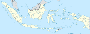
Location of Rangkasbitung in Indonesia
Coordinates: 6°7′12″S 106°9′1″E / 6.12000°S 106.15028°E / -6.12000; 106.15028
Country Indonesia
Province Banten
RegencyLebak Regency
Government
 • CamatAgus Sudrajat, S.Sos., M.Si.
Area
 • Total73.10 km2 (28.22 sq mi)
Population
 (mid 2021 estimate)
 • Total137,041
 • Density1,900/km2 (4,900/sq mi)
 [1]
Time zoneUTC+7 (WIB)
Area code+62 252
Websiteweb.archive.org/web/20220402143930/https://rangkasbitung.id/

Rangkasbitung (Sundanese: ᮛᮀᮊᮞ᮪ᮘᮤᮒᮥᮀ) (colloquially called Rangkas) is a town which is the administrative centre of Lebak Regency, in Banten Province of Java, Indonesia. It had a population of 134,945 at the 2020 Census, while the official estimate as at mid 2021 was 137,041.[2]

It is the site of the Multatuli Museum, a history museum which opened in 2018.
Climate

Rangkasbitung has a tropical rainforest climate (Af) with heavy rainfall year-round.

Climate data for Rangkasbitung
Month Jan Feb Mar Apr May Jun Jul Aug Sep Oct Nov Dec Year
Mean daily maximum °C (°F) 30.7
(87.3)
31.1
(88.0)
31.6
(88.9)
32.2
(90.0)
32.5
(90.5)
32.4
(90.3)
32.5
(90.5)
32.6
(90.7)
33.0
(91.4)
33.1
(91.6)
32.6
(90.7)
31.9
(89.4)
32.2
(89.9)
Daily mean °C (°F) 26.7
(80.1)
27.0
(80.6)
27.2
(81.0)
27.5
(81.5)
27.7
(81.9)
27.3
(81.1)
27.1
(80.8)
27.0
(80.6)
27.5
(81.5)
27.8
(82.0)
27.7
(81.9)
27.4
(81.3)
27.3
(81.2)
Mean daily minimum °C (°F) 22.8
(73.0)
22.9
(73.2)
22.8
(73.0)
22.9
(73.2)
23.0
(73.4)
22.3
(72.1)
21.8
(71.2)
21.5
(70.7)
22.0
(71.6)
22.5
(72.5)
22.9
(73.2)
23.0
(73.4)
22.5
(72.5)
Average rainfall mm (inches) 321
(12.6)
245
(9.6)
242
(9.5)
219
(8.6)
184
(7.2)
113
(4.4)
136
(5.4)
144
(5.7)
144
(5.7)
182
(7.2)
190
(7.5)
219
(8.6)
2,339
(92)
Source: Climate-Data.org[3]

6°22′S 106°15′E / 6.367°S 106.250°E / -6.367; 106.250

Transportation

The town lies on the road connecting Jakarta, Serpong and Pandeglang. It is also connected with western railway line of Java, connecting Jakarta with Serang until Merak. The town is served by Jakarta Metrorail.

Notable residents

References

  1. ^ Badan Pusat Statistik, Jakarta, 2022.
  2. ^ Badan Pusat Statistik, Jakarta, 2022.
  3. ^ "Climate: Rangkasbitung". Climate-Data.org. Retrieved 12 November 2020.
  4. ^ Archived at Ghostarchive and the Wayback Machine: Van Halen Interview. YouTube.