This special page shows all files uploaded to the English Wikipedia. (See also the list for Wikimedia Commons.) By default, the last uploaded files are shown at top of the list, but clicking on a column header will change the sorting.
Deleted files are not shown here but are included in the upload log.
| Date | Name | Thumbnail | Size | Description |
|---|---|---|---|---|
| 20:45, 26 November 2022 | Colonization road in 1901, colourised.png (file) |  |
466 KB | == Summary == ((Information | description = "A Section of Road Passing Through Burned Forest in Brudenell Township, 1901", colourised with palette.fm AI | source = "Rockingham, a Brule on Corduroy Road" – Archives of Ontario – C 120-2-0-0-54, S5049, Charles Macnamara fonds, B379883. Found at [https://dspace.library.uvic.ca/bitstream/handle/1828/9225/Murray_Derek_PhD_2018.pdf?sequence=1&isAllowed=y] | date = circa 1901 | author = Dan McKendry in Buckboard | per... |
| 02:53, 14 November 2022 | Highway 31 at Cass Bridge.png (file) |  |
683 KB | == Summary == ((Information | description = Ontario Highway 31 at Cass Bridge | source = [https://archive.org/details/n06ontariosession64ontauoft/page/n707/mode/2up?view=theater Annual Report for 1930 and 1931] | date = 1930 and 1931 | author = Department of Highways of Ontario | permission = ((PD-Canada-Crown)) | other_versions = )) ((Keep local)) |
| 03:34, 13 November 2022 | South on Bank from Wellington, Ottawa.png (file) |  |
661 KB | Colourised with AI |
| 20:47, 15 October 2022 | Hwy 2 Trenton, Ontario.png (file) |  |
3.11 MB | == Summary == ((Information | description = Former Ontario Highway 2 (Dundas Street) facing west into downtown Trenton from the Trent–Severn Waterway. | source = [https://www.flickr.com/photos/dougtone/3538734918/ King's Highway 2 – Ontario] on Flickr | date = August 26, 2012 | author = [https://www.flickr.com/photos/dougtone/ Doug Kerr] | permission = ((cc-by-sa-2.0)) | other_versions = | additional_information = Cropped and colour corrected fr... |
| 20:29, 15 October 2022 | Highway 2 Gananoque.png (file) |  |
537 KB | == Summary == ((Information | description = Gananoque welcome arch, facing east near the Thousand Islands Parkway at the western end of the short remaining section of Ontario Highway 2. | source = [https://www.flickr.com/photos/dougtone/3538734918/ King's Highway 2 – Ontario] on Flickr | date = August 26, 2012 | author = [https://www.flickr.com/photos/dougtone/ Doug Kerr] | permission = ((cc-by-sa-2.0)) | other_versions = | additional_information = Cropped and c... |
| 02:24, 10 October 2022 | Sudbury inset, 1965 ORM.png (file) |  |
475 KB | == Summary == ((Information | description = Sudbury inset from the front side of the 1965 Ontario Road Map | source = Ontario Road Map, 1965 edition. Cartography by C.P. Robins. From [https://ericsplates.weebly.com/highway.html Eric's Licence Plates] | date = 1965 | author = Ontario Department of Highways (Ministry of Transportation of Ontario) | permission = ((PD-Canada-Crown)) | other_versions = | additional_information = )) ((Keep local)) |
| 18:17, 2 October 2022 | Highway 35 construction at Hall's Lake, 1934.png (file) |  |
306 KB | == Summary == ((Information | description = Construction of what would become Highway 35, at Halls Lake | source = [https://heritagemapsalgonquin.com/content/galleries/stanhope-gallery/building-of-highway-35.pdf The Building of Highway 35], Minden & Area Magazine, 1986. Page 7. | date = 1934 | author = unknown | permission = ((PD-Canada)) | other_versions = )) ((Keep local)) |
| 02:10, 1 October 2022 | Enterprise Hill.png (file) |  |
8.76 MB | take two |
| 21:34, 2 September 2022 | Highway 120 at French River, 1955.png (file) |  |
2.75 MB | == Summary == ((Information | description = Highway 120 (later Highway 11) at the French River, in Quetico Provincial Park, in 1955 | source = Annual Report for the fiscal year ending March 31, 1956. p. 14. | date = 1955 | author = Department of Highways of Ontario | permission = ((PD-Canada-Crown)) | other_versions = )) ((Keep local)) |
| 02:56, 3 June 2022 | Geraldon to Hearst construction camp.png (file) |  |
992 KB | == Summary == ((Information | description = A construction camp in northern Ontario during the building of the Geraldton–Hearst Highway (now part of Ontario Highway 11 | source = [https://archive.org/details/n04ontariosession74ontauoft/page/n1021/mode/2up?view=theater Annual Report for the Fiscal Year Ending March 31, 1941] | date = 1940 | author = Department of Highways of Ontario | permission = ((PD-Canada-Crown)) | other_versions = )) ((Keep local)) |
| 22:57, 2 June 2022 | McQuesten opens QEW, 1940.png (file) |  |
458 KB | == Summary == ((Information | description = Thomas McQuesten cuts a ribbon to open the Queen Elizabeth Way | source = [https://archive.org/details/n06ontariosession64ontauoft/page/n685/mode/2up?view=theater Annual Report, 1930/31] | date = August 23, 1940 | author = Department of Highways of Ontario | permission = ((PD-Canada-Crown)) | other_versions = )) ((Keep local)) |
| 02:22, 30 May 2022 | Ferguson Highway south of Bracebridge, 1930.png (file) |  |
417 KB | == Summary == ((Information | description = Facing north along what is now Muskoka District Road 16 (Eccleston Drive) into Bracebridge. When this bridge opened in 1930, it formed part of the Ferguson Highway between Severn Bridge and Cochrane | source = ((cite report | title = Annual Report | edition = 1930 | publisher = Department of Northern Development | date = February 5, 1931 | page = 9 | url = https://archive.org/details/n05onta... |
| 02:37, 28 May 2022 | Highway 11 at Crown Hill, 1931.png (file) |  |
348 KB | == Summary == ((Information | description = A freshly paved (with concrete) Ontario Highway 11 facing northeast from the Crown Hill junction northeast of Barrie | source = [https://archive.org/details/n06ontariosession64ontauoft/page/n685/mode/2up?view=theater Annual Report, 1930/31] | date = circa 1931 | author = Department of Highways of Ontario | permission = ((PD-Canada-Crown)) | other_versions = )) ((Keep local)) |
| 02:25, 20 May 2022 | Highway 5 near Clappison's Corners, 1955.png (file) |  |
1.99 MB | better version |
| 02:44, 21 April 2022 | New St. George underpass, 1932.png (file) |  |
241 KB | == Summary == ((Information | description = Old railway underpass for Ontario Highway 5 in St. George, after 1932 | source = [https://archive.org/details/n06ontariosession65ontauoft/page/n619/mode/2up?view=theater Annual Report, 1932] | date = circa 1932 | author = Department of Highways of Ontario | permission = ((PD-Canada-Crown)) | other_versions = )) ((Keep local)) |
| 02:43, 21 April 2022 | St. George underpass, before 1932.png (file) |  |
481 KB | == Summary == ((Information | description = Old railway underpass for Ontario Highway 5 in St. George, before 1932 | source = [https://archive.org/details/n06ontariosession65ontauoft/page/18/mode/2up?view=theater Annual Report, 1932] | date = circa 1932 | author = Department of Highways of Ontario | permission = ((PD-Canada-Crown)) | other_versions = )) ((Keep local)) |
| 23:29, 18 April 2022 | Clappison cut 4.png (file) | 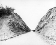 |
362 KB | ((Information |Description = Completed Clappison Cut on Highway 6 near Hamilton, Ontario |Source = [http://preview.hpl.ca:8080/Sites/latelogin.jspx?recordsWithCatalogName=IMDB:127&r=1650324243949#1650324446005_0 Hamilton Public Library] |Date = 1920s |Author = Unknown, likely Ontario Department of Highways |Permission = ((PD-Canada|local)) |other_versions = )) ((Keep local)) |
| 04:40, 17 April 2022 | Clappison cut 2.png (file) |  |
470 KB | == Summary == ((Information | description = Construction of the Clappison Cut on what would become Ontario Highway 5 and later Ontario Highway 6 north of Hamilton | source = [https://henleyshamilton1.wordpress.com/2012/07/17/clappison-cut-being-cut-1924/ Henley's Hamilton: Clappison Cut] | date = circa 1921 or 1922 | author = unknown | permission = ((PD-Canada)) | other_versions = )) ((Keep local)) |
| 04:33, 17 April 2022 | Clappison cut 1.png (file) |  |
237 KB | == Summary == ((Information | description = Construction of the Clappison Cut on what would become Ontario Highway 5 and later Ontario Highway 6 north of Hamilton. Photo faces south towards Burlington Bay. | source = [https://henleyshamilton1.wordpress.com/2012/07/17/clappison-cut-being-cut-1924/ Henley's Hamilton: Clappison Cut] | date = circa 1921 or 1922 | author = unknown | permission = ((PD-Canada)) | other_versions = )) ((Ke... |
| 04:33, 17 April 2022 | Clappison cut 3.png (file) | 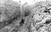 |
286 KB | == Summary == ((Information | description = Construction of the Clappison Cut on what would become Ontario Highway 5 and later Ontario Highway 6 north of Hamilton | source = [https://henleyshamilton1.wordpress.com/2012/07/17/clappison-cut-being-cut-1924/ Henley's Hamilton: Clappison Cut] | date = circa 1921 or 1922 | author = unknown | permission = ((PD-Canada)) | other_versions = )) ((Keep local)) |
| 13:13, 16 April 2022 | Sixteen Mile Creek bridge, 1922.png (file) |  |
311 KB | == Summary == ((Information | description = The new Sixteen Mile Creek bridge on the Dundas Highway (later Ontario Highway 5). Original caption: "Dundas Street Provincial Highway: High level bridge over Sixteen Mile Creek. Length of bridge 936 feet; height of floor above bed of stream 126 feet." | source = [https://archive.org/details/n04ontariosession55ontauoft/page/n169/mode/2up?view=theater Annual Report, 1922] | date = circa 1922 | author = Department of P... |
| 23:58, 13 April 2022 | Ottawa-Prescott Highway prior to 1919.png (file) |  |
660 KB | == Summary == ((Information | description = Ontario Highway 16 prior to being taken over as part of the provincial highway system in 1918. Original caption: "The Ottawa–Prescott Highway: In its original condition, narrow, fences filled with stone and brush, without grading or drainage" | source = [https://archive.org/details/n04ontariosession53ontauoft/page/n131/mode/2up?view=theater Annual Report, 1920] | date = circa 1918 | author = Department of Public High... |
| 20:44, 10 April 2022 | Highway 8 south of Galt, 1921.png (file) |  |
413 KB | == Summary == ((Information | description = Ontario Highway 8 south of Galt (now Cambridge). Original caption: "Hamilton-Kitchener Provincial Highway: Asphaltic concrete pavement 20 feet wide south of Galt" | source = [https://archive.org/details/n04ontariosession54ontauoft/page/n221/mode/2up?view=theater Annual Report, 1921] | date = circa 1921 | author = Department of Public Highways of Ontario | permission = ((PD-Canada-Crown)) | other_versions = )) ((K... |
| 18:13, 10 April 2022 | Kingston Road at Danforth, 1938.png (file) |  |
279 KB | == Summary == ((Information | description = New overpass built to connect Danforth Avenue (Ontario Highway 5) with Kingston Road (Ontario Highway 2) in Scarborough, one of the first grade-separated intersections in Ontario. Original caption: "Overhead Bridge — Danforth and Kingston Road." | source = [https://archive.org/details/n05ontariosession72ontauoft/page/n623/mode/2up?view=theater Department of Highways Annual Report, 1938] | date =... |
| 00:31, 6 April 2022 | Ottawa St facing east at at Henry Sturm Blvd, 1961.png (file) |  |
183 KB | == Summary == ((Information | description = Facing east along Ottawa Street towards Henry Strum Blvd, prior to construction of the Conestoga Parkway | source = [https://www.thekingshighway.ca/PHOTOS/Hwy8photos2.htm Photographic History of King's Highway 8] | date = 1961 | author = Ontario Department of Highways | permission = ((PD-Canada-Crown)) | other_versions = )) ((Keep local)) |
| 04:52, 3 March 2022 | Highway 8 between Stratford and Sebringville, 1922.png (file) |  |
638 KB | == Summary == ((Information | description = Paving along the Stratford–Goderich Highway (later Ontario Highway 8) between Stratford and Sebringville, shortly after being paved | source = [https://archive.org/details/n04ontariosession55ontauoft/page/n175/mode/2up?view=theater Department of Public Highways Annual Report, 1922] | date = circa 1922 | author = Department of Public Highways of Ontario | permission = ((PD-Canada-Crown)) | other_versions = )) ((Ke... |
| 00:57, 17 February 2022 | Highway 8 northwest near Rockton.png (file) |  |
6.81 MB | cropped |
| 00:55, 17 February 2022 | Freeport Diversion.png (file) |  |
5.02 MB | cropped |
| 03:04, 15 February 2022 | Huron Road 1858.png (file) |  |
215 KB | == Summary == ((Information | description = The Huron Road (later Ontario Highway 8), unknown location between Goderich and Waterloo. | source = [https://archive.org/details/canadacompanyhur0000leer/page/158/mode/2up?view=theater ''The Canada Company and the Huron Tract, 1826-1853''], page 158]. From Archives of Ontario P 129 ACC 1327 AO 6476. | date = 1858 | author = unknown | permission = ((PD)) | other_versions = )) ((Keep local)) |
| 01:28, 15 February 2022 | Queenston Road, Cape Horn, 1918.png (file) |  |
313 KB | crop |
| 03:13, 2 February 2022 | Highway 7 and 8 in Stratford.png (file) |  |
7.08 MB | == Summary == ((Information | description = Facing east along Highway 7/8 in downtown Stratford. | source = [https://flickr.com/photos/dougtone/9189580498/ King's Highway 8 – Ontario] on Flickr | date = May 26, 2013 | author = [https://www.flickr.com/photos/dougtone/ Doug Kerr] | permission = ((cc-by-sa-2.0)) | other_versions = | additional_information = )) ((Keep local)) |
| 20:15, 30 November 2021 | Hespeler Bypass cropped.png (file) | 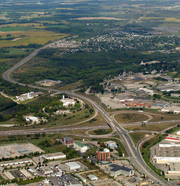 |
8.9 MB | ((Keep local)) ((Information |Description = Hespeler Bypass ("New" Highway 24, though it is no longer part of Highway 24) facing north from its interchange with Highway 401 |Source = ((own)) |Date = September 17, 2011 |Author = '''<font color="#5A5AC5">ʄɭoʏɗiaɲ</font>''' <sup><font color="#3AAA3A">τ</font></sup> <sub><font color="#3AAA3A">¢</font><... |
| 04:11, 21 October 2021 | Highway 11A aerial, 1947.png (file) |  |
1.12 MB | == Summary == ((Information | description = Aerial photograph of Highway 11A prior to construction of Highway 401 | source = [https://www.toronto.ca/city-government/accountability-operations-customer-service/access-city-information-or-records/city-of-toronto-archives/whats-online/maps/aerial-photographs/aerial-photographs-1947/ Aerial Photographs 1947, Sheet 8G] | date = April 1947 | author = City of Toronto | permission = ((PD-Canada)) | other_versions = )) {... |
| 01:50, 19 October 2021 | Avenue Road north towards Wilson Avenue, April 26, 1940.png (file) |  |
457 KB | == Summary == ((Information | description = Avenue Road in North York, facing north towards Wilson Avenue | source = [https://www.thekingshighway.ca/PHOTOS/Hwy11A_torontophotos.htm The King's Highways – Highway 11A] | date = April 26, 1940 | author = Department of Highways of Ontario | permission = ((PD-Canada-Crown)) | other_versions = )) ((Keep local)) |
| 16:23, 12 October 2021 | Highway 4 north of St. Thomas, June 23, 1948.png (file) |  |
766 KB | == Summary == ((Information | description = Ontario Highway 4 north of St. Thomas | source = [https://www.thekingshighway.ca/PHOTOS/Hwy4photos.htm The King's Highways – Highway 4] | date = June 23, 1948 | author = Department of Highways of Ontario | permission = ((PD-Canada-Crown)) | other_versions = )) ((Keep local)) |
| 01:18, 27 September 2021 | Highway 400 and 88, 1962.png (file) |  |
325 KB | == Summary == ((Information | description = Highway 400 and Highway 88 interchange | source = [https://www.thekingshighway.ca/PHOTOS/Hwy88photos.htm The King's Highways – Highway 88] | date = May 1962 | author = Department of Highways of Ontario | permission = ((PD-Canada-Crown)) | other_versions = )) ((Keep local)) |
| 03:59, 24 September 2021 | Old Plank Road 1868.png (file) |  |
3.74 MB | == Summary == ((Information | description = Main Street (now Holland Street West) facing east in Bond Head | source = [http://archives.bradford.library.on.ca/index.php/bond-head-4 Bradford West Gwillimbury Public Library Archives] | date = c. 1868 | author = Unknown | permission = ((PD-Canada)) | other_versions = )) ((Keep local)) |
| 23:31, 17 September 2021 | 88 west from 400.png (file) |  |
5.46 MB | brighten |
| 15:56, 17 September 2021 | Highway 88 Bond Head 1860.png (file) | 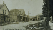 |
235 KB | == Summary == ((Information | description = Main Street (now Holland Street West) facing west in Bond Head | source = [https://bradfordwestgwillimbury.civicweb.net/document/117846 Village of Bond Head Heritage Conservation District Study] | date = c. 1860 | author = Unknown | permission = ((PD-Canada)) | other_versions = )) ((Keep local)) |
| 02:07, 15 September 2021 | Hwy 88 west in 1908.png (file) |  |
632 KB | == Summary == ((Information | description = Main Street (now Holland Street West) facing west in Bradford | source = [https://www.bradfordtoday.ca/local-news/the-1st-canada-day-what-bradford-west-gwillimbury-was-like-in-1867-971338 The 1st Canada Day: What Bradford West Gwillimbury was like in 1867] | date = 1908 | author = Unknown | permission = ((PD-Canada)) | other_versions = )) ((Keep local)) |
| 01:01, 31 August 2021 | Hwy 401-418 interchange2.png (file) |  |
3.47 MB | ((Keep local)) ((Information |Description = Northward view of interchange between Ontario Highway 401 and Ontario Highway 418 |Source = ((own)) |Date = August 30, 2021 |Author = '''<font color="#5A5AC5">Floydian</font>''' <sup><font color="#3AAA3A">τ</font></sup> <sub><font color="#3AAA3A">¢</font></sub>, with assistance from Raymond Bond )) == Licensing == ((cc-by-sa-4.0)) |
| 01:01, 31 August 2021 | Hwy 401-418 interchange.png (file) |  |
3.88 MB | ((Keep local)) ((Information |Description = Southward view of interchange between Ontario Highway 401 and Ontario Highway 418 |Source = ((own)) |Date = August 30, 2021 |Author = '''<font color="#5A5AC5">Floydian</font>''' <sup><font color="#3AAA3A">τ</font></sup> <sub><font color="#3AAA3A">¢</font></sub>, with assistance from Raymond Bond )) == Licensing == ((cc-by-sa-4.0)) |
| 01:00, 31 August 2021 | Holt Road Dogbone.png (file) |  |
2.65 MB | ((Keep local)) ((Information |Description = Dogbone interchange on Ontario Highway 401 at Holt Road in Clarington |Source = ((own)) |Date = August 30, 2021 |Author = '''<font color="#5A5AC5">Floydian</font>''' <sup><font color="#3AAA3A">τ</font></sup> <sub><font color="#3AAA3A">¢</font></sub>, with assistance from Raymond Bond )) == Licensing == ((cc-by-sa-4.0)) |
| 17:42, 18 June 2021 | Highway 17B - Thessalon 2016.png (file) | 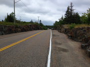 |
4.84 MB | == Summary == ((Information | description = Ontario Highway 17B entering Thessalon from the west, near Lakeside Drive and Dawson Street | source = Courtesy of Jonathan Upton | date = 2016 | author = Jonathan Upton | permission = ((OTRS-pending)) | other_versions = )) ((cc-by-sa-4.0)) ((Keep local)) |
| 16:37, 18 June 2021 | 17B Thessalon 1920.png (file) |  |
1 MB | == Summary == ((Information | description = What would eventually become Ontario Highway 17B (Lakeside Drive) on the west side of Thessalon | source = https://images.ourontario.ca/northofhuron/78484/data | date = 1920 | author = Ontario Department of Highways | permission = ((PD-Canada-Crown)) | other_versions = )) ((Keep local)) |
| 01:54, 8 June 2021 | 169 into Gravenhurst cropped.png (file) | 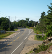 |
7.39 MB | ((Keep local)) == Summary == ((Information |Description=Highway 169 as it enters Gravenhurst, taken from the west rock outcropping. |Source=((own)) |Date=July 3, 2011 |Author='''<font color="#5A5AC5">ʄɭoʏɗiaɲ</font>''' <sup><font color="#3AAA3A">τ</font></sup> <sub><font color="#3AAA3A">¢</font></sub> |Permission= |other_versions=Cropped version of [[:File:169_int... |
| 02:59, 1 June 2021 | ON 41 bypass north of Roblin.png (file) |  |
972 KB | == Summary == ((Information | description = Ontario Highway 41 approximately 4 km north of Roblin, facing south, showing a new alignment (left) through a rock cut built to straighten and flatten the old route (right) | source = Ontario Department of Highways Annual Report for the Fiscal Year Ending March 31, 1949 | date = April 2, 1948 | author = Ontario Department of Highways | permission = ((PD-Canada-Crown)) | other_versions = )) ((K... |
| 03:32, 29 May 2021 | Colonization road in 1901.png (file) |  |
286 KB | == Summary == ((Information | description = "A Section of Road Passing Through Burned Forest in Brudenell Township, 1901" | source = "Rockingham, a Brule on Corduroy Road" – Archives of Ontario – C 120-2-0-0-54, S5049, Charles Macnamara fonds, B379883. Found at [https://dspace.library.uvic.ca/bitstream/handle/1828/9225/Murray_Derek_PhD_2018.pdf?sequence=1&isAllowed=y] | date = circa 1901 | author = Dan McKendry in Buckboard | permission = ((PD)) | other_ve... |
| 05:50, 24 May 2021 | Pembroke Highway Map timeline.ogv (file) | 5.82 MB | Background map via OpenStreetMap Additions by Floydian, using the following Public Domain images: *File:Ontario 17.svg *File:Ontario 41.svg *File:Ontario 62.svg *File:Ontario 148.svg | |
| 02:11, 17 May 2021 | Highway 15 north through Smiths Falls 2012.png (file) |  |
6.81 MB | == Summary == ((Information | description = Facing north from the crossing of the Rideau Canal along Ontario Highway 15 towards downtown Smiths Falls. | source = [https://www.flickr.com/photos/dougtone/7886481890 King's Highway 15 – Ontario] on Flickr | date = August 26, 2012 | author = [https://www.flickr.com/photos/dougtone/ Doug Kerr] | permission = ((cc-by-sa-2.0)) | other_versions = | additional_information = Cropped and colour corrected from original by [[... |