Lake Traverse Indian Reservation | |
|---|---|
 Location in North Dakota and South Dakota | |
| Tribe | Sisseton Wahpeton Oyate |
| Country | United States |
| States | North Dakota South Dakota |
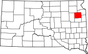
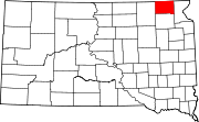
| Counties | Richland Sargent Codington Day Grant Marshall Roberts |
| Headquarters | Agency Village |
| Government | |
| • Body | Tribal Council |
| • Chairman | J. Garret Renville |
| • Vice-Chairman | Lexie Fancher-Lincoln |
| • Secretary | Curtis Bissonette |
| Population (2024)[1] | |
| • Total | 14,800 |
| Website | swo-nsn.gov |
The Lake Traverse Indian Reservation is the homeland of the federally recognized Sisseton Wahpeton Oyate, a branch of the Santee Dakota group of Native Americans. Most of the reservation covers parts of five counties in northeastern South Dakota, while smaller parts are in two counties in southeastern North Dakota, United States.
The Reservation was created by treaty on April 22, 1867 A.D. and called the Flatiron Reservation, in reference to its triangular shape.[2] It was created for the "friendly Dakota" from the Minnesota hostilities of 1862-1866. Signatories of the treaty were Gabriel Renville, John Otherday plus twenty-one other Sisseton and Wahpeton leaders.[2] Gabriel Renville was the first Chief of the Reservation.
Its resident population of 10,408 people, was counted during the 2000 census. About one-third of its inhabitants identify as of solely Native American heritage. Its largest community is the city of Sisseton, South Dakota. It operates a tribal college, Sisseton-Wahpeton Community College.