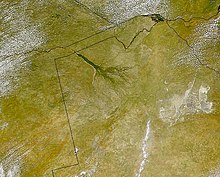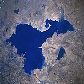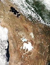

An endorheic basin (/ˌɛndoʊˈriː.ɪk/ EN-doh-REE-ik; also endoreic basin and endorreic basin) is a drainage basin that normally retains water and allows no outflow to other, external bodies of water (e.g. rivers and oceans); instead, the water drainage flows into permanent and seasonal lakes and swamps that equilibrate through evaporation. Endorheic basins are also called closed basins, terminal basins, and internal drainage systems.
Endorheic regions contrast with open lakes (exorheic regions), where surface waters eventually drain into the ocean.[1] In general, water basins with subsurface outflows that lead to the ocean are not considered endorheic;[2][3][4] but cryptorheic.[5] Endorheic basins constitute local base levels, defining a limit of the erosion and deposition processes of nearby areas.[6] Endorheic water bodies include the Caspian Sea, which is the world's largest inland body of water.[7]
The term endorheic derives from the French word endoréisme, which combines endo- (Ancient Greek: ἔνδον éndon 'within') and ῥεῖν rheîn 'flow'.[8]
|
Main article: Endorheic lake |
Endorheic lakes (terminal lakes) are bodies of water that do not flow into an ocean or a sea. Most of the water that falls to Earth percolates into the oceans and the seas by way of a network of rivers, lakes, and wetlands.[9] Analogous to endorheic lakes is the class of bodies of water located in closed watersheds (endorheic watersheds) where the local topography prevents the drainage of water into the oceans and the seas.[10][11] These endorheic watersheds (containing water in rivers or lakes that form a balance of surface inflows, evaporation and seepage) are often called sinks.[12]
Endorheic lakes are typically located in the interior of a landmass, far from an ocean, and in areas of relatively low rainfall. Their watersheds are often confined by natural geologic land formations such as a mountain range, cutting off water egress to the ocean. The inland water flows into dry watersheds where the water evaporates, leaving a high concentration of minerals and other inflow erosion products. Over time this input of erosion products can cause the endorheic lake to become relatively saline (a "salt lake"). Since the main outflow pathways of these lakes are chiefly through evaporation and seepage, endorheic lakes are usually more sensitive to environmental pollutant inputs than water bodies that have access to oceans, as pollution can be trapped in them and accumulate over time.[7]

Endorheic regions can occur in any climate but are most commonly found in desert locations.[13] This reflects the balance between tectonic subsidence and rates of evaporation and sedimentation. Where the basin floor is dropping more rapidly than water and sediments can accumulate, any lake in the basin will remain below the sill level (the level at which water can find a path out of the basin). Low rainfall or rapid evaporation in the watershed favor this case. In areas where rainfall is higher, riparian erosion will generally carve drainage channels (particularly in times of flood), or cause the water level in the terminal lake to rise until it finds an outlet, breaking the enclosed endorheic hydrological system's geographical barrier and opening it to the surrounding terrain.[14][15] The Black Sea was likely such a lake, having once been an independent hydrological system before the Mediterranean Sea broke through the terrain separating the two.[16] Lake Bonneville was another such lake, overflowing its basin in the Bonneville flood.[17] The Malheur/Harney lake system in Oregon is normally cut off from drainage to the ocean, but has an outflow channel to the Malheur River. This is presently dry, but may have flowed as recently as 1,000 years ago.[18]
Examples of relatively humid regions in endorheic basins often exist at high elevation. These regions tend to be marshy and are subject to substantial flooding in wet years. The area containing Mexico City is one such case, with annual precipitation of 850 mm (33 in) and characterized by waterlogged soils that require draining.[19]
Endorheic regions tend to be far inland with their boundaries defined by mountains or other geological features that block their access to oceans. Since the inflowing water can evacuate only through seepage or evaporation, dried minerals or other products collect in the basin, eventually making the water saline and also making the basin vulnerable to pollution.[7] Continents vary in their concentration of endorheic regions due to conditions of geography and climate. Australia has the highest percentage of endorheic regions at 21 per cent while North America has the least at five per cent.[20] Approximately 18 per cent of the Earth's land drains to endorheic lakes or seas, the largest of these land areas being the interior of Asia.
In deserts, water inflow is low and loss to solar evaporation high, drastically reducing the formation of complete drainage systems. In the extreme case, where there is no discernible drainage system, the basin is described as arheic.[13] Closed water flow areas often lead to the concentration of salts and other minerals in the basin. Minerals leached from the surrounding rocks are deposited in the basin, and left behind when the water evaporates. Thus endorheic basins often contain extensive salt pans (also called salt flats, salt lakes, alkali flats, dry lake beds, or playas). These areas tend to be large, flat hardened surfaces and are sometimes used for aviation runways, or land speed record attempts, because of their extensive areas of perfectly level terrain.
Both permanent and seasonal endorheic lakes can form in endorheic basins. Some endorheic basins are essentially stable because climate change has reduced precipitation to the degree that a lake no longer forms. Even most permanent endorheic lakes change size and shape dramatically over time, often becoming much smaller or breaking into several smaller parts during the dry season. As humans have expanded into previously uninhabitable desert areas, the river systems that feed many endorheic lakes have been altered by the construction of dams and aqueducts. As a result, many endorheic lakes in developed or developing countries have contracted dramatically, resulting in increased salinity, higher concentrations of pollutants, and the disruption of ecosystems.
Even within exorheic basins, there can be "non-contributing", low-lying areas that trap runoff and prevent it from contributing to flows downstream during years of average or below-average runoff. In flat river basins, non-contributing areas can be a large fraction of the river basin, e.g. Lake Winnipeg's basin.[21] A lake may be endorheic during dry years and can overflow its basin during wet years, e.g., the former Tulare Lake.
Because the Earth's climate has recently been through a warming and drying phase with the end of the Ice Ages, many endorheic areas such as Death Valley that are now dry deserts were large lakes relatively recently. During the last ice age, the Sahara may have contained lakes larger than any now existing.[22]
Climate change coupled with the mismanagement of water in these endorheic regions has led to devastating losses in ecosystem services and toxic surges of pollutants.[23] The desiccation of saline lakes produces fine dust particles that impair agriculture productivity and harm human health.[24][25] Anthropogenic activity has also caused a redistribution of water from these hydrologically landlocked basins such that endorheic water loss has contributed to sea level rise, and it is estimated that most of the terrestrial water lost ends up in the ocean.[26] In regions such as Central Asia, where people depend on endorheic basins and other surface water sources to satisfy their water needs, human activity greatly impacts the availability of that water.[27]
|
See also: List of endorheic basins |

Large endorheic regions in Africa are located in the Sahara Desert, the Sahel, the Kalahari Desert, and the East African Rift:
There are endorheic lakes in Antarctica in the McMurdo Dry Valleys, Victoria Land, the largest ice-free area in Antarctica.


Much of Western and Central Asia is a giant endorheic region made up of a number of contiguous closed basins. The region contains several basins and terminal lakes, including:
Other endorheic lakes and basins in Asia include:

Australia, being very dry and having exceedingly low runoff ratios due to its ancient soils, has many endorheic drainages. The most important are:

Though a large portion of Europe drains to the endorheic Caspian Sea, Europe's wet climate means it contains relatively few terminal lakes itself: any such basin is likely to continue to fill until it reaches an overflow level connecting it with an outlet or erodes the barrier blocking its exit.
There are some seemingly endorheic lakes, but in fact they are cryptorheic, being drained either through manmade canals, via karstic phenomena, or other subsurface seepage.[clarification needed]
A few minor true endorheic lakes exist in Spain (e.g. Laguna de Gallocanta, Estany de Banyoles), Italy, Cyprus (Larnaca and Akrotiri salt lakes) and Greece.


Many small lakes and ponds in North Dakota and the Northern Great Plains are endorheic; some of them have salt encrustations along their shores.
Some of Earth's ancient endorheic systems and lakes include: