Town in New York, United States
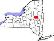
Mayfield is a town in Fulton County, New York, United States, northeast of Gloversville and Johnstown. The town contains a village also named Mayfield. The population of the town was 6,495 at the 2010 census.[3]
History
The land that is now the town was part of the Mayfield Patent of 1770. The town was established in 1793 from the town of Caughnawaga in Montgomery County before the formation of Fulton County in 1838. It was one of the first three such towns formed. Part of Mayfield was taken in 1805 to form the town of Wells (now in Hamilton County). An additional part of Mayfield was added to Wells in 1812. Mayfield was reduced once again in 1842 to form the town of Perth. The early economy was based on lumber and leather production. The Oliver Rice House located on Old NY 30 was listed on the National Register of Historic Places in 1995.[4]
Geography
According to the United States Census Bureau, the town has a total area of 64.7 square miles (167.5 km2), of which 58.4 square miles (151.2 km2) is land and 6.3 square miles (16.3 km2), or 9.74%, is water. Mayfield is mostly within the Adirondack Park and is on the southwestern shore of Great Sacandaga Lake. New York State Route 30 is an important north-south highway in Mayfield. NY-30 intersects New York State Route 30A at Riceville. New York State Route 349 is an east-west highway in the southern part of the town. East-west highways New York State Route 29 and New York State Route 29A converge in the southern part of Mayfield, east of Vail Mills.
Demographics
Historical population
| Census | Pop. | Note | %± |
|---|
| 1820 | 2,025 | | — |
|---|
| 1830 | 2,614 | | 29.1% |
|---|
| 1840 | 2,615 | | 0.0% |
|---|
| 1850 | 2,429 | | −7.1% |
|---|
| 1860 | 2,367 | | −2.6% |
|---|
| 1870 | 2,241 | | −5.3% |
|---|
| 1880 | 2,231 | | −0.4% |
|---|
| 1890 | 2,181 | | −2.2% |
|---|
| 1900 | 2,136 | | −2.1% |
|---|
| 1910 | 2,065 | | −3.3% |
|---|
| 1920 | 1,806 | | −12.5% |
|---|
| 1930 | 2,077 | | 15.0% |
|---|
| 1940 | 2,734 | | 31.6% |
|---|
| 1950 | 3,145 | | 15.0% |
|---|
| 1960 | 3,613 | | 14.9% |
|---|
| 1970 | 4,522 | | 25.2% |
|---|
| 1980 | 5,439 | | 20.3% |
|---|
| 1990 | 5,738 | | 5.5% |
|---|
| 2000 | 6,427 | | 12.0% |
|---|
| 2010 | 6,495 | | 1.1% |
|---|
| 2016 (est.) | 6,272 | [2] | −3.4% |
|---|
|
As of the census[6] of 2000, there were 6,432 people, 2,535 households, and 1,804 families residing in the town. The population density was 110.1 inhabitants per square mile (42.5/km2). There were 3,211 housing units at an average density of 55.0 per square mile (21.2/km2). The racial makeup of the town was 97.99% White, 0.39% Black or African American, 0.22% Native American, 0.42% Asian, 0.47% from other races, and 0.51% from two or more races. Hispanic or Latino of any race were 0.87% of the population.
There were 2,535 households, out of which 32.7% had children under the age of 18 living with them, 55.7% were married couples living together, 10.3% had a female householder with no husband present, and 28.8% were non-families. 23.1% of all households were made up of individuals, and 10.8% had someone living alone who was 65 years of age or older. The average household size was 2.53 and the average family size was 2.95.
In the town, the population was spread out, with 25.2% under the age of 18, 6.4% from 18 to 24, 28.2% from 25 to 44, 26.1% from 45 to 64, and 14.1% who were 65 years of age or older. The median age was 39 years. For every 100 females, there were 98.2 males. For every 100 females age 18 and over, there were 95.6 males.
The median income for a household in the town was $37,982, and the median income for a family was $42,289. Males had a median income of $30,326 versus $22,105 for females. The per capita income for the town was $17,972. About 5.9% of families and 8.6% of the population were below the poverty line, including 11.9% of those under age 18 and 7.4% of those age 65 or over.