This is a Wikipediauser page. This is not an encyclopedia article or the talk page for an encyclopedia article. If you find this page on any site other than Wikipedia, you are viewing a mirror site. Be aware that the page may be outdated and that the user in whose space this page is located may have no personal affiliation with any site other than Wikipedia. The original page is located at https://en.wikipedia.org/wiki/User:Kew_Gardens_613/sandbox_6.
This is the user sandbox of Kew Gardens 613. A user sandbox is a subpage of the user's user page. It serves as a testing spot and page development space for the user and is not an encyclopedia article. Create or edit your own sandbox here.Other sandboxes: Main sandbox | Template sandbox Finished writing a draft article? Are you ready to request review of it by an experienced editor for possible inclusion in Wikipedia? Submit your draft for review!
This page is here to try to work on a split of the History of the New York City Subway article. The article already is pretty long, and with added information it will get longer. Other editors, feel free to add, fix, and add references to what is here. The goal is to transfer this material to the mainspace.
December 2001 NYCT Committee Agenda (page 78), with a recommended implementation date of January 2002
Just read in a Queens community newspaper (W. Queens Gazette) that MTA will run all Ws local only in Astoria as of 1/7/02. This after surveys showed the Ns were vastly overcrowded and the Ws undercrowded. Turns out the few weeks the W ran local after the N was restored post 9/11 was an experiment - during that period, the usage of the N and W was almost 50-50 (as you would expect, since they alternate in service).
"The resulting service plan provided a net increase in Astoria Line service, albeit with a decrease in frequency at local stations during the peak hour. Since approximately 43% of Astoria Line riders board at express stations, it was believed that the express/local operation would provide sufficient capacity on the N and W trains.
"In practice, since the service commenced in July 2001, the expected operational benefits of the express/local operation have not been realized, and the Astoria Line component of the service plan has proved problematic from a customer perspective. According to traffic checks conducted in August 2001, the ridership split between the N and W routes was not as even as expected, with N trains carrying 1.9 times as many passengers as W trains in the mornings, and 2.6 times as many in the evenings. As a result, a number of complaints were received from local riders, who experienced long waits and crowded conditions on the N, with lightly loaded W trains passing by on the express track.
"Immediately following the September 11 World Trade Center attack, N service was suspended, and the W operated via the local tracks at all times. When N service was restored in October, the W continued to operate local for several weeks on a trial basis. Checks conducted during this trial period found that the ridership split between the two services was more even, and that the termina was able to accommodate the all-local operation."
http://talk.nycsubway.org/perl/read?subtalk=303599
11/9 W express resumed
"The W provides express service from Astoria into Manhattan from 6 a.m. and 1 p.m. weekdays from Ditmars Boulevard, Astoria Boulevard and Queensborough Plaza en route to Manhattan. It runs express in the other direction from 1 p.m. to 9:30 p.m. but terminates at 57th Street/7th Avenue in Manhattan after 9:30 p.m. The W provides local service in Queens at all other timess."
Actually, the last southbound express left at 12:38, and then northbound began around 1. Like the J, 6 and 7.
I used to get that job on vacation relief, and both southbound trips were express (the second one being that last one at that time), and then the second northbound trip was express. So 3 out of 4 intervals were express, including the entire second round trip.
"Study an express train for the Astoria Line from Astoria Boulevard to Queensboro Plaza. Like the 7 train, the express N or Q train would run only during peak hours in the peak direction. This service would help residents of northern Astoria reach the central business district in less time, as well as more evenly distribute ridership to prevent overcrowding. In the summer of 2001, the MTA experimented with peak hour express service on the Astoria Line, but found that demand did not support the additional trains; express trains were mostly empty
(with 65% choosing the local train). However, with increasing development, and population growth in northern Astoria, ridership is expected to increase, and an express service may make sense in the long term.
In May 1994, a $15,222,222 contract was awarded for the rehabilitation of the Archer Avenue Fan Plants, which are located between the Parsons Boulevard and Sutphin Boulevard stations. They were upgraded to comply with the latest federal standards to ensure proper ventilation in case of tunnel fires. As part of the project, the remote operating controls were relocated from the Parsons Boulevard signal tower to the power control center at West 53rd Street.[1]: C-91
April 13, 1989 survey of Nevins found corroded and crumbled concrete, but failed to find immediately hazardous structural problems; discovered in summer 1990, forced to award an emergency contract to reconstruct mezzanine
Had been scheduled for renovation in 1992
Station Modernization Program
Designed to achieve aesthetic and circulation improvements
Goal was to return stations to a SOGR more quickly and cheaper than under SMP, all work TA workers, stations initially expected to be completed within a year and cost $1 million
Began without adequate planning like SMP, cost escalation and delays
Station Rehabilitation Program
1/2 done by contractors In 9/90 expected to do 118 rehabs between 1991 and 1996
Platform Extensions
IRT request to lengthen platforms for 8 or 10- car trains, instead of 5 and 6-car locals; all platforms south of Brooklyn Bridge and north of 96th Street could fit 8- or 10-car trains
Most local platforms were 200 feet, while expresses were 350 feet[7]
FY1906–Brighton and West End Lines for six-car elevated trains; underway on Myrtle Avenue Line[8]
Work on extending the platform began in January 1910 to fit 10-car express trains and 6-car local trains; operation of six-car locals ready by November 1, and 10-car expresses by February 1, 1911
Increase capacity by 23% for $1,500,000
Lenox Yard shop extended to accommodate 10-car trains
1911 Annual Report
Atlantic Avenue station extended to accommodate 10-car trains
6-car local opened October 24 and 10-car opened January 23
1920s
1920- Nevins Street lengthened from 350 to 480 feet to accommodate 10-car trains; east end of Mott Avenue extended 230 feet to connect with the NYC Railroad
1924 Annual Report
Lengthened center platform at Pennsylvania Station by 15 feet to the north; extend Jackson Avenue on the Flushing Line
Group 5 – Lexington Avenue Line (Spring Street, Bleecker Street and Astor Place) [23]: 1266 [24]: 5
Group 7 – Lexington Avenue Line (Canal Street and Worth Street)[19]: 1080
Group 8 – Astoria Line (Queensboro Plaza, 39th Avenue, 36th Avenue, Broadway, 30th Avenue, Astoria Boulevard and Ditmars Boulevard)[25]: 95 – Cost $748,000[26] Take no more than 12 months[27]
Group 9 – Flushing Line (45th Road, 33rd Street, 40th Street, 46th Street, 52nd Street, 61st Street, 69th Street, 74th Street, 82nd Street, 90th Street, Junction Boulevard, 103rd Street–Corona Plaza, 111th Street and Willets Point Boulevard)[28]
Group 10 – Flushing Line (Times Square, Fifth Avenue, Vernon Boulevard–Jackson Avenue and Hunters Point Avenue)[29]: 254
Group 11 – Spring Street, Canal Street, Ralph Avenue, Broadway–East New York, 75th Avenue and Sutphin Boulevard
Borough Hall (Lexington Avenue), Nevins Street, Atlantic Avenue, Franklin Avenue, Utica Avenue, Sutter Avenue, Rockaway Avenue – $800,000 – Platforms lengthened a few feet to accommodate the cars that already use them; Passengers in the tenth car had to walk to the ninth to use them.
C135 Group 12 – Lexington Avenue Line (Bowling Green, Wall Street, Fulton Street, Canal Street, Spring Street, Bleecker Street and Astor Place)
February 19, 1962 – northbound platforms at Canal, Spring, Bleecker and Astor open; southbound done in 1949 – $3,509,000 improvement program started in April 1960
C136 Group 13 – Lexington Avenue Line (Grand Central, 86th Street, 125th Street, 138th Street–Grand Concourse and 149th Street–Grand Concourse) and White Plains Road Line (149th Street–Grand Concourse)[32]: 460
C137 Group 14 – Jerome Avenue Line (167th Street, 170th Street, Mt. Eden Avenue, 176th Street, Burnside Avenue, 183rd Street, Fordham Road, Kingsbridge Road, Bedford Park Boulevard, Mosholu Parkway and Woodlawn) and White Plains Road Line (East 238th Street and East 241st Street)[35]: 266 and 634 [36]: 620, 649 [37]
C138 Group 15 – Eastern Parkway Line (Borough Hall, Atlantic Avenue, Franklin Avenue and Utica Avenue)
C150 Group 20 – Dyre Avenue Line (Morris Park, Pelham Parkway, Gun Hill Road and Baychester Avenue)[40]: 426
C153 Group 21 Portions A and B, Broadway-Seventh Avenue Line: Wall Street, Fulton Street and Park Place and Lenox Avenue Line (110th Street, 116th Street, 125th Street, 135th Street) [35]: 56, 635
C154 Group 22 – Brooklyn Line (Clark Street, Borough Hall, Bergen Street, Grand Army Plaza, Eastern Parkway, Nostrand Avenue and Kingston Avenue) and Nostrand Avenue Line (President Street, Sterling Street, Winthrop Street, Church Avenue, Beverley Road, Newkirk Avenue and Flatbush Avenue) [35]: 635
C158 Group 23 – Broadway–Seventh Avenue Line (Rector Street, Cortlandt Street, Chambers Street, Franklin Street, Canal Street, Houston Street, Christopher Street, 14th Street, 18th Street, 23rd Street, 28th Street and 34th Street)[40]: 183
C157 Group 24 – Brighton Line (Atlantic Avenue, Seventh Avenue, Parkside Avenue, Church Avenue, Beverly Road, Cortelyou Road and Newkirk Avenue): 619 [41]
C164 Group 25 – Brighton Line (Avenue H, Avenue J, Avenue M, Kings Highway, Avenue U, Neck Road, Brighton Beach, Ocean Parkway, West Eighth (U.L) and Coney Island)
( on August 7, 1967, granting an Extension of Time to the Contractor to January 24, 1967. to complete work under the contract dated May 21, 1964): 124, 409
C178 – Fourth Avenue Line (Court Street and Lawrence Street)[35]: 152
C181 Group 27 – Broadway Line (Whitehall Street, Rector Street, Cortlandt Street, City Hall, Canal Street, Broadway and Prince Street)
C193 Group 30 – Pacific Street, Union Street, 9th Street, Prospect Avenue, 25th Street, 36th Street
50 additional stations within two years of 1967 on West End, Sea Beach and Fourth Avenue[43]
C210 Group 31 – West End Line – Ninth Avenue, Fort Hamilton Parkway, 50th Street, 55th Street, 62nd Street, 71st Street, 79th Street, 18th Avenue, 20th Avenue, Bay Parkway and 25th Avenue[44]
It is shown in the color purple on station signs, the official subway map, internal route maps in R188 cars, and route signs on the front and sides of R62A subway cars. Before the line was opened all the way to Flushing, it was known as the Corona Line or Woodside and Corona Line.[52] Prior to the discontinuance of BMT services in 1949, the portion of the IRT Flushing Line between Times Square and Queensboro Plaza was known as the Queensboro Line.[53][54]
At Queensboro Plaza, the eastbound track (railroad north) is above the westbound track, with both tracks on the south side of the island platforms. On the north side of these platforms is the BMT Astoria Line. East of this point, both the Flushing Line and the Astoria Line were formerly operated by the IRT and the BMT, respectively. Connections still exist between the eastbound tracks just east of the platforms, but cannot be used for revenue service as BMT trains are wider than IRT trains. This is the only track connection between the Flushing Line and the rest of the subway system.[56]
West of Queensboro Plaza, the line sharply turns south onto an elevated structure over 23rd Street. It heads into the west end of Amtrak's Sunnyside Yard, and passes through two underground stations before entering Manhattan via the Steinway Tunnel under the East River. In Manhattan, the line runs under 42nd Street, with part directly underneath the 42nd Street Shuttle (S train), before angling towards 41st Street. The Times Square–42nd Street station, with no track connections to other lines, is directly under 41st Street.[56]
West of Times Square, the tracks curve sharply downward before turning under 11th Avenue. The tracks end at 24th Street, although the last station is at 34th Street.[56][58] This segment was built as part of the extension of the Flushing Line west to Manhattan's Far West Side (see below). A decommissioned lower level at the IND Eighth Avenue Line's 42nd Street–Port Authority Bus Terminal station formerly blocked the way; it had been rumored that the IND built it to keep the IRT from extending the Flushing Line, although no blueprints indicate that the IRT planned such an expansion. While some originally questioned the necessity of the plan, with London receiving the 2012 Summer Olympics, the city pursued it as a means to enable the redevelopment of the far West Side under the Hudson Yards Redevelopment Project.
Distinctions
The Flushing Line is one of only two New York City non-shuttle subway lines that hosts only a single service and does not share operating trackage with any other line or service; the other is the BMT Canarsie Line, carrying the L service. Because of this, the MTA is automating the line with new trains using communication-based train control (CBTC), similar to the Canarsie Line.
The IRT Flushing Line's 7 service has the distinction of running trains with the largest number of cars in the New York City Subway. 7 trains are eleven cars long; most other New York City Subway services run ten or eight-car trains. The trains are not the longest by total length, however. An IND/BMT train of ten 60-foot (18 m)-long cars or eight 75-foot (23 m)-long cars, which is 600 feet (180 m) long, is still 35 feet (11 m) longer than an IRT train of eleven 51.4-foot (15.7 m)-long cars, which is 565 feet (172 m) long.[56]
The Flushing Line today consists of two main portions: the elevated portion east of Hunters Point Avenue, and the subway portion to the west. While planning for the elevated portion began with the signing of the Dual Contracts in 1913, the planning for the subway portion dates back to 1885, not for a subway line, but for an underground trolley line. On February 25, 1885, the East River Tunnel Railroad Company was incorporated in order to construct a rail tunnel from Ravensood to a point in Manhattan which would allow for a direct connection between the Long Island Rail Road and the New York Central Railroad. At that time period, movement through the New York metropolitan area was hampered by many large, nearly impassable bodies of water, figuratively cutting the different regions apart from each other (except for ferry service, which wasn't always possible or practical). In addition, plans to build the Queensboro Bridge were stagnant at the time. Surveying work was done to evaulate possible tunnel sites, but no more work was done on the project. The company was reorganized as the New York and Long Island Railroad Company on July 22, 1887.
Manhattan route
The initial plan for the route in Manhattan was filed on January 7, 1888. The line would have started at Ninth Avenue and 30th Street, before going diagonally under private property to 33rd Street and Sixth Avenue. From there, it would have continued diagonally to 34th Street and Fifth Avenue, continuing on 34th Street to Second Avenue, before tunneling under the East River at a point between 34th Street and 35th Street. The route was modified with a route filed on May 11, 1888: the route would start at 38th Street and Eleventh Avenue on the surface, before entering a tunnel on 38th Street before reaching Tenth Avenue. The line would then continue east in a tunnel to the east River. Track connections would be provided to the New York Central Railroad's West Side Line, to the Hudson Tunnel Railway at Washington Square, and to Grand Central Depot via a tunnel spur up Park Avenue. The final modification was filed on January 13, 1890: the route was moved further north, mostly running via 42nd Street. The route was going to run under 42nd Street from the East River to Tenth Avenue, where two spurs, using an open cut and private rights-of-way, would branch off: one would connect to the New York Central at Eleventh Avenue and 43rd Street, while the other would terminate at Eleventh Avenue and 41st Street. The change in route was due to the vocal opposition of the residents along the 34th Street and 38th Street routes.
Queens route
In Queens, the route was to be constructed in a tunnel from the East River to 5th Street and then under a private right-of-way to Fourth Avenue, before running via that street to Jackson Avenue, and then finally to Thompson Avenue by running alongside Jackson Avenue. The planned route was revised with a new map on January 30, 1892.
On Jan. 30, 1892, the N.Y. & L.I. filed a revised map of the Long Island City section in the Queens County Register's Office. The route was shown primarily as a connecting railroad between the various L.I.RR. lines in Brooklyn and Queens. In Long Island City the tunnels ran under 4th St. as before, but now the tunnels continued as far as Van Alst Ave. (21st St.). The remainder of the route was as follows: curving north under the L.I.RR. tracks by either of two alternative routes under private right-of-way to Hunter's Point Ave. & Meadow St. (Skillman Ave.), thence under Skillman Ave. to a portal between Davis St. (Court) & Pearson St., thence one branch over a trestle on private right-of-way near Nelson St. (47th Ave.), then around the north end of Dutch Kills (a waterway), then south around the Kills at the east of Orton (30th) St. via a private right-of-way to the intersection of Review Ave. & Young St. (now closed but then an extension of the present 34th St.), thence by a curve to a connection into the Montauk Division of the L.I.RR.; also at the beginning of the curve, a sub-branch crossing over the Montauk via a trestle and over Newtown Creek on a bridge. This sub-branch was for a proposed link to the Evergreen Branch of the L.I.RR. in Brooklyn. There was another branch route planned to begin at the portal along Skillman Ave. and private right-of-way to connect L.I.RR. Main Line at about the point where Skillman Ave. crosses Queens Blvd.
An additional branch would have started at the intersection of the branch to the Montauk Division and 48th Avenue, before running via a private right-of-way to a point where Thomson Avenue met the Main Line. Finally, a separate branch would originate at Fifth Street, and then run under a private right-of-way north of Vernon Avenue and Third Street to Newtown Creek and Eleventh Street, before running under the Creek in a tunnel to Oakland Street to Greenpoint in Brooklyn.
New York City granted a franchise to the Company for construction on Dec. 31, 1890, for the part in Manhattan, while the City of Long Island City approved the application October 20, 1891 for the section in that area. Various extensions of time were granted by the political bodies for the construction which lagged ending on January 1, 1907.
New money was needed to invest in the project and one of the men of the time who became interested in it and believed that it had possibilities was Mr. William Steinway, founder of the Steinway & Sons Piano Co. He owned a sizable part of Long Island City real estate & owned the Steinway and Hunter's Point Railroad which was a local horse car line. By obtaining control of the tunnel company, it would increase the value of his properties. It was his plan to operate the tunnels by electricity which had recently been harnessed for electric traction motors. Stations were to be scattered along the route for both passenger and freight service.
Initial construction
The route was finalized in the City of New York in 1890 and in Long Island City by 1891. The contract for the construction was awarded to Myles Tierney a contractor who had built the Washington Bridge over the Harlem River at 180th Street. He in turn gave the contract to the Inter-Island Construction Co. which he founded on Jan. 6, 1891 in association with Niven. Construction was started on June 7, 1892, as a NY&LIRR project,[59]: 163–168 and the bottom of the tunnel shaft was reached in December of the same year.
The tunnel was to begin on the New York side near the Hudson River docks in Manhattan, from there it would go east along 42nd Street to Grand Central and carry straight on under the East River. In Long Island City, the tunnel portals were to be between 5th Street (now 49th Avenue) and 4th Street (now 50th Avenue). It would go under Jackson Avenue and finally Thomson Avenue, intersecting LIRR tracks at Hunterspoint Avenue. The total cost of the 5.6-mile (9.0 km) tunnel was to be US$11.7 million. The estimated total cost exceeded the financial capabilities of the company by far. So in July 1891, piano maker William Steinway started to fund the tunnel. In Astoria, Steinway had acquired, in addition to its factory, considerable real estate assets. As Steinway was the NY&LIRR's biggest stockholder, the tunnel was named after him. Steinway advised the company to utilize electricity to power the tunnels, believing that the construction of the tunnel would increase the value of his properties within the vicinity.
However, soon after the start of construction, there were many complications. The project was difficult due to complex geological formations beneath the river, and there were frequent blowouts and floods. It was curtailed for a little while when five people were killed on December 28, 1892. At the corner of Vernon Boulevard, Jackson Avenue and 50th Avenue, a 85-foot (26 m)-deep shaft was dug, and on December 28, during an attempt to heat frozen dynamite in the shaft, an uncontrolled explosion claimed five dead and twelve injured. Numerous surrounding houses were heavily damaged. Due to high compensation claims, the Company was financially ruined. Attempts to raise additional funds failed because of the stock market crash of 1893. Work was stopped as a result, and it was boarded up. Investors refused to fund the tunnel because they feared that it was unsafe. Until Steinway died in 1896, some attempts were occasionally made to resume construction.
On June 3, 1892, building of the tunnel commenced near the intersection of 50th Avenue and Vernon and Jackson Avenues. However, several failures and hindrances, which included an underground spring preventing the extraction of rubble, resulted in the termination of the project on February 2, 1893. Several calls for the resumption of the project between 1893 and 1896, in addition to a proposed extension to New Jersey, were futile.[60]
The tunnel was holed through on May 16, 1907, and it was completed on September 24, 1907. While demonstration trolley car runs were conducted through the tunnels, Belmont did not have a franchise to operate a transit line. The concession to operate the tunnels had expired on January 1, 1907, and the city of New York was unwilling to renew the contract. The city did not tolerate privately operated subways and legally prevented the IRT from operating the tunnel with the trams. So for the next five years, the tunnels, with trolley loops on both the Manhattan and Queens sides, remained inoperative. Belmont sold the tunnels to the city in 1913 in the wake of the Dual Contracts, which included the Steinway Tunnel as part of the new Flushing subway line.[61]Surveys and tunnel plans were prepared from scratch by the IRT. For the proposed tram service under the East River, the plans for the tunnel were modified for dedicated tram operation. The tunnel's trackbed was raised, the gradient increased, and the route shortened. The tunnel was to turn at a loop at the corner of 42nd Street and Park Avenue in Manhattan and go as far as Vernon Boulevard in Queens. There, the tram of New York and Queens County Railway was to be connected via a ramp. These three underground stations were Lexington Avenue in Manhattan and Jackson Avenue and Van Alst Avenue in Queens. The total cost amounted to $8 million. The city objected to the tunnel project multiple times and after several disasters nearly stopped it.
The westernmost of the four shafts for the tunnel was in Manhattan and was numbered #1, while the easternmost shaft, in Queens, was numbered #4. Construction began on July 14, 1905, when shaft #4 was sunk; shaft #2 on the opposite shore was sunk by September 1. Shaft #3 was sunk in the Man-O-War Reef, a graniteoutcrop in the East River that was expanded and renamed Belmont Island.
Fifty tramcars were made available for operation through the tunnel. They possessed a 42-foot-5-inch (12.93 m)-long and 8-foot-11-inch (2.72 m)-wide all-steel superstructure with double-sided semi-open entrances at the ends. Power was drawn from an iron rail on the ceiling, to which the car roof's 11+3⁄8-inch (290 mm)-high pantograph would attach. The cars were also fitted with rod pantographs for street operation.
The Flushing Line was extended one stop from Vernon–Jackson Avenues to Hunters Point Avenue on February 15, 1916.[63][64] On November 5, 1916, the Flushing Line was extended two more stops to the east to the Queensboro Plaza station.[54][65][64]
At Queensboro Plaza, the line met the BMT's 60th Street Tunnel, as well as a spur from the elevatedIRT Second Avenue Line on the Queensboro Bridge. From this point east, the Flushing and Astoria Lines were built by the City of New York as part of the Dual Contracts. They were officially IRT lines on which the BMT held irrevocable and equal trackage rights. Because BMT trains were wider, and the platforms had been built for the IRT, normal BMT trains ran only to Queensboro Plaza, with a transfer to shuttles, using elevated cars, that alternated between the Astoria–Ditmars Boulevard and Flushing–Main Street terminals. IRT trains simply continued from the Queensboro Line and Queensboro Bridge onto the lines to Astoria and Flushing, which was originally called the Corona Line or Woodside and Corona Line before it was completed to Flushing.[citation needed]
On December 17, 1912, the Public Service Commission (PSC) approved the route as far as Wateredge Avenue.[66]: 50 By December 1913, the IRT and the City of New York agreed to extend the Corona Line to Flushing, the first extension under the Dual Contracts.[67]: 398
The line was opened from Queensboro Plaza to Alburtis Avenue on April 21, 1917.[54][68][69][70] By June 1917, ridership on the line was exceeding expectations, with 363,726 passengers using the Corona Line that month, 126,100 using the Queensboro Plaza station, and 363,508 using the Queensboro Subway.[71]
On July 23, 1917, Second Avenue Elevated trains began operating over new tracks over the Queensboro Bridge to Queensboro Plaza and the Astoria Line. Initially, service from the elevated only went to the Astoria Line, with Queeensboro Subway service going to the Flushing Line, with transfers available at Queensboro Plaza.[72] Prior to the change, trains from the Queensboro Subway alternated between Astoria and Corona. The change resulted in congestion at the Queensboro Plaza station due to the large volume of passengers transferring to trains via the Queensboro Subway. As a result of outrage by the riding public, Queens Borough President Connolly and Queens Borough Alderman Samuel Burden took up complaints with the PSC.[73]
BMT shuttles began to use the Flushing and Astoria Lines on April 8, 1923.[75] East of there, sources conflict on when each section opened. A New York Times article from May 8 reports that service began on May 7 to what is now the Mets–Willets Point station, and mentions delays due to the structure sinking.[76] Articles from May 13 and 15 cover a celebration to coincide with the opening to the Willets Point stop on May 14.[77][78] In fall 1927, it was discovered that the line's structure was sinking in the old marshland on the western bank of the Flushing River, delaying the extension to Flushing.[74] In the meantime, service continued to terminate at 103rd Street–Corona Plaza.[79][80] The eastern extension to Flushing–Main Street opened on January 21, 1928.[81] At the onset of service to Flushing, Second Avenue Elevated trains terminated at Willets Point due to the lack of necessary equipment at Flushing to accommodate them.[80] On May 21, 1928, Long Island Rail Road management announced that the diversion of passengers from its Port Washington Branch to the new subway to Flushing might result in cuts in service. The extension of the subway in January resulted in a loss of 15,000 to 20,000 daily passengers between Penn Station and points between Flushing and Little Neck, including Whitestone service.[82]
Extension westward
Queensboro Subway Service Extended To Times Square station 1927
In July 1920, Transit Commissioner Delaney proposed constructing a station between Fifth Avenue and Sixth Avenue. The 42nd Street Property Owners and Merchants' Association supported the construction of the station.[83] In November 1921, the contract for the extension of the Queensboro Subway from Grand Central to Eighth Avenue was awarded.[84] On March 22, 1926, the line was extended one stop westward from Grand Central to Fifth Avenue.[85] In the fall of 1926, it was announced that the line to Times Square would be completed by January 1, 1927, but was later pushed to February 19. Due to difficulties in construction, the timeline was pushed back to March 15 on March 1, 1927.[86] The line was finally extended to Times Square on March 14, 1927, one day before the latest deadline.[87]
Unrealized eastern expansion
The Main Street station was not intended to be the Flushing Line's terminus.[88]: 49 [89] While the controversy over an elevated line in Flushing was ongoing in January 1913, the Whitestone Improvement Association pushed for an elevated to Whitestone, College Point, and Bayside. However, some members of that group wanted to oppose the Flushing line's construction if there was not going to be an extension to Whitestone. In January 1913, groups representing communities in south Flushing collaborated to push for an elevated along what was then the LIRR's Central Branch,[88]: 53–55 in the current right-of-way of Kissena Corridor Park.[88]: 277 Shortly after, the New York Public Service Commission (PSC) announced its intent to extend the line as an el from Corona to Flushing, with a possible further extension to Little Neck Bay in Bayside.[88]: 56 There was consensus that the line should not abruptly end in Corona, but even with the 5.5-mile-long (8.9 km) extension to Bayside, the borough would still have fewer Dual Contracts route mileage than either Brooklyn or the Bronx. TheNew York Times wrote that compared to the Bronx, Queens would have far less subway mileage per capita even with the Flushing extension.[90]
The Bayside extension was tentatively approved in June 1913, but only after the construction of the initial extension to Flushing.[88]: 61 Under the revised subway expansion plan put forth in December 1913, the Flushing Line would be extended past Main Street, along and/or parallel to the right-of-way of the nearby Port Washington Branch of the LIRR towards Bell Boulevard in Bayside. A spur line would branch off north along 149th Street towards College Point.[91]
In 1914, the PSC chairman and the commissioner committed to building the line toward Bayside. However, at the time, the LIRR and IRT were administered separately, and the IRT plan would require rebuilding a section of the Port Washington branch between the Broadway and Auburndale stations. The LIRR moved to block the IRT extension past Flushing since it would compete with the Port Washington Branch service in Bayside.[88]: 62 One member of the United Civic Association submitted a proposal to the LIRR to let the IRT use the Port Washington Branch to serve Flushing and Bayside, using a connection between the two lines in Corona.[88]: 63 The PSC supported the connection as an interim measure, and on March 11, 1915, it voted to let the Bayside connection be built. Subsequently, engineers surveying the planned intersection of the LIRR and IRT lines found that the IRT land would not actually overlap with any LIRR land.[88]: 63 [92] The LIRR president at the time, Ralph Peters, offered to lease the Port Washington and Whitestone Branches to the IRT for rapid transit use for $250,000 annually (equivalent to $7,530,000 in 2023), excluding other maintenance costs. The lease would last for ten years, with an option to extend the lease by ten more years. The PSC favored the idea of the IRT being a lessee along these lines, but did not know where to put the Corona connection.[88]: 64 Even the majority of groups in eastern Queens supported the lease plan.[93] The only group who opposed the lease agreement was the Flushing Association, who preferred a previous plan to build the Corona Line extension as a subway under Amity Street (currently Roosevelt Avenue), ending at Main Street.[88]: 64–65
Afterward, the PSC largely ignored the lease plan since it was still focused on building the first phase of the Dual Contracts. The Flushing Business Men's Association kept advocating for the Amity Street subway, causing a schism between them and the rest of the groups that supported the LIRR lease. Through the summer of 1915, the PSC and the LIRR negotiated the planned lease to $125,000 a first year, equivalent to $3,760,000 in 2023, with an eight percent increase each year; the negotiations then stalled in 1916.[88]: 65–66 The Whitestone Improvement Association, impatient with the pace of negotiations, approved of the subway under Amity Street even though it would not serve them directly.[88]: 66 [94] The PSC's chief engineer wrote in a report that a combined 20,600 riders would use the Whitestone and Bayside lines each day in either direction, and that by 1927, there would be 34,000 riders per day per direction.[94][88]: 67 The Third Ward Rapid Transit Association wrote a report showing how much they had petitioned for Flushing subway extensions to that point, compared to how little progress they had made in doing so.[95] Negotiations continued to be stalled in 1917.[88]: 67 Despite the line not having been extended past Corona yet, the idea of a subway extension to Little Neck encouraged development there.[88]: 68
The Whitestone Branch would have had to be rebuilt if it were leased to the subway, with railroad crossings removed and the single track doubled. The PSC located 14 places where crossings needed to be eliminated. However, by early 1917, there was barely enough money to build the subway to Flushing, let alone a link to Whitestone and Bayside.[88]: 68 A lease agreement was announced on October 16, 1917,[96] but the IRT withdrew from the agreement a month later, citing that it was inappropriate to enter such an agreement at that time.[88]: 68 Thereafter, the PSC instead turned its attention back to the Main Street subway extension.[88]: 71
Even after the Main Street station opened in 1928, efforts to extend the line past Flushing persisted. In 1928, the New York City Board of Transportation (BOT) proposed allowing IRT trains to build a connection to use the Port Washington branch, but the IRT did not accept the offer since this would entail upgrading railroad crossings and the single-tracked line. Subsequently, the LIRR abandoned the branch in 1932.[88]: 72 As part of the 1929 IND Second System plan, the Flushing Line would have had branches to College Point and Bayside east of Main Street.[88]: Chapter 3 [97][98] That plan was revived in 1939.[99] The BOT kept proposing an extension of the Flushing Line past Main Street until 1945, when World War II ended and new budgets did not allow for a Flushing extension. Since then, several New York City Transit Authority proposals for an eastward extension have all failed.[88]: 72
Impact on the development of Queens
With the extension of the line to Corona, the adjacent communities (Long Island City, Sunnyside, Woodside, Jackson Heights, Elmhurst, Corona and East Elmhurst) experienced massive growth. The line was described by Mayor William Gaynor as a line going through "cornfields", and through its construction converted these empty plots of land into that densely-populated communities that they are today.[100] The line's construction was planned in conjunction with the street below it: Roosevelt Avenue. The street was referred to as "the proposed Roosevelt Avenue" by the PSC.[88]: 47 For instance, Jackson Heights had a population of 32,932 in 1910, but in 1940, after the line's construction its population swelled to 199,987.[67]: 383
Slight improvements and service curtailments
World's Fair Improvements
On May 7, 1937, the Board of Estimate voted to increase the amount allocated to rebuilding the Willets Point Boulevard station from $650,000 to $800,000 in order to allow the station to accommodate the large number of passengers going to the World's Fair, and to allow for express service.[101]
For the 1939 New York World's Fair, the Willets Point Boulevard station was rebuilt and centered on 123rd Street, just west of where the station originally lay. Some remnants of the old station are still visible; ironwork tends to indicate where the older outside-platform stations were, and the remains of the fare entry area can be seen east of the current station. The original Willets Point Boulevard station was a "minor" stop on the Flushing Line; it had only two stairways and short station canopies at platform level. It was rebuilt into the much larger station in use today, and the ramp used during two World's Fairs still exists, but is only used during special events, such as the US Open for tennis. Express service to the World's Fair began on the Flushing Line on April 24, 1939.[102] This was the first time the middle express track had been used for revenue service; prior to the fair, the express track had only been used for non-revenue moves and re-routes during construction.[citation needed]
Service changes
A poster describing the changes at Queensborough Plaza in 1949
In 1942, when IRT Second Avenue Line service ended, major overhauls for the Corona fleet were transferred to the Coney Island shop. In addition, free transfers to the IRT Third Avenue Line were offered at Grand Central from June 13, 1942 (when Second Avenue Line service ended, including the Queensboro Bridge connection) until May 12, 1955 (when Third Avenue Line service ended).[citation needed]
Currently and historically, the IRT assigned the number 7 to its Flushing Line subway service, though this did not appear on any equipment until the introduction of the R12 class cars in 1948. The BMT assigned the number 9 to its service, used on maps but not signed on trains.[citation needed]
On October 17, 1949, the joint BMT/IRT service arrangement ended. The Flushing Line became the responsibility of IRT. The Astoria Line had its platforms shaved back, and became BMT-only. Passengers no longer had to climb stairs between the upper and lower level with this change as they could transfer across the platforms. The project cost $1,375,000. Because of this, routes through the then eight-track Queensboro Plaza station were consolidated and the northern half of the structure was later torn down. Evidence of where the torn-down platforms were, as well as the trackways that approached this area, can still be seen in the ironwork at the station.[103]
Signalling and station improvements
The station's extra-long platforms, which allow for 11-car operation, are also a remnant of the joint service period. However, the rest of the stations on the line were only able to fit 9-car train sets. These platforms were extended to 11 cars in the late 1950s as the signal system was being improved on the Flushing Line.[104][105]
Identification of Trains and Routing Automatically (IDENTRA) was implemented on the line in the 1957 and used until 1997, when a route selector punch box with B1 Astoria, local/express buttons was installed at the 10/11 car marker on the upper level of Queensboro Plaza.[104][106] IDENTRA used a removable round circular disc type radio antenna assembly, slide-mounted on the small mounting brackets that were attached on the front of R12, R14, R15, and R17 cars that were assigned to the 7 route, which had been used on the line since 1948. Similar to the use of radio transponders in the CBTC installation, the system used the antennas to determine whether a train was running local or express, and then accordingly switched the track at interlockings near the Queensboro Plaza and Flushing–Main Street stations. This move reduced the number of signal towers on the line from 9 to 2[104][107] and allowed to operate 37 eleven-car trains instead of only 30 nine-car trains per hour.[108] The consolidated signal system was in use by 1956 while the selector system was in service by 1958.[105] This system, still in use by many transit agencies such as SEPTA's Broad Street Line, is also nicknamed the "toilet seat" because the removable disc antenna is shaped like a toilet seat.[citation needed]
In 1954, with increased ridership on the line, the trains were lengthened to nine cars each, and were extended to ten cars on November 1, 1962. With the 1964–1964 World's Fair in Flushing Meadows–Corona Park in April 1964, trains were lengthened to eleven cars from ten cars.[105][109]
Rolling stock along the Flushing Line received "strip maps" in 1965, the first such installation in the system. The strip maps showed Flushing Line stations only, but the transfers available at each station were listed.[110]
Decline and rehabilitation
As with much of the rest of the subway system, the IRT Flushing Line was allowed to deteriorate throughout the 1970s to the late 1980s. Structural defects that required immediate attention at the time were labeled as "Code Red" defects or "Red Tag" areas, and were numerous on the Flushing Line. Some columns that supported elevated structures on the Flushing Line were so shaky that trains did not run when the wind speed exceeded 65 miles per hour (105 km/h). This was particularly widespread on the Flushing and the BMT Jamaica Lines.[citation needed]
On May 13, 1985, a 41⁄2-year long project to overhaul the IRT Flushing Line commenced. It forced single-tracking on much of the line during weekends, and the elimination of express service for the duration of the project. The MTA advertised this change by putting leaflets in the New York Times, the Staten Island Advance, the Daily News, and Newsday. The project laid new track, replaced or repaired concrete and steel structures, replaced wooden station canopies with aluminum, improved lighting, improved signage, and installed new ventilation and pumping equipment. Expanded service was provided when the Mets played home games or when there were sporting events in Flushing Meadows–Corona Park. Paradoxically, Flushing local trains had better on-time performance during the construction than before it started.[citation needed]
The $60 million rehabilitation project on the Queens Boulevard concrete viaduct ended on August 21, 1989. When Flushing express service was restored, trains no longer stopped at 61st Street–Woodside. This led to protests by community members to get express service back at 61st Street station. The reason for the discontinuance on the Flushing express was because the MTA felt it took too long to transfer between locals and expresses. The service was also due to fears of delays on the line when locals and expresses merged after 33rd Street–Rawson Street. The change was supposed to enable local trains to stop at 61st Street every four minutes (15 trains per hour) during rush hours, but according to riders, the trains arrived every 8–10 minutes. The community opposition led to service changes, and expresses began stopping at Woodside again a few months later.[111]
Early 21st century upgrades
Automation of the line
In January 2012, the MTA selected Thales for a $343 million contract to set up a communications-based train control (CBTC) system as part of the plan to automate the line. This was the second installation of CBTC, following a successful implementation on the BMT Canarsie Line. The total cost was $550 million for the signals and other trackside infrastructure, and $613.7 million for CBTC-compliant rolling stock.[107] The safety assessment at system level was performed using the formal methodEvent-B.[112]
The MTA chose the Flushing Line for the next implementation of CBTC because it is also a self-contained line with no direct connections to other subway lines currently in use. Funding was allocated in the 2010–2014 capital budget for CBTC installation on the Flushing Line, with scheduled installation completion in 2016.[113] The R188 cars were ordered to equip the line with compatible rolling stock. CBTC on the line will allow the 7 and <7> services to run 7% more service, or 2 more trains per hour (tph) during peak hours (it currently runs 27 tph).[114] However, the system is currently retrofitted to operate at 33 tph even without CBTC.[107][115]
The first train of R188 cars began operating in passenger service on November 9, 2013.[116][117] Test runs of R188s in automated mode started in late 2014.[107] However, the CBTC retrofit date was later pushed back to 2017[118] or 2018[119] after a series of problems that workers encountered during installation, including problems with the R188s.[118][119] The project also went over budget, costing $405 million for a plan originally marked at $265.6 million.[118]
Completely independent of the CBTC installation is the 7 Subway Extension (see below), which features both CBTC signals and fixed-block signaling. The extension will also increase line capacity.[107]
In the 1990s, the Metropolitan Transportation Authority (MTA) began exploring the possibility of a Flushing Line extension to New Jersey.[120] In 2001, a business and civic group convened by Senator Charles Schumer argued that a proposed westward extension of the Midtown office district could not be accomplished without a subway extension, saying:[121]
The long blocks along the avenues make the walk as long as 20 minutes to the westernmost parts of the area. In addition, there is no convenient link from Grand Central Station or elsewhere on the east side of Manhattan, making the Far West Side a difficult commute for workers from parts of Manhattan, Queens, Westchester and Connecticut.[121]
An extension of the Flushing Line was then proposed as part of the New York City bid for the 2012 Summer Olympics.[122][123] The City wanted to get funding before July 2005, at which time the International Olympic Committee would vote on funding, but due to budget shortfalls, the MTA could not pay to fund the extension.[120] Although New York City lost their Olympic bid.[124] After the bid's failure, the government of New York City devised a rezoning plan for the Hudson Yards area and proposed two new subway stations to serve that area.[125] The subway extension was approved[120] following the successful rezoning of about 60 blocks from 28th to 43rd Streets, which became the Hudson Yards neighborhood.[126] In October 2007, the MTA awarded a $1.145 billion contract to build an extension from Times Square to Hudson Yards.[127][128][129]
There is only one new station at 34th Street and Eleventh Avenue to serve Hudson Yards, but in the MTA's original plans, there was another station proposed at 10th Avenue and 41st Street. The 10th Avenue station was eliminated due to lack of funding.[127] The extension's opening was delayed several times due to issues in installing the custom-made incline elevators for the 34th Street station.[130][131][132] The extension eventually opened on September 13, 2015.[133]
^Only the Flushing-bound local side platform is wheelchair-accessible. Trains operate on this platform only during New York Mets games and other special events.[136]
References
^"NYC Transit Committee Agenda May 1994" (Document). New York City Transit. May 16, 1994. ((cite document)): Cite has empty unknown parameters: |access-date=, |url=, and |website= (help)
^ abcAnnual Report — 1962–1963. New York City Transit Authority. 1963.
^Conningham, Joseph J. (April 1, 2009). "Roots of an Evolution: Fifty Years of Automated Train Control in New York". Railway Age. Retrieved September 15, 2015. The latter included an installation on the IRT Flushing (7) line of the US&S IDENTRA (Identification of Trains and Routing Automatically) system in which a passive coil on the lead car actuated wayside readers to set routes and station signs. – via HighBeam (subscription required)
^"Automatic Control of Switches In New York Subway". Railway Signaling and Communications (4). Chicago, Ill.: Simmons-Boardman Publishing Corporation: 33. 1954.
^"TA to Show Fair Train". Long Island Star – Journal. August 31, 1963. Retrieved August 30, 2016 – via Fulton History.
^ abcMitchell L. Moss (November 2011). "HOW NEW YORK CITY WON THE OLYMPICS"(PDF). Rudin Center for Transportation Policy and Management, Robert F. Wagner Graduate School of Public Service. New York University. Retrieved September 11, 2015.
History of the New York City Subway after unification
After World War II, ridership on the New York City Subway was at an all-time high. In 1946, record ridership was recorded with 2,067,000,000 passengers paying fares. However, the maintenance of the train system did not keep up with the high ridership, and the system entered an era of deferred maintenance in which infrastructure was allowed to deteriorate. After the war, many subway construction projects were completed including the Chrystie Street Connection. Soon after, the city entered a fiscal crisis and the closure of elevated lines throughout the city continued.
In addition, construction and maintenance of existing lines was deferred, and graffiti and crime were very common. Trains frequently broke down, were poorly maintained, and were often late, while ridership declined by the millions each year. As in all of the city, crime was rampant in the subway in the 1970s. Thefts, robberies, shootings and killings became more frequent. The rolling stock was very often graffiti-painted or vandalism-damaged both inside and outside. As the New York City Police Department was completely overwhelmed, the public reacted with unease, and the subway was deliberately avoided. Around 1980, the reliability of the vehicles was a tenth of their reliability in the 1960s, and 40 percent of the network required speed restrictions. Because there had been no further studies of the subway since 1975, one third of the fleet was out of use during rush hours due to serious technical defects. In addition, signs were fitted incorrectly, and spare parts were missing or were bought in too large quantities, could not be found, or could not be installed due to lack of repairmen.
The New York City Subway tried to keep its budget balanced between spending and revenue, so deferred maintenance became more common, which drew a slow but steady decline of the system and rolling stock. Furthermore, the workers were consolidated into the Transport Workers Union in 1968. A pension was set up, and workers were allowed to retire after 20 years of service without any transitional period. About a third of the most highly experienced staff immediately retired, resulting in a large shortage of skilled workers.
Only in the 1980s did an $18 billion financing program for the rehabilitation of the subway start. Between 1985 and 1991 over 3,000 subway cars were overhauled and fitted with air conditioning. In this way, comfort, reliability and durability would be increased in order to postpone new purchases. The TA only replaced the oldest cars each division, so that despite the fact that the fleet was overaged, the TA bought only 1,350 new vehicles. Increased patrols and fences around the train yards offered better protection against graffiti and vandalism. At the same time, the TA began an extensive renovation of the routes. Within ten years the tracks were thereby renewed almost systemwide. The Williamsburg Bridge and the Manhattan Bridge, which had strong corrosion damage, were refurbished over the years. The renovation of the stations was initially limited to security measures, fresh paint, new lighting and signs, but the TA also tried to improve the service that had been neglected. This ranged from new uniforms and training for the staff to correct destination signs on the rolling stock. Some subway services were also adapted to the changing needs of customers. Another stated goal was to reduce crime or at least an improvement in the subjective sense of security. At night, the railway police and members of the citizens' initiative Guardian Angels, formed in 1979, patrolled in the subway trains. It was not until the 1990s that the crime in the city and its subway declined significantly. Nevertheless, the reputation as a slow, dilapidated, dirty and unsafe means of transportation remains associated with the subway.
Background
During World War II, ridership on the New York City Subway surged. Due to the war, there was the rationing of gasoline, which made it harder to get around the city by car, and therefore the ridership of the transit system increased. Subway construction projects that had been halted by the war's outbreak such as the ramp connecting the IND Culver Line to the BMT Culver Line, and the completion of the IND Fulton Street Line were resumed. In 1951 a half-billion dollar bond issue was passed to build the Second Avenue Subway, but money from this issue was used for other priorities and the building of short connector lines, namely a ramp extending the IND Culver Line over the ex-BMT Culver Line at Ditmas and McDonald Avenues in Brooklyn (1954), allowing IND subway service to operate to Coney Island for the first time,[1] the 60th Street Tunnel Connection (1955), linking the BMT Broadway Line to the IND Queens Boulevard Line,[1] and the Chrystie Street Connection (1967), linking the BMT line via the Manhattan Bridge to the IND Sixth Avenue Line.[2]
However, many of the lines that were planned to be built were not, and instead of a net increase in subway track milage, there was a decrease. From the 1950s to the 1970s, additional elevated lines were closed and demolished. These closures included the entire IRT Third Avenue Line in Manhattan (1955) and the Bronx (1973), as well as the BMT Lexington Avenue Line (1950), much of the remainder of the BMT Fulton Street Line (1956), the downtown Brooklyn part of the BMT Myrtle Avenue Line (1969), and the BMT Culver Shuttle (1975), all in Brooklyn, and the BMT Jamaica Line in Queens starting in 1977. The BMT Archer Avenue Line was supposed to replace the BMT Jamaica Line's eastern end, but it was never completed to its full extent, and opened in 1988 as a stub-end line, terminating at Jamaica Center.[1]
During the 1960s, car ownership became more popular, and residents of New York City started moving to the suburbs, bringing their tax dollars with them. With the urban flight, the population of the city decreased and subway ridership, in turn, also went down. Partially because of the loss of revenue, the city went on the decline and in 1975, at the height of the city's financial crisis, the city went bankrupt.
The period of decline in the 1970s and 1980s was preceded by a planned expansion of the subway system. The New York City Transit Authority became part of the Metropolitan Transportation Authority, which was created by the New York State Legislature, on March 1, 1968. The new agency started out with ambitious plans. At this time US$600,000,000 was made available for a large subway expansion proposed by then-Mayor John Lindsay. About $1,230,000,000 was spent to create three tunnels and a half-dozen holes as part of construction on the Second Avenue and 63rd Street Lines.[3] The two-phase "Program for Action" was funded as follows:[4]
Phase I was to cost $1.6 billion and be completed over the span of a decade.
Phase II came after Phase I and cost $1.3 billion. Phase II was composed of mostly extensions of existing lines and Phase I-built lines.
A summary of the new subway lines and new subway related expenditures proposed in phase I of the 1968 "Program for Action" follows:
A 2-track subway line, splitting from the IND Queens Boulevard Line at Briarwood, to Springfield Boulevard in southeastern Queens via the Atlantic Branch of the Long Island Rail Road.
The Second Avenue Subway from 34th Street in East Midtown to the Bronx, with a connection to the 63rd Street Tunnel. The portion of the line from 63rd Street in Manhattan to 138th Street in the Bronx, would be built as two tracks.
Phase II of the 1968 "Program for Action" contained the following plans:
Completion of the Second Avenue Subway from 34th Street south to the Financial District along Water Street to Whitehall Street. A cross-platform interchange would be provided at Grand Street.
A midtown tunnel distribution system along 57th, 48th, 42nd and 33rd Streets
A new railroad station at 149th Street in the Bronx, near the current Yankees–East 153rd Street station
Also as part of the Program for Action, existing elevated structures were to be replaced with new subways. The eastern end of the BMT Jamaica Line was to be replaced with the BMT Archer Avenue Line, while the IRT Third Avenue Line was being torn down in favor of a new subway line running parallel to the Metro-North tracks at Park Avenue.
Construction for the lines stopped in 1975 because the city went bankrupt, yet none of the lines were done when federal payments were suspended in 1985.
Fast food stands operated in stations until the 1980sA typical graffiti-tagged car in 1979A graffitied car on the IRT Lexington Avenue Line (1973)
In 1973, the city's graffiti epidemic surged to levels never seen before; nearly every subway car was tagged with graffiti by the end of the year.[5] It was aided by the budgetary restraints on New York City, which limited its ability to remove graffiti and perform transit maintenance.[6] Mayor John Lindsay declared the first war on graffiti in 1972, but it would be a while before the city was able and willing to dedicate enough resources to that problem to start impacting the growing subculture.[6][7] The MTA tried rubbing the graffiti off with an acid solution, but maintaining the cars to keep them relatively graffiti-free was costing them around $1.3 million annually. In winter 1973, the car-washing program was stopped. In September 1974, exterior washing with an acid solution started, but the solution was found to have caused more harm than good.
As graffiti became associated with crime, many demanded that the government take a more serious stance toward it, particularly after the popularization of the Fixing Broken Windows philosophy in 1982.[7][8][9] By the 1980s, increased police surveillance and implementation of increased security measures (razor wire, guard dogs) combined with continuous efforts to clean it up led to the weakening of the New York's graffiti subculture.[5] As a result of subways being harder to paint, more writers went into the streets, which is now, along with commuter trains and box cars, the most prevalent form of writing. But the streets became more dangerous due to the burgeoning crack epidemic, legislation was underway to make penalties for graffiti artists more severe, and restrictions on paint sale and display made obtaining materials difficult.[6]
An extensive car-washing program in the late 1980s ensured the elimination of graffiti throughout the system's rolling stock. In 1984 the NYCTA began a five-year program to eradicate graffiti. The years between 1985 and 1989 became known as the "die hard" era.[6] A last shot for the graffiti artists of this time was in the form of subway cars destined for the scrap yard.[6] With the increased security, the culture had taken a step back. The previous elaborate "burners" on the outside of cars were now marred with simplistic marker tags which often soaked through the paint. By mid-1986 the NYCTA were winning their "war on graffiti." On May 12, 1989, the rolling stock was made 100% graffiti-free, with the washing of the last train in the subway system that still had graffiti.[1][6][7][10][11] As the population of artists lowered so did the violence associated with graffiti crews and "bombing."[6]
Ridership and service cuts
With a decrease in subway ridership and an increasing deficit, the MTA, under its chairman, David Yunich, sought to reduce operating costs, and started to cut back subway service, either by reconfiguring subway services, shortening subway trains or trying to eliminate service on some lines altogether. Ridership had fallen to 1918 levels by June 1975, and ridership was decreasing at an average of 25 million passengers a year. In January 1977, to both save money and increase safety, subway trains were shortened during off hours. By October 1977, a planned Metropolitan Transportation Center at Third Avenue and 48th Street was dropped. LIRR trains using the 63rd Street tunnel would run to Grand Central, whenever that line would be built. $63 million had been spent on Second Avenue Subway construction through December 1978, even though subway construction only consisted of three short segments of tunnel when it was halted in April 1975. Ridership kept dropping rapidly; it dropped by 25 million passengers between June 30, 1976 and June 30, 1977, and within a span of eight years, 327 million passengers stopped using the subway. Some estimated that if this rate of decline were to continue, there would be no passengers on the system by 2002.
As a result of declining ridership, the number of subway cars used during the morning rush hours dropped from 5,557 in 1974 to about 4,900 in 1978. Headways were increased, too, so people were waiting longer periods of time for shorter trains that were intensely crowded. Headways on the A, D, N and RR services were 5 minutes during rush hours (or 12 trains per hour) in 1978; they were 4 minutes (or 15 trains per hour) in 1974.[12]
On May 27, 1975, the NYCTA announced that in September of that year 94 daily IRT trips would be discontinued, accounting for 4 percent of then-existing service on the IRT. The trips were to be discontinued to cut operating deficits. Express service on the 7 was to be discontinued between the hours of 9:30 a.m. and 3:30 p.m. and was to be replaced by more frequent local service.[13] Also, during the same month, the NYCTA was considering making the A train a local at all times except rush hours, when it would remain an express.[14]
On December 17, 1975, the MTA announced that a 4.4 percent cutback of rush hour train service would take place on January 18, 1976. The cutbacks, the third of the year, trimmed 279 train runs from the previous 6,900. Service was most drastically reduced on the Lexington Avenue Line, with seven fewer express trains during the morning rush hour heading southbound. The cuts were the first of a three-phase program that was put in effect between January and July 1976. The cuts permitted a savings of $12.6 million a year for the NYCTA, which had an increasing deficit. Other subway services were changed or discontinued as part of the plan. On January 19, F trains were planned to stop running express in Brooklyn, and the GG was to be cut back to Smith–Ninth Streets. In April it was planned that all rush hour 1 trains would begin running to 242nd Street; these runs had previously terminated at 137th Street. During midday hours, trains on the 1 were to be shortened to five cars. In July, it was planned that the EE would be discontinued; N trains were to have been extended to Continental Avenue via the Queens Boulevard Line to replace it. Manhattan-bound N trains were to continue running express, while in the opposite direction they would run local. N trains would alternate between terminating at Whitehall Street or Coney Island during rush hours. CC trains, in July, were planned to be extended from Hudson Terminal to Rockaway Park replacing the E, which was to have been cut back to Hudson Terminal. The K was planned to be discontinued in July.[15] The changes that were supposed to take place in July instead took effect on August 30. 215 more runs were eliminated on that date. In 1967 there were 8,200 daily trips, and on August 30, 1976 there were 6,337 daily trips.[12]
On December 14, 1976, the NYCTA proposed another package of service cuts. The cuts, planned to take effect in January 1977, would have eliminated service on the Bowling Green–South Ferry Shuttle, the Franklin Avenue Shuttle, and AA service, which was to be replaced by the A during late nights. GG service would be cut back to Queens Plaza during late evenings and late nights. B and N service would have been cut back to shuttles, running between 36th Street and Coney Island on their respective lines. It was also proposed that during off-peak hours 10-car trains would be cut to eight, six or four car trains.[16]
Deferred maintenance and infrastructure
The BMT Sea Beach Line. Note the single express track; the other express track was removed in the 1980s due to deferred maintenance.The R46s, the newest cars in the system in 1976, broke down the most due to their cracked trucks.
The subway had been gradually neglected since the 1940s, and its situation had been exacerbated by the low fare. Because the early subway systems competed with each other, they tended to cover the same areas of the city, leading to much overlapping service. The amount of service has actually decreased since the 1940s as many elevated railways were torn down, and finding funding for underground replacements has proven difficult. The subway's decline began in the 1960s and continued through the late 1980s.
On May 20, 1970, two people died at the Jackson Heights–Roosevelt Avenue station in the worst subway collision since the 1928 Times Square derailment. Following the 1970 accident, New York Magazine highlighted the state of the subway system in a lengthy expose.[17] Even though each of the approximately 7,200 subway cars were checked once every six weeks or 7,500 miles (12,100 km) of service, four or five dead motors were allowable in a peak-hour 10-car train, according to some transit workers' accounts. About 85.8% of trains were on schedule in 1985, with 1,142 equipment-related delays in April 1970.[17] However, issues such as broken lights, fans, and signs; defective doors, wheels, and brakes; and subway cars that often became uncoupled or "pulled apart", were still prevalent. One out of three IRT stations did not have running water in case of emergency. In addition, the system's staff were leaving in massive numbers, with 5,655 workers having retired or quit from early 1969 to mid-1970.[17]
In the late 1970s, hundreds of slow speed orders were found throughout the system due to the risk of derailments. Graffiti covered every single subway car in the system, and the number of available cars for rush hour services continued to drop, from 5,557 in 1976, then to 5,025 in 1977, and finally to 4,900 in May 1978. Mean Distance Between Failures (MDBF) rates were at all time lows, as the MDBF rate system-wide was 6,000 miles by 1980. Maintenance on rolling stock was so bad than by 1979, two hundred retired R16 cars were put back into service to replace the newest rolling stock in the system, the R46. Most R46s had cracked trucks, and were only allowed to operate during rush hours as they were sent for rehabilitation.
At the height of the transit crisis in 1983, on-time performance dropped below 50%.[18] Hundreds of trains never made it to their destination and in 1981, 325 train runs were abandoned on a typical day.[18] Additionally, cars caught fire 2,500 times every year.[18]
In December 1978 a New York Daily News article highlighted the worst part of the subway. The worst subway station overall, in terms of crime and its condition, was Grand Central–42nd Street, while the worst elevated station was Metropolitan Avenue in Queens. The subway cars in the worst condition were the R10s. The subway line with the worst signals was the IRT Broadway–Seventh Avenue Line, so the signals were upgraded in the 1980s. The track in the worst shape was that of the BMT Sea Beach Line, which had more or less the same infrastructure as when it opened in 1915.
Even with the addition of $800 million of state funds promised in 1978, less than half of the $600 million authorized in the 1967 bond issue for major construction had been spent. The MTA made improvements to tunnels, tracks, switches and signals. It had to do this with a smaller amount of funding than available in the past due to the fiscal crisis, and keep the subway operating 24 hours a day. However, it had a major public relations problem. As people didn't see any improvements, they assumed that crime was out of control, and for a while it was, but this assumption was maintained even during periods of reduced crime. In an attempt to alleviate the crime situation and extend the service life of rolling stock, half-length trains began running during off-peak hours. Infrastructure was in such poor condition that even the 63rd Street and Archer Avenue subway projects were threatened by 1980. The 63rd Street Line was flooded with water, while the Archer Avenue Line could barely be built past Parsons Boulevard.
Due to deferred maintenance, the condition of the subway system reached dangerous conditions in the early 1980s; new construction was, by then, considered ludicrous. Even as the only new construction was going on in the 63rd Street Line, Manhattan residents at the vicinity of York Avenue and East 63rd Street protested over the MTA's intention to build a ventilation shaft for the line. During the early 1980s, work on the 63rd Street and Archer Avenue lines continued, although the MTA considered stopping work on these projects in October 1980, and spending the money instead on maintaining the existing system.
Structural defects were found in elevated structures systemwide and on the Manhattan and Williamsburg Bridges, causing frequent closures or delays on many subway lines during the 1980s. Reroutes from both bridges were necessitated; while the Manhattan Bridge, between 1986 and 2004, had two of its four tracks closed at a time for construction, the Williamsburg Bridge needed a shutdown from April to June 1988 for emergency structural repairs to be made. Federal funding for the repair of the BMT Jamaica Line was deferred throughout the 1980s due to the extremely bad state of the Williamsburg Bridge. On the bridge, pigeon droppings corroded the bridge's steel, broken cable strands suspending the bridge numbered over 200, and concrete in the bridge began to come off and leave large holes.
Due to low ridership and the increasing shabbiness of the subway, parts or most of several lines—the BMT Canarsie Line; the IND Crosstown Line; either the IND Concourse Line or the IRT Jerome Avenue Line north of 161st Street–Yankee Stadium; and the BMT Jamaica Line east of either Broadway Junction or Cypress Hills—were proposed for closure and abandonment by the late 1970s and early 1980s.[19] In fact, the eastern part of the BMT Jamaica Line was actually demolished, mainly as part of the Program for Action, but also due to low ridership.
In 1981, operation on the New York City Subway was so bad that:[20][21]
In January 1981, there was one Tuesday where 1⁄3 of the subway fleet was not in service. In the first two weeks of January, 500 trains were canceled each day. A trip that could take 10 minutes in 1910, took 40 minutes in 1981.
There were 30 derailments in 1980 (by comparison, there was one in 2014).
By January 1981, none of the 2,637 A Division cars had ever had an overhaul. Infrastructure was not routinely inspected and few repairs were made until a failure occurred. Most rolling stock had gone unmaintained and unrepaired since 1975. The average Mean Distance Between Failures in 1981 was 6,639 miles, down from 13,900 in 1977 and 24,000 in 1970.
The R44s and R46s, the newest cars in the system, made up 1⁄4 of the B Division's 4,178 subway cars. Even thought they were the newest cars, they had a variety of problems. The R46s broke down the most and had cracked trucks, while the R44s had issues because of the sophisticated technology that was installed in anticipation of operating on a fully automated IND Second Avenue Line.
As elevated structures were torn down as part of the Program for Action, existing elevated structures became more dangerous by the day. One individual walking under the BMT Astoria Line displayed, for the New York Post, a large collection of debris that rained from the line as trains passed by. In January 1979, another individual was almost killed by falling debris under the IRT Pelham Line between Zerega and Castle Hill Avenues. In September 1979, multiple claims of "stuff falling from the (West End) El" along New Utrecht Avenue led attorneys for a Bensonhurst anti-noise group and state senator Martin Solomon to file suit against the MTA to fix the structure.
On October 27, 1976, loose chunks of concrete were falling from a retaining wall on the southbound side of the BMT Brighton Line just south of the Beverley Road station. After many temporary reroutes and usage of the Manhattan-bound express track in both directions, the southbound track alignment had to be changed; all trains had to use a single track and a shuttle had to be created between Beverley Road and Prospect Park. Starting November 1, 1976 and continuing until February 25, 1977, hundreds of trains were cancelled and/or rerouted due to the construction.
In the 1960s, mayor Robert Wagner ordered an increase in the Transit Police force from 1,219 to 3,100 officers. During the hours at which crimes most frequently occurred (between 8:00 p.m. and 4:00 a.m.), the officers went on patrol in all stations and trains. In response, crime rates decreased, as extensively reported by the press.[22] Due to another crime increase in the subway, the rear cars of subway consists were shut at night beginning in July 1974.[23]
However, during the subway's main era of decline following the city's 1976 fiscal crisis, crime was being announced on the subway every day, with an additional 11 "crimes against the infrastructure" in open cut areas of the subway in 1977, wherein TA staff were injured, some seriously. There were other rampant crimes as well, so that two hundred were arrested for possible subway crimes in the first two weeks of December 1977, under an operation dubbed "Subway Sweep". Passengers were afraid of the subway because of its crime, angry over long waits for trains that were shortened to save money, and upset over the general malfunctioning of the system. The subway also had many dark subway cars. Further compounding the issue, on July 13, 1977, a blackout cut off electricity to most of the city and to Westchester. Due to a sudden increase of violent crimes on the subway in the last week of 1978, police statistics about crime in the subway were being questioned. In 1979, six murders on the subway occurred in the first two months of the year, compared to nine during the entire previous year. The IRT Lexington Avenue Line was known to frequent muggers, so in February 1979, a group headed by Curtis Sliwa, began unarmed patrols of the 4 train during the night time, in an effort to discourage crime. They were known as the Guardian Angels, and would eventually expand their operations into other parts of the five boroughs. By February 1980, the Guardian Angels' ranks numbered 220.[24]
To attract passengers, in September 1978 the TA introduced the “Train to the Plane”, a premium-fare service that provided limited stops along Sixth Avenue in Manhattan from 57th Street to Howard Beach, where passengers could transfer to a shuttle bus to JFK Airport. The service was staffed by a transit police officer 24/7, and the additional fare was paid on board. This was discontinued in 1990 due to low ridership and the high cost of its operation.[25][26][27]
In March 1979, Mayor Ed Koch asked the city's top law enforcement officials to devise a plan to counteract rising subway violence and to stop insisting that the subways were safer than the streets. Two weeks after Koch's request, top TA cops were publicly requesting Transit Police Chief Sanford Garelik's resignation because they claimed that he lost control of the fight against subway crime. Finally, on September 11, 1979, Garelik was fired, and replaced with Deputy Chief of Personnel James B. Meehan, reporting directly to City Police Commissioner Robert McGuire. Garelik continued in his role of chief of security for the MTA. By September 1979, around 250 felonies per week (or about 13,000 that year) were being recorded on the subway, making the crime rate the most of any other mass transit network anywhere in the world. Some police officers supposedly could not act upon quality of life crimes, and that they should only look for violent crimes. Among other problems included:
MTA police radios and New York City Police Department radios transmitted at different frequencies, so they could not coordinate with each other. Subway patrols were also adherent to tight schedules, and felons quickly knew when and where police would make patrols. Public morale of the MTA police was low at the time. so that by October 1979, additional decoy and undercover units were deployed in the subway.[28]
Meehan had claimed to be able to, along with 2.3 thousand police officers, "provide sufficient protection to straphangers", but Sliwa had brought a group together to act upon crime, so that between March 1979 and March 1980, felonies per day dropped from 261 to 154. However, overall crime grew by 70% between 1979 and 1980.[29]
On the IRT Pelham Line in 1980, a sharp rise in window-smashing on subway cars caused $2 million in damages; it spread to other lines during the course of the year. When the broken windows were discovered in trains that were still in service, they needed to be taken out of service, causing additional delays; in August 1980 alone, 775 vandalism-related delays were reported.[30] Vandalism of subway cars, including windows, continued through the mid-1980s; between January 27 and February 2, 1985, 1,129 pieces of glass were replaced on subway cars on the 1, 6, CC, E, and K trains.[31] Often, bus transfers, sold on the street for 50 cents, were also sold illegally, mainly at subway-to-bus transfer hubs.[32] Mayor Koch even proposed to put a subway court in the Times Square subway station to speed up arraignments, as there were so many subway-related crimes by then. Meanwhile, high-ranking senior City Hall and transit officials considered raising the fare from 60 to 65 cents to fund additional transit police officers, who began to ride the subway during late nights (between 8 p.m. and 4 a.m.) owing to a sharp increase in crime in 1982. Operation High Visibility, commenced in June 1985, had this program extended to 6 a.m., and a police officer was to be present on every train in the system during that time.[33]
On January 20, 1982, MTA Chairman Richard Ravitch told the business group Association for a Better New York, that he would not let his teenage sons ride the subway at night, and that even he, as the subway chairman, was nervous riding the trains.[34] The MTA began to discuss how the ridership issue could be fixed, but by October 1982, mostly due to fears about transit crime, poor subway performance and some economic factors, ridership on the subway was at extremely low levels matching 1917 ridership.[35] Within less than ten years, the MTA had lost around 300 million passengers, mainly because of fears of crime. In July 1985, the Citizens Crime Commission of New York City published a study showing this trend, fearing the frequent robberies and generally bad circumstances.[36] As a result, the Fixing Broken Windows policy, which proposed to stop large-profile crimes by prosecuting quality of life crimes, was implemented.[8][37] Along this line of thinking, the MTA began a five-year program to eradicate graffiti from subway trains in 1984, and hired one of the original theorists of Broken Windows policing, George L. Kelling, as a consultant for the program in 1985.[38][39][40]
In the early afternoon of December 22, 1984, Bernhard Goetz shot four young African American men from the Bronx on a New York City Subway train; the incident got nationwide media coverage. That day, the men—Barry Allen, Troy Canty, Darrell Cabey (all 19), and James Ramseur (18)—boarded a downtown 2 train (Broadway–Seventh Avenue Line express) carrying screwdrivers, apparently on a mission to steal money from video arcade machines in Manhattan.[41] When the train arrived at the 14th Street station in Manhattan, 15 to 20 other passengers remained with them in R22 subway car 7657,[42][43] the seventh car of the ten-car train.[44]: 23 [45] At the 14th Street station, Goetz entered the car through the rearmost door, crossed the aisle, and took a seat on the long bench across from the door. After Canty asked Goetz how he was, Goetz replied affirmatively, at which point the four boys supposedly moved over to the left of Goetz, blocking Goetz off from the other passengers in the car. They then asked Goetz for money. He fired five shots, seriously wounding all four men. Nine days later he surrendered to police and was eventually charged with attempted murder, assault, reckless endangerment, and several firearms offenses. A jury found him not guilty of all charges except for one count of carrying an unlicensed firearm, for which he served eight months of a one-year sentence.[46] The incident sparked a nationwide debate on race and crime in major cities, the legal limits of self-defense, and the extent to which the citizenry could rely on the police to secure their safety.[47] Although Goetz, dubbed the "Subway Vigilante" by New York City's press, came to symbolize New Yorkers' frustrations with the high crime rates of the 1980s, he was both praised and vilified in the media and public opinion. The incident has also been cited as a contributing factor to the groundswell movement against urban crime and disorder,[48] and the successful National Rifle Association campaigns to loosen restrictions on the concealed carrying of firearms.
In 1989, the Metropolitan Transportation Authority asked the transit police (then located within the NYCTA) to focus on minor offenses such as fare evasion. In the early nineties, the NYCTA adopted similar policing methods for Penn Station and Grand Central Terminal. When in 1993, MayorRudy Giuliani and Police Commissioner Howard Safir were elected to official positions, the Broken Windows strategy was more widely deployed in New York City under the rubrics of "zero tolerance" and "quality of life". Crime rates in the subway and city dropped,[49] prompting New York Magazine to declare "The End of Crime as We Know It" on the cover of its August 14, 1995 edition. Giuliani's campaign credited the success to the zero tolerance policy.[50] The extent to which his policies deserve the credit is disputed.[51] Incoming New York City Police Department Commissioner William J. Bratton and author of Fixing Broken Windows, George L. Kelling, however, stated the police played an "important, even central, role" in the declining crime rates.[52]
On April 2, 1995, the New York City Police Department and the Transit Police Department merged.[1]
Effects of the Program for Action
The IRT Third Avenue Line in the Bronx was a casualty of the Program for Action.
Fare evasion seemed a small problem compared to the graffiti and crime; however, fare evasion was causing the NYCTA to lose revenue.[57] NYCTA’s strategy for restoring riders’ confidence took a two-pronged approach. In 1981, MTA’s first capital program started system’s physical restoration to a State-of-Good-Repair. Improving TA’s image in riders’ minds is as important as overcoming deferred maintenance. Prompt removal of graffiti [58] and prevention of blatant fare evasion would become central pillars of the strategy to assure customers that the subway is “fast, clean, and safe”:[59]
Similarly, fare evasion was taken seriously. The NYCTA began formally measuring evasion in November 1988. When TA’s Fare Abuse Task Force (FATF) was convened in January 1989, evasion was 3.9%. After a 15-cent fare increase to $1.15 in August 1990, a record 231,937 people per day, or 6.9%, didn’t pay. The pandemonium continued through 1991.[60] To combat the mounting problem, FATF designated 305 “target stations” with most evaders for intensive enforcement and monitoring. Teams of uniformed and undercover police officers randomly conducted “mini-sweeps”, swarming and arresting groups of evaders.[61] Special “mobile booking centers” in converted citybuses allowed fast-track offender processing.[62] Fare abuse agents covered turnstiles in shifts and issued citations. Plainclothes surveyors collected data for five hours per week at target locations, predominantly during morning peak hours. Finally, in 1992, evasion began to show a steady and remarkable decline, dropping to about 2.7% in 1994.[63]
The dramatic decrease in evasion during this period coincided with a reinvigorated Transit Police, a 25% expansion of City police, and a general drop in crime in U.S. cities. In the city, crime rate decline begun in 1991 under Mayor David Dinkins and continued through next two decades under Mayors Rudolph Giuliani and Michael Bloomberg. Some observers credited the “broken windows” approach of law enforcement [64] where minor crimes like evasion are routinely prosecuted, and statistical crimefighting tools, whereas others have indicated different reasons for crime reduction.[65][66] Regardless of causality, evasion checks resulted in many arrests for outstanding warrants or weapons charges, likely contributing somewhat to public safety improvements. Arrests weren’t the only way to combat evasions, and by the early 1990s NYCTA was examining methods to improve fare control passenger throughputs, reduce fare collection costs, and maintain control over evasions and general grime. The AFC system was being designed, and evasion-preventing capability was a key consideration.
TA’s queuing studies concluded that purchasing tokens from clerks was not efficient. Preventing ‘slug’ use required sophisticated measures like tokens with metal alloy centers and electronic token verification devices. To provide better access control, the NYCTA experimented with floor-to-ceiling gates and “high wheel” turnstiles. Prototypes installed at 110th Street/Lexington Avenue station during a “target hardening” trial reduced evasions compared to nearby “control” stations.[67] However, controls consisting entirely of “high-wheels” created draconian, prison-like environments, with detrimental effects on station aesthetics. Compromises with more secure low-turnstile designs were difficult, as AFC did not prevent fare evasion.[68]
On October 30, 1992, the installation of Automated Fare Collection turnstiles began,[69] and on June 1, 1993, the MTA distributed 3,000 MetroCards in the first major test of the technology for the entire subway system and the entire bus system.[70] Less than a year later, on January 6, 1994, MetroCard-compatible turnstiles opened at Wall Street on the IRT Lexington Avenue Line (4 and 5 trains) and Whitehall Street–South Ferry on the BMT Broadway Line (N, R, and W trains).[69] New turnstiles, including unstaffed high wheels, and floor-to-ceiling service gates, featured lessons learned from trials. As AFC equipment was rolled out, evasion plummeted. Fare abuse agents, together with independent monitoring, were eliminated. All MetroCard turnstiles were installed by May 14, 1997, when the entire bus and subway system accepted MetroCard.[69]
Ridership during 1979, which increased 4% over 1978 levels, was attributed to an improving economy.[71]
A multi-part Daily News series on the subway in 1979 advertised "a whole new subway"; numerous improvements and rehabilitations were performed as a result:
Installation of air conditioning in all IRT cars by 1990
Improvements to all 460 stations between 1979 and 1984, at a cost of $304 million; ultimately, 84 were.
Completion of the 63rd Street Line bypass to Forest Hills–71st Avenue, which was ultimately not completed, was projected to be finished by 1990.
Over six years, $1.7 billion would be provided by the state and the Port Authority under the Urban Mass Transit Act.[71]
Phyllis Cerf Wagner, the aesthetics chairman at the time, additionally announced "Operation Facelift", a program calling for new paint, better lighting, increased platform seating, and faster window and door replacements. She planned the removal underground concession stands, persuaded the MTA to cease painting rolling stock silver with a blue stripe, and envisioned an underground mall modeled after Underground Atlanta, that would stretch from Herald Square to 47th–50th Streets–Rockefeller Center stations (connecting with the existing Rockefeller Center concourse) and Grand Central–42nd Street. The underground mall was not completed, but the majority of the aforementioned improvements were eventually carried out.[71]
During the mid-1980s, reconstruction began. Stations were refurbished and rolling stock was repaired and replaced. Poor maintenance trends began to reverse by 1986. There were three in-service derailments in 1985, compared with 15 in 1984 and 21 in 1983. The number of "red tag" areas — areas of track necessitating immediate repairs, meaning trains needed to slow to 10 mph — dropped from over 500 to two in 1986.[72] As an example, the BMT Brighton Line's tracks between Sheepshead Bay and Prospect Park were replaced in 1986 — the first time this had been done in 20 years. However, when the project was completed, trains were either too high or too far away from many of the platforms. Some areas necessitated the ripping up of tracks, removal of the ballast trackbed, and finally replacement of the track.[73] The 325 R62 cars, in service for a year on the 4, were proving reliable, at an average of 50,000 miles between failures (compared to 9,000 for the other subway car models). The Mean Distance between Failures of many rolling stock classes was improving; it had been as low as 6,000 miles in 1980, and increased to 10,000 miles by September 1986. At that time, 670 new cars were accepted, 850 overhauled cars were in service, and 3,000 cars were made graffiti-free. Speedometers were also installed on existing and new rolling stock.[71]
On January 1, 1982, the MTA implemented the first of its five-year Capital Improvement programs to repair the existing system.[1] Scheduled Maintenance Services were formed to replace components before they failed. Subway cars in classes R26 to R46 went through general overhaul programs to fix and rehabilitate rolling stock. Older equipment (any car classes with contract numbers below R32s on the B Division and R26s on the A Division) were retrofitted with air conditioning. The red tag areas were incrementally repaired and welded rail could be seen on many lines by the end of the 1980s. At the end of the century, the MDBF rates for the entire system were at record highs and steadily increasing. The Franklin Avenue Shuttle, however, was worse in 1989 than it was in 1980, and necessitated a complete renovation by 1998, because the MTA planned to abandon the line by the end of the century.[71]
Projects during this time
Smith–Ninth Streets, which received new escalators
Starting in the early 1970s, there were plans for improving the subway system.
Halfway through Phase I of the 1968 Program for Action, a status report was issued. It stated: "Almost all of the projects are well ahead of the goal recommended five years ago. Despite technical setbacks, legal roadblocks, administrative frustrations and limited funding, progress has been substantial." Other improvements, not stated in the report, were also being done. As of 1973, progress had been made on several projects, the first six of which were Program for Action projects:
The 63rd Street Tunnel was completed and outfitting for the new lines that were to run through it was to begin in early 1974.
Three new subway lines were under construction (63rd Street, Second Avenue, and Archer Avenue Lines).
Eight new subway lines were under design.
Two underground crosstown people-movers were being studied.
Rolling stock ordered during these years had a common front end, with a silver finish with a blue stripe along the side:
800 new R40 and R42 subway cars were placed into service. In 1968, 27% of the fleet was considered to be beyond retirement age (which was said to be 30 years if a subway car is properly maintained); in 1973, this was halved to about 14%. In 1968, there were 6,975 subway cars in the fleet, of which 1,883 were beyond their useful lives; by 1973, there were 6,826 cars in the fleet, of which 956 were beyond their useful lives.
The first 8-car train of R44s was placed into revenue service on December 16, 1971 on a one-month trial. The first train of R44s in "permanent" revenue service left 179th Street - Jamaica on the F train on April 19, 1972. By 1973, 300 R44s were placed in service and 745 R46 subway cars were ordered from Pullman Standard (and this number would increase slightly to 754 cars). The first four R46 cars would be delivered on March 27, 1975, and would be tested on the express tracks of the Sea Beach Line. The first R46 train went into revenue service on July 14, 1975.
Bowling Green modernization and expansion. This project started on July 19, 1972 to relieve overcrowding as a result of new office development in the area.
49th Street modernization, to be completed in 1974.
50th Street station design, to be completed in late 1973.
50 BMT stations had their platforms extended (or were currently being extended) to accommodate 600-foot trains.
200 new token booths were deployed with another 300 planned.
980 new on-train radios were installed aboard subway cars that did not previously have them.
Projects to figure out how to air condition IRT cars were started. Two IRT cars completed a two-year air conditioning test on September 5, 1973, and the first two 10-car IRT trains retrofitted with air conditioning entered service on June 24, 1975.
Conditions became so bad on some lines that in April 1974, the City approved emergency appropriations to several problems. A collapsing section of a retaining wall on the BMT Sea Beach Line between Fort Hamilton Parkway and New Utrecht Avenue was to be rebuilt. At times, trains were rerouted to the express tracks to avoid vibrations in the area. Cable in the Steinway Tunnel that was temporarily shored up when a duct fell on a Flushing-bound IRT train was to be reinstalled, and a sinking pier on a trestle near Broad Channel on the IND Rockaway Line was to be fixed.
In 1976, the MTA, as a cost saving measure, looked to discontinue the Franklin Avenue Shuttle, but neighborhood support for it saved it from being closed. The possibility of the discontinuation was revisited again in 1998, but again, fierce community opposition to it forced the MTA to rehabilitate the line.[74]
In 1977, the Linden Shops opened in Brooklyn, enabling the MTA to build track panels indoors throughout the year, among other objects.
In 1981, the MTA began installing welded rails on a few underground portions of the system.
In June 1983, the following projects were considered by the MTA:[76][77]
The JFK Express would be extended to Rockaway Park–Beach 116th Street, and the $5 fare and the special guard would be eliminated, making it like any other subway line. Trains would be 8 cars long instead of 4 cars long, and the headway between trains would be 18 minutes, instead of 20 minutes.
During rush hours, the CC would terminate at Euclid Avenue, instead of serving the Rockaways.
B train service would run all day from Coney Island to 168th Street, instead of terminating at 57th Street during non-peak hours.
AA service, which operated during non-rush hours, would be eliminated.
A new shuttle service, named H, would run between 57th Street and World Trade Center.
Ridership on the subway system was still down, and on March 25, 1986, the Regional Plan Association (RPA) proposed several changes.[78][79] A major part of the plan was eliminating parts of the system and expanding the system to reflect population shifts. The plan called for eliminating 26 miles of elevated lines and building 17 miles of new subway lines, and 20 miles of new surface lines. They proposed numerous possible solutions. They proposed expanding the subway fleet to reduce crowding, as well as allowing city residents to ride LIRR or Metro-North trains to Midtown Manhattan at reduced fares. They suggested that more premium services could be created for which higher fees could be charged, like the JFK Express. Another suggestion was an express bus from the George Washington Bridge Bus Terminal to midtown Manhattan. To save money, according to their proposal, one person train operation should have been during off-peak hours. To make subway service more attractive, speeds would have to be increased to 17 miles per hour for local trains and 21 to 25 miles per hour for express trains. To allow this improvement to occur, 10 percent of stations, 45 out of 437, those that are underused would have to have been closed. Another method to make subway service more attractive was to double of off-peak service to every 5 to 7 minutes during middays and to every 10 minutes during night hours.[80]
The RPA also recommended the following prioritized expenditures looking forward to the year 2000:[78]
Provide the East Side Access to Grand Central Terminal via the lower level of the 63rd Street Line at a cost of $1.4 billion (to be completed in the early 2020s)
Purchase 500 new subway cars at a cost of $500 million.
In April 1986, the New York City Transit Authority began to study the possibility of eliminating sections of 11 subway lines because of low ridership. The segments are primarily located in low-income neighborhoods of the Bronx, Brooklyn and Queens, with a total of 79 stations, and 45 miles of track, for a total of 6.5 percent of the system. The lines were first identified in the first part of a three-year project, the Strategic Plan Initiative, which started in April 1985, by the MTA to evaluate the region's bus, subway, and commuter rail systems. The eleven segments all had low ridership, needed expensive rebuilding, and duplicated service on parallel lines. The lines being studied included the following lines:[80]
The IRT Broadway–Seventh Avenue Line from 215th Street to 242nd Street, which was duplicated by buses.
The IRT White Plains Road Line from East 180th Street to 241st Street, which was duplicated by buses.
The entire IRT Dyre Avenue Line, which was duplicated by buses.
The IRT Jerome Avenue Line from 167th Street to Woodlawn, which was paralleled by the IND Concourse Line.
The entire IND Rockaway Line south of Howard Beach, due to low ridership.
The IND Culver Line south of Avenue U, due to low ridership and duplication by buses.
The entire IND Crosstown Line, due to low ridership and duplication by buses.
The BMT Jamaica Line between Crescent Street and 121st Street, due to low ridership and duplication by buses.
The entire BMT Myrtle Avenue Line, which was duplicated by buses.
The entire BMT Sea Beach Line, which ran close to the BMT West End Line.
The entire BMT Franklin Avenue Line, due to major deterioration.
Reverse signaling on both express tracks on the IND Queens Boulevard Line, and 250 new subway cars that would be used to provide the additional service
700 new IRT subway cars that would be purchased in two groups: the first by 1996, the second by 2011, and a new storage yard on the LIRR Bay Ridge Branch near the Brooklyn Terminal Market
Additional yards at 65th Street, Brooklyn and Sunnyside, Queens
Extension of the IRT Nostrand Avenue Line about 1,000 feet for the creation of a double crossover and turnback facilities
Extension of South Ferry to accommodate 10-car trains (done in March 2009)
On May 12, 1989, the last train with graffiti was taken out of service;[83] the subway has been mostly graffiti-free since this point.[10]
On October 29, 1989, the IND 63rd Street Line was opened. It was nicknamed the "tunnel to nowhere" due to its stub end at 21st Street–Queensbridge, and also due to the fact that the three-station extension lay dormant for over a decade after completion.[1][84] The 3.2 mile line included three new stations and cost a total of $868 million. The line was viewed as an enormous waste of money.[85]
In the 1980s, the MTA considered buying 208 63-foot (19 m) subway cars to replace 260 51-foot (16 m) IRT cars, even though these longer cars were never tried anywhere on the IRT. The cars would be purchased using $190 million from the Transportation Bond Act voters approved in November 1979. Advantages of the car were the same as in the R44 and R46 orders—fewer subway cars of longer length can make up a 510-foot train and reducing operating and maintenance costs; however, drawbacks identified for these cars included not lining up with the movable platforms at 14th Street–Union Square, and not fitting tight curves, such as at South Ferry. After paying consultant Louis T. Klauder and Associates $894,312 to evaluate the merits of the 63-foot car, the plans were dropped.[86]
By March 1982, the MTA closed a deal to purchase 325 new IRT subway cars from Kawasaki Heavy Industries of Japan. It would be the first purchase of foreign-made subway cars that ever ran on the New York City Subway system.[87] Other candidates for this order included Bombardier and the Budd Company.[87] The first Capital Program allocated funding for the purchase of 1,150 subway cars, and Kawasaki was not interested in building another 825 IRT cars. Bombardier ended up winning the contract for the R62As.
In October 1982, a consortium of French engineering companies was selected by the MTA to build 225 subway cars, which became known as the R68s.[88] The consortium was chosen over bids from the Budd Company and the Sumitomo Group. The first regular R68 train went into revenue service in Brighton Beach on June 20, 1986, after passing a successful 30-day test. Two hundred option-1 cars were later delivered for a total of 425 cars. The option for 200 additional R68s was given to Kawasaki and the car class became known as the R68A.[89][90] The first R68A cars were delivered to New York City on April 12, 1988 and transferred to the MTA the following day. The first train of R68As began a 30-day acceptance test on May 18, 1988 on the IND Concourse Line.
The R10, R14, R16, R17, R21, and R22 car classes all were retired with the deliveries of the R62/As and R68/As.
^Linder, Bernard (December 2008). "Sixth Avenue Subway Service Changes". New York Division Bulliten. 51 (12). Electric Railroaders' Association: 2–4. Retrieved August 6, 2016.
^Cite error: The named reference nyc subway in the 1970s was invoked but never defined (see the help page).
^"65 cent fare considered in talks on coping with subway crime," New York Times, September 27, 1980, page A1.
^"Smashed windows: vandals New Kick," New York Daily News, October 14, 1980, page 5.
^"Vandals on the Rails," New York Daily News, February 17th, 1985, Brooklyn section, page 1.
^"Illegal Transfers Costing TA $1.2M," New York Daily News, December 21st, 1984, page 29.
^"Cops Are Night Riders," New York Daily News, front page picture caption, June 6th, 1985.
^"The Fear Hits Home: Ravitch Kin Are Not Night Riders," New York Daily News, January 21, 1982, page 4.
^"Subway Ridership Hits 65 Year Low," New York Daily News, October 1, 1982, page 7.
^Citizens Crime Commission of New York City; Regional Plan Association (1986). "Downtown Safety Security and Economic Development (Paperback)". Downtown Safety Security and Economic Development. New York, NY, USA: Downtown Research & Development. p. 148. Retrieved November 24, 2009.
^Levitt, Steven D.: "Understanding Why Crime Fell in the 1990s: Four Factors that Explain the Decline and Six that Do Not", Journal of Economic Perspectives, 18(1), 163–190
^Weidner, Robert R. Target Hardening at a New York City Subway Station: Decreased Fare Evasion – at What Price? In Crime Prevention Studies, Vol. 6, Criminal Justice Press, Monsey, N.Y., 1996.
^Rivera, Joseph. Vandal Squad – Inside the New York City Transit Police Department 1984-2004. Brooklyn, N.Y., 2008.
^Metropolitan Transportation Authority. The 1980 “Train to the Plane” TV Commercial, from the Transit Museum Archives, New York, N.Y., 1980. Retrieved from https://www.youtube.com/watch?v=qkL1LIUsmqc on June 27, 2010.
^Sims, Calvin. Despite Curbs, Fare Beating Is Surging Again in Subways. In the New York Times, August 16, 1991.
^Bratton, William and P. Knobler. Ch. 9. In The Turnaround: How America's Top Cop Reversed the Crime Epidemic. Random House, New York, N.Y., 1998.
^Sims, Calvin. Fare Beaters in Subway Pay in the End, in Sweat. In New York Times, February 18, 1991.
^Hom, Keith J. Reinventing Transit: the Twenty-Year “Overnight” Success Story of NYC Transit. Presented at the Metropolitan Conference on Public Transportation Research, Chicago, Ill., June 11, 1999.
^Kelling, George L. and J.Q. Wilson. Broken Windows: The Police and Neighborhood Safety. In Atlantic Monthly, March, 1982.
^Levitt, Steven D. and S.J. Dubner. Ch. 4: Where Have All the Criminals Gone. In Freakonomics: A Rouge Economist Explores the Hidden Side of Everything. New York, N.Y. 2005.
^Langan, Patrick A. and M.R. Durose. The Remarkable Drop in Crime in New York City. Presented at the International Conference on Crime, the Italian National Institute of Statistics, Rome, December 3~5, 2003. Retrieved from http://www.istat.it/istat/eventi/2003/perunasocieta/ relazioni/Langan_rel.pdf on October 4, 2010.
^Weidner, Robert R. Target-Hardening at a New York City Subway Station: Decreased Fare Evasion – at What Price? In Crime Prevention Studies, Vol. 6, Criminal Justice Press, Monsey, N.Y., 1996.
^Strom, Stephanie. Cheats Outfox New Turnstile For Subways. In New York Times, May 16, 1991.
Note that this is a list of New York City Subway lines, which are the physical infrastructure over which services operate. Lines with colors next to them are trunk lines; trunk lines determine the color of New York City Subway service bullets, except for shuttles, which are dark gray.
Stations and line segments in italics are closed, demolished, or planned (temporary closures are marked with asterisks). Track connections to other lines' terminals are displayed in brackets. Struck through passenger track connections are closed or unused in regular service.


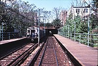


.jpg)


