Little Rock was named for a stone outcropping on the bank of the Arkansas River used by early travelers as a landmark, which marked the transition from the flat Mississippi Delta region to the Ouachita Mountain foothills.[6] It was named in 1722 by French explorer and traderJean-Baptiste Bénard de la Harpe.[7] Travelers referred to the area as the "Little Rock". Though there was an effort to officially name the city "Arkopolis" upon its founding in the 1820s, and that name did appear on a few maps made by the US Geological Survey, the name Little Rock is eventually what stuck.[8][9][10]
The territorial capitol had been located at Arkansas Post in Southeast Arkansas since 1819, but the site had proven unsuitable as a settlement due to frequent flooding of the Arkansas River. Over the years, the "little rock" was known as a waypoint along the river, but remained unsettled. A land speculator from St. Louis, Missouri who had acquired many acres around the "little rock" began pressuring the Arkansas territorial legislature in February 1820 to move the capital to the site, but the representatives could not decide between Little Rock or Cadron (now Conway), which was the preferred site of Territorial GovernorJames Miller. The issue was tabled until October 1820, by which time most of the legislators and other influential men had purchased lots around Little Rock.[11] The legislature moved the capital to Little Rock, where it has remained ever since.
According to the United States Census Bureau, the city has a total area of 116.8 square miles (303 km2), of which 116.2 square miles (301 km2) is land and 0.6 square miles (1.6 km2) (0.52%) is water.
Little Rock is on the south bank of the Arkansas River in Central Arkansas. Fourche Creek and Rock Creek run through the city, and flow into the river. The western part of the city is in the foothills of the Ouachita Mountains. Northwest of the city limits are Pinnacle Mountain and Lake Maumelle, which provides Little Rock's drinking water.
The city of North Little Rock is just across the river from Little Rock, but it is a separate city. North Little Rock was once the 8th ward of Little Rock. An Arkansas Supreme Court decision on February 6, 1904, allowed the ward to merge with the neighboring town of North Little Rock. The merged town quickly renamed itself Argenta (the local name for the former 8th Ward), but returned to its original name in October 1917.[15]
Little Rock lies in the humid subtropical climate zone (Cfa), with hot, humid summers and cool winters with usually little snow. It has experienced temperatures as low as −12 °F (−24 °C), which was recorded on February 12, 1899, and as high as 114 °F (46 °C), which was recorded on August 3, 2011.[16]
Little Rock city, Arkansas – Racial and Ethnic Composition Note: the US Census treats Hispanic/Latino as an ethnic category. This table excludes Latinos from the racial categories and assigns them to a separate category. Hispanics/Latinos may be of any race.
As of the 2020 United States Census, there were 202,591 people, 80,063 households, and 45,577 families residing in the city.
2010 census
Map of racial distribution in Little Rock, 2010 U.S. Census. Each dot is 25 people: ⬤ White⬤ Black⬤ Asian⬤ Hispanic⬤ Other
As of the 2010 census, there were 193,524 people, 82,018 households, and 47,799 families residing in the city. The population density was 1,576.0 inhabitants per square mile (608.5/km2). There were 91,288 housing units at an average density of 769.1 per square mile (297.0/km2). The racial makeup of the city was 48.9% White, 42.3% Black, 0.4% Native American, 2.7% Asian, 0.08% Pacific Islander, 3.9% from other races, and 1.7% from two or more races. 6.8% of the population is Hispanic or Latino.
There were 82,018 households, of which 30.5% had children under the age of 18 living with them, 36.6% were married couples living together, 17.5% had a female householder with no husband present, and 41.7% were non-families. 34.8% of all households were made up of individuals, and 8.8% had someone living alone who was 65 years of age or older. The average household size was 2.30 and the average family size was 3.00.
In the city, the population was spread out, with 24.7% under the age of 18, 10.0% from 18 to 24, 31.7% from 25 to 44, 22.0% from 45 to 64, and 11.6% who were 65 years of age or older. The median age was 34 years. For every 100 females, there were 89.2 males. For every 100 females age 18 and over, there were 85 males.
The median income for a household in the city was $37,572, and the median income for a family was $47,446. Males had a median income of $35,689 versus $26,802 for females. The per capita income for the city was $23,209[citation needed]. 14.3% of the population is below the poverty line. Out of the total population, 20.9% of those under the age of 18 and 9.0% of those 65 and older were living below the poverty line.
In the late 1980s, Little Rock experienced a 51% increase in murder arrests of children under 17, and a 40% increase among 18- to 24-year-olds. From 1988 to 1992, murder arrests of youths under 18 increased by 256%.[28] By the end of 1992, Little Rock reached a record of 61 homicides,[29] but in 1993 surpassed it with 76.[30] It was one of the highest per-capita homicide rates in the country, placing Little Rock fifth in Money Magazine's 1994 list of most dangerous cities.[28] In July 2017, a shootout occurred at the Power Ultra Lounge nightclub in downtown Little Rock; although there were no deaths, 28 people were injured and one hospitalized. In 2021, Little Rock saw a decrease in most violent crime, but a 24% increase in homicides from 2020.[31] The 65 homicides were the third-most on record in the city. Little Rock set a new record of 81 homicides in 2022.[32]
One of the state's largest public employers, with over 10,552 employees, the University of Arkansas for Medical Sciences (UAMS) and its healthcare partners—Arkansas Children's Hospital and the Central Arkansas Veterans Healthcare System—have a total annual economic impact in Arkansas of about $5 billion. UAMS receives less than 11% of its funding from the state; it is funded by payments for clinical services (64%), grants and contracts (18%), philanthropy and other (5%), and tuition and fees (2%).
The Little Rock port is an inter-modal river port with a large industrial business complex. It is designated as Foreign Trade Zone 14. International corporations such as Danish manufacturer LM Glasfiber have established new facilities adjacent to the port.
Quapaw Quarter – start of the 20th century Little Rock consists of three National Register historic districts with at least a hundred buildings on the National Register of Historic Places.
Museums
The Arkansas Museum of Fine Arts, the state's largest cultural institution, is a museum of art and an active center for the visual and performing arts.
The Museum of Discovery features hands-on exhibits in the fields of science, history and technology.
The William J. Clinton Presidential Center includes the Clinton presidential library and the offices of the Clinton Foundation and the Clinton School of Public Service. The Library facility, designed by architect James Polshek, cantilevers over the Arkansas River, echoing Clinton's campaign promise of "building a bridge to the 21st century". The archives and library have 2 million photographs, 80 million pages of documents, 21 million e-mail messages, and nearly 80,000 artifacts from the Clinton presidency. The museum within the library showcases artifacts from Clinton's term and has a full-scale replica of the Clinton-era Oval Office. Opened on November 18, 2004, the Clinton Presidential Center cost $165 million to construct and covers 150,000 square feet (14,000 m2) within a 28-acre (113,000 m2) park.
The Historic Arkansas Museum is a regional history museum focusing primarily on the frontier time period.
The MacArthur Museum of Arkansas Military History opened in 2001, the last remaining structure of the original Little Rock Arsenal and one of the oldest buildings in central Arkansas, it was the birthplace of General Douglas MacArthur who went on to be the supreme commander of US forces in the South Pacific during World War II.
The Old State House Museum is a former state capitol building now home to a history museum focusing on Arkansas's recent history.
The Mosaic Templars Cultural Center is a nationally accredited, state-funded museum and cultural center focusing on African American history and culture in Arkansas.
The ESSE Purse Museum illustrates the stories of American women's lives during the 1900s through their handbags and the day-to-day items carried in them
The Little Rock Central High School is still a functioning high school but contains a museum, visitors center, and park on the school grounds.
Music and theater
Founded in 1976, the Arkansas Repertory Theatre is the state's largest nonprofit professional theatre company. A member of the League of Resident Theatres (LORT D), The Rep has produced more than 300 productions, including 40 world premieres, in its building in downtown Little Rock. Producing Artistic Director John Miller-Stephany leads a resident staff of designers, technicians and administrators in eight to ten productions for an annual audience in excess of 70,000 for MainStage productions, educational programming and touring. The Rep produces works from contemporary comedies and dramas to world premiers and the classics of dramatic literature.
Little Rock's War Memorial Stadium hosts at least one University of Arkansas Razorback football game each year. The stadium is known for being in the middle of a golf course. Each fall, the city closes the golf course on Razorback football weekends to allow the estimated 80,000 people who attend take part in tailgating activities. War Memorial also hosts the Arkansas High School football state championships, and starting in the fall of 2006 hosts one game apiece for the University of Central Arkansas and the University of Arkansas at Pine Bluff. Arkansas State University also plays at the stadium from time to time.
Little Rock was a host of the First and Second Rounds of the 2008 NCAA men's basketball tournament. It has also been a host of the SEC women's basketball tournament.
Little Rock is home to the Grande Maumelle Sailing Club. Established in 1959, the club hosts multiple regattas during the year on both Lake Maumelle and the Arkansas River.
Little Rock is also home to the Little Rock Marathon, held on the first Saturday of March every year since 2003. The marathon features the world's largest medal given to marathon participants.[42]
The Arkansas River Trail runs 17 miles (27 km) along both sides of the Arkansas River through a portion of Little Rock, including over the Big Dam Bridge, the longest pedestrian/bicycle bridge in North America that has never been used by trains or motor vehicles at 4,226 feet (1,288 m).
Little Rock Zoo, founded in 1926, consists of at least 725 animals and over 200 species.[46]
The city has operated under the city manager form of government since November 1957. In 1993, voters approved changes from seven at-large city directors (who rated the position of mayor among themselves) to a popularly elected mayor, seven ward directors and three at-large directors. The position of mayor remained a part-time position until August 2007. At that point, voters approved making the mayor's position a full-time position with veto power, while a vice mayor is selected by and among members of the city board. The current mayor, elected in November 2018, is Frank Scott Jr., a former assistant bank executive, pastor and state highway commissioner. The city manager is Bruce T. Moore, the longest-serving city manager in Little Rock history.[47] The city employs over 2,500 people in 14 different departments, including the police department, the fire department, parks and recreation, and the zoo.
Most Pulaski County government offices are in Little Rock, including the Quorum, Circuit, District, and Juvenile Courts; and the Assessor, County Judge, County Attorney, and Public Defender's offices.
A pair of smaller, historically black colleges, Arkansas Baptist College and Philander Smith College, affiliated with the United Methodist Church, are also in Little Rock. Located in downtown is the Clinton School of Public Service, a branch of the University of Arkansas System, which offers master's degrees in public service. Pulaski Technical College has two locations in Little Rock. The Pulaski Technical College Little Rock-South site houses programs in automotive technology, collision repair technology, commercial driver training, diesel technology, small engine repair technology and motorcycle/all-terrain vehicle repair technology. The Pulaski Technical College Culinary Arts and Hospitality Management Institute and The Finish Line Cafe are also in Little Rock-South. There is a Missionary Baptist Seminary in Little Rock associated with the American Baptist Association. The school began as Missionary Baptist College in Sheridan in Grant County.
The Arkansas Democrat Gazette is the largest newspaper in the city, as well as the state. As of March 31, 2006, Sunday circulation is 275,991 copies, while daily (Monday-Saturday) circulation is 180,662, according to the Audit Bureau of Circulations. The monthly magazine Arkansas Life, part of the newspaper's niche publications division, began publication in September 2008. From 2007 to 2015, the newspaper also published the free tabloid Sync Weekly. Beginning in 2020, the ADG ceased weekday publication of the newspaper and moved to an exclusive online version. The only physical newspaper the Democrat-Gazette now publishes is a Sunday edition.[52]
The Daily Record provides daily legal and real estate news each weekday. Healthcare news covered by Healthcare Journal of Little Rock. Entertainment and political coverage is provided weekly in Arkansas Times. Business and economics news is published weekly in Arkansas Business. Entertainment, Political, Business, and Economics news is published Monthly in "Arkansas Talks".
In addition to area newspapers, the Little Rock market is served by a variety of magazines covering diverse interests. The publications are:
At Home in Arkansas
AY Magazine
Inviting Arkansas
Little Rock Family
Little Rock Soiree
RealLIVING
Television
Many television networks have local affiliates in Little Rock, in addition to numerous independent stations. As for cable TV services, Comcast has a monopoly over Little Rock and much of Pulaski County. Some suburbs have the option of having Comcast, Charter or other cable companies.
Television stations in the Little Rock area include:
Two primary Interstate Highways and four auxiliary Interstates serve Little Rock. Interstate 40 (I-40) passes through North Little Rock to the north, and I-30 enters the city from the south, ending at I-40 in the north of the Arkansas River. Shorter routes designed to accommodate the flow of urban traffic across town include I-430, which bypasses the city to the west, I-440, which serves the eastern part of Little Rock including Clinton National Airport, and I-630 which runs east–west through the city, connecting west Little Rock with the central business district. I-530 runs southeast to Pine Bluff as a spur route.[53]U.S. Route 70 parallels I-40 into North Little Rock before multiplexing with I-30. US 67 and US 167 share the same route from the northeast before splitting. US 67 and US 70 multiplex with I-30 to the southwest. US 167 multiplexes with US 65 and I-530 to the southeast.
Map of Little Rock Railway and Electric Company c. 1907
Rock Region Metro, which until 2015 was named the Central Arkansas Transit Authority (CATA), provide public bus service within the city. As of January 2010, CATA operated 23 regular fixed routes, 3 express routes, as well as special events shuttle buses and paratransit service for disabled persons.[citation needed] Of the 23 fixed-route services, 16 offer daily service, 6 offer weekday service with limited service on Saturday, and one route runs exclusively on weekdays. The three express routes run on weekday mornings and afternoons. Since November 2004, Rock Region Metro's Metro Streetcar system (formerly the River Rail Electric Streetcar) has served downtown Little Rock and North Little Rock. The Streetcar is a 3.4-mile (5.5 km)-long heritage streetcar system that runs from the North Little Rock City Hall and throughout downtown Little Rock before it crosses over to the William J. Clinton Presidential Library. The streetcar line has fourteen stops and a fleet of five cars with a daily ridership of around 350.
Greyhound Lines serves Dallas and Memphis, as well as intermediate points, with numerous connections to other cities and towns. Jefferson Lines serves Fort Smith, Kansas City, and Oklahoma City, as well as intermediate points, with numerous connections to other cities and towns. These carriers operate out of the North Little Rock bus station.
Amtrak serves the city twice daily via the Texas Eagle, with northbound service to Chicago and southbound service to San Antonio, as well as numerous intermediate points. Through service to Los Angeles and intermediate points operates three times a week. The train carries coaches, a sleeping car, a dining car, and a Sightseer Lounge car. Reservations are required.
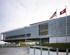
Six airlines serve 16 national gateway cities from Clinton National Airport. In 2006 they carried approximately 2.1 million passengers on approximately 116 daily flights to and from Little Rock.
Modal characteristics
According to the 2016 American Community Survey, 82.9 percent of working Little Rock residents commuted by driving alone, 8.9 percent carpooled, 1.1 percent used public transportation, and 1.8 percent walked. About 1.3 percent commuted by all other means of transportation, including taxi, bicycle, and motorcycle. About 4 percent worked out of the home.[54]
In 2015, 8.2 percent of city of Little Rock households were without a car, which increased slightly to 8.9 percent in 2016. The national average was 8.7 percent in 2016. Little Rock averaged 1.58 cars per household in 2016, compared to a national average of 1.8 per household.[55]
The City of Little Rock and the surrounding area are serviced by Metropolitan Emergency Medical Services (MEMS), a public, non-profit, public utility model[56] ambulance service.[57]
In the early years of EMS, the city of Little Rock was serviced by multiple ambulance services. Subsequently, patient care was overshadowed by profit. A walk-out of one of the two services, Medic Vac, led to the creation of the Little Rock Ambulance Authority and MEMS in 1984.[58][59]
^Mean monthly maxima and minima (i.e. the expected highest and lowest temperature readings at any point during the year or given month) calculated based on data at said location from 1991 to 2020.
^Official records for Little Rock began on 1 July 1879 at the State Capitol and maintained there until 30 April 1942. The next day, and until 7 August 1942, temperature and precipitation were recorded separately at two different locations in and around Little Rock, and the official climatology station has been Adams Field since 8 August 1942. For more information, see Threadex
^"The Hyde Park Historical Record". Hyde Park Historical Society. December 29, 2017. Archived from the original on May 9, 2021. Retrieved November 15, 2020 – via Google Books.
^Graeme Cope, "'A Thorn in the Side'? The Mothers' League of Central High School and the Little Rock Desegregation Crisis of 1957", Arkansas Historical Quarterly (1998) 57#2 pp: 160–190 in JSTOR
^Pierce, Michael (2011). "Historians of the Central High Crisis and Little Rock's Working-Class Whites: A Review Essay". Arkansas Historical Quarterly. 70 (4): 468–483. JSTOR23188020.
^Mary L. Dudziak, "The Little Rock Crisis and Foreign Affairs: Race, Resistance, and the Image of American Democracy", Southern California Law Review 70 (1996) pp: 1641–1716.
^General Highway Map, Pulaski County, Arkansas(PDF) (Map). 1:62500. Cartography by Planning and Research Department. Arkansas State Highway and Transportation Department. December 22, 2011. Archived(PDF) from the original on July 7, 2011. Retrieved March 9, 2013.
O'Donnell, William W. (1987). The Civil War Quadrennium: A Narrative History of Day-to-Day Life in Little Rock, Arkansas During the American War Between Northern and Southern States 1861-1865 (2nd ed.). Little Rock, Ark.: Civil War Round Table of Arkansas. LCCN85-72643 – via Horton Brothers Printing Company.
Redefining the Color Line: Black Activism in Little Rock, Arkansas, 1940-1970, John A. Kirk, 2002.


.jpg)
.png)

.jpg)


.jpg)

