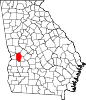
City in Georgia, United States
Buena Vista ( BEW-nə VIS-tə) is a city in Marion County, Georgia, United States. It is part of the Columbus, Georgia-Alabama metropolitan statistical area. The population was 1,585 at the 2020 census,[2] down from 2,173 in 2010. Formerly known as "Pea Ridge", the city changed its name to Buena Vista in honor of Zachary Taylor's victory in the Mexican–American War.[5][6] The city is the county seat of Marion County.[7] It is the birthplace of baseball legend Josh Gibson and Medal of Honor recipient Luther H. Story.
History
Buena Vista was first settled in 1818 by settlers from Georgia. A postal office was established in 1837, and it was incorporated as a town. In 1850, the seat of Marion County was transferred to Buena Vista from Tazewell. Buena Vista was incorporated as a city in 1891, and again in 1920. In 1906, a major fire destroyed much of Buena Vista, however it was rebuilt with brick soon after. Following the fire, the town received an influx of European immigrants.[8][9]
Geography
Buena Vista is in central Marion County in western Georgia. Georgia State Routes 26 and 41 cross in the center of town. SR 26 leads west 16 miles (26 km) to Cusseta and southeast 14 miles (23 km) to Ellaville, while SR 41 leads north 19 miles (31 km) to Geneva and south 19 miles (31 km) to Preston. State Route 137 leads northeast 6 miles (10 km) to Tazewell and west-northwest 7 miles (11 km) to Union.[citation needed]
According to the United States Census Bureau, Buena Vista has a total area of 3.3 square miles (8.5 km2), of which 0.06 square miles (0.16 km2), or 1.68%, are water.[1] The city is part of the Flint River watershed. Sitting atop a ridge, it is drained by three separate stream systems. To the northeast is Oochee Creek, an east-flowing tributary of Buck Creek, which runs to the Flint River at Montezuma. The southeast part of the city drains to Muckalee Creek, which joins the Flint River at Albany. The west side of Buena Vista drains to Peacock Ditch, a tributary of Kinchafoonee Creek, which joins Muckalee Creek at Albany.[citation needed]
Demographics
Historical population
| Census | Pop. | Note | %± |
|---|
| 1850 | 530 | | — |
|---|
| 1870 | 525 | | — |
|---|
| 1880 | 529 | | 0.8% |
|---|
| 1890 | 788 | | 49.0% |
|---|
| 1900 | 1,161 | | 47.3% |
|---|
| 1910 | 1,016 | | −12.5% |
|---|
| 1920 | 1,230 | | 21.1% |
|---|
| 1930 | 1,097 | | −10.8% |
|---|
| 1940 | 1,161 | | 5.8% |
|---|
| 1950 | 1,428 | | 23.0% |
|---|
| 1960 | 1,574 | | 10.2% |
|---|
| 1970 | 1,486 | | −5.6% |
|---|
| 1980 | 1,544 | | 3.9% |
|---|
| 1990 | 1,472 | | −4.7% |
|---|
| 2000 | 1,664 | | 13.0% |
|---|
| 2010 | 2,173 | | 30.6% |
|---|
| 2020 | 1,585 | | −27.1% |
|---|
|
As of the 2020 United States census, there were 1,585 people, 722 households, and 478 families residing in the city.
Education
Marion County School District serves pre-school to grade twelve, and consists of one primary school (grades: pre-k through 5th) and a middle/high school (grades: 6th-12th).[12] The district has 108 full-time teachers and over 1,686 students.[13]
- L. K. Moss Primary School
- Marion County Middle High School—www.marion.k12.ga.us
The Marion County School District is in the process of opening a new middle/high school. The 146,000-square-foot (13,600 m2) structure will sit on 200 acres of land in the middle of the county and is scheduled to open for the 2012–13 school year.


_Buena_Vista,_GA.JPG)

.JPG)


_Buena_Vista,_GA.JPG)
_Buena_Vista,_GA.JPG)
_Buena_Vista,_GA.JPG)
_Buena_Vista,_GA.JPG)