The first non-Indigenous settlers began to move into the area from Philadelphia and Connecticut in the mid-1700s. At the time, the area was part of Luzerne County. As more and more people from Connecticut moved in, there began to be some conflict. Connecticut's original land grant gave it control of land within the northern and southern boundaries from present-day Connecticut to the Pacific Ocean. Their land grant overlapped with that of Pennsylvania. Soon fighting began between migrants from each state, resulting in the 1769–1799 Pennamite–Yankee Wars. In the end, the government of Connecticut surrendered its claim on the area.
Formation
In 1810, Susquehanna County was formed out of Luzerne County and later in 1812, Montrose was made the county seat.
Coal and early prosperity
After the Civil War, coal started to be mined. Following this, railways and roads were built into the county allowing for more people to come. At one point the county had nearly 50,000 people. Coal became, as with neighboring counties, the backbone of the economy. This boom in coal would allow for an age of prosperity in the county.
Great Depression
When the Great Depression hit, the coal industry suffered horribly. Within months, the coal industry was struggling. During World War II, the coal industry picked up again, but only for a short time. Soon after, the economy in the county failed. Many mines were closed, railways were torn apart, and the economy took a turn for the worse. Unemployment rose and population decline increased.[dubious – discuss]
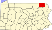
Geography
Milk Can Corners in Hallstead
According to the U.S. Census Bureau, the county has a total area of 832 square miles (2,150 km2), of which 823 square miles (2,130 km2) is land and 8.7 square miles (23 km2) (1.0%) is water.[5]
Susquehanna County is very mountainous, with large concentrations of mountains in the east and smaller, more hill-like mountains in the west. The highest mountain in the county is North Knob just west of Union Dale. Most people live in one of the several long and mostly narrow valleys. These valleys are good farming land.
The county has a warm-summer humid continental climate (Dfb) and average monthly temperatures in Montrose range from 21.2 °F in January to 67.7 °F in July.[6]
U.S. Decennial Census[7] 1790-1960[8] 1900-1990[9] 1990-2000[10] 2010-2017[1]
Susquehanna Depot Main Street
As of the census[11] of 2000, there were 42,238 people, 16,529 households, and 11,785 families residing in the county. The population density was 51 people per square mile (20 people/km2). There were 21,829 housing units at an average density of 26 units per square mile (10/km2). The racial makeup of the county was 98.54% White, 0.30% Black or African American, 0.15% Native American, 0.22% Asian, 0.01% Pacific Islander, 0.17% from other races, and 0.60% from two or more races. 0.67% of the population were Hispanic or Latino of any race. 26% were of English, 16.1% were of German, 15.1% Irish, 8.6% Italian and 7.7% Polish ancestry.
There were 16,529 households, out of which 31.90% had children under the age of 18 living with them, 57.70% were married couples living together, 8.60% had a female householder with no husband present, and 28.70% were non-families. 24.30% of all households were made up of individuals, and 11.50% had someone living alone who was 65 years of age or older. The average household size was 2.53 and the average family size was 2.99.
In the county, the population was spread out, with 25.50% under the age of 18, 6.70% from 18 to 24, 27.10% from 25 to 44, 25.20% from 45 to 64, and 15.50% who were 65 years of age or older. The median age was 40 years. For every 100 females, there were 98.90 males. For every 100 females age 18 and over, there were 95.80 males.
Clerk of Courts and Prothonotary, Jan Krupinski, Republican
Coroner, Tony Conarton, Republican
District Attorney, Marion O'Malley, Republican [16]
Recorder of Deeds and Register of Wills, Michelle Estabrook, Republican
Sheriff, Lance Benedict, Republican
Treasurer, Jason Miller, Republican
Auditor, George Starzec, Republican
Auditor, Susan Jennings, Democrat
State Representatives
Tina Pickett, Republican (110th district) - Apolacon, Auburn, Dimock, Forest Lake, Jessup, Middletown, and Rush Townships, and Little Meadows Borough
Jonathan Fritz, Republican (111th district) - Ararat, Bridgewater, Brooklyn, Choconut, Clifford, Franklin, Gibson, Great Bend, Harford, Harmony, Herrick, Jackson, Lathrop, Lenox, Liberty, New Milford, Oakland, Silver Lake, Springville, and Thompson Townships, and Friendsville, Great Bend, Hallstead, Hop Bottom, Lanesboro, Montrose, New Milford, Oakland, Susquehanna Depot, Thompson, and Union Dale Boroughs
State Senators
Lisa Baker, Republican (20th district) - Ararat, Auburn, Brooklyn, Clifford, Gibson, Great Bend, Harford, Harmony, Herrick, Jackson, Lathrop, Lenox, New Milford, Oakland, Springville, and Thompson Townships, and Forest City, Great Bend, Hallstead, Hop Bottom, Lanesboro, New Milford, Oakland, Susquehanna Depot, Thompson, and Union Dale Boroughs
Gene Yaw, Republican (23rd district) - Apolacon, Bridgewater, Choconut, Dimock, Forest Lake, Franklin, Jessup, Liberty, Middletown, Rush and Silver Lake Townships, and Friendsville, Little Meadows, and Montrose Boroughs
Since unconventional drilling for natural gas began in 2008, some say the economy has improved. [citation needed] According to the U.S. Bureau of Labor Statistics, the unemployment rate in Susquehanna County was 6.1 percent in January 2008. It has since fluctuated between a high of 11.1 percent and a low of 3.1 percent. As of January 2018, the unemployment rate was 5.7 percent.[22] After decades of population growth since the 1950s, the population in Susquehanna County has since begun to decline, concurrent with the expansion of natural gas drilling and accompanying infrastructure. Between 2010 and 2016, there was an estimated population decline of 5.8 percent. As of 2011, there were 1,079 active natural gas wells in the county which had collectively been issued 795 notices of violations by the Department of Environmental Protection of Pennsylvania.[23]
Tourism
Susquehanna County's natural environment, skiing, and small villages make it a growing tourist destination.[citation needed]
Education
Map of Susquehanna County, Pennsylvania, school districts
Public libraries
Susquehanna County Historical Society & Free Library Association
Susquehanna County's last mainline passenger train services, through New Milford and Hallstead, ended in January 1970. Since then, freight trains (presently Norfolk Southern) use the railroad line.
Map of Susquehanna County with municipalities labeled
Under Pennsylvania law, there are four types of incorporated municipalities: cities, boroughs, townships, and, in two cases at most, towns. The following boroughs and townships are located in Susquehanna County: