The confluence of the Shinmachi River and the Suketō River in Tokushima City, Tokushima Prefecture centered on the prefectural headquartersTokushima Prefectural Office
Tokushima Prefecture (徳島県, Tokushima-ken) is a prefecture of Japan located on the island of Shikoku.[2] Tokushima Prefecture has a population of 728,633 (1 October 2019) and has a geographic area of 4,146 km2 (1,601 sq mi). Tokushima Prefecture borders Kagawa Prefecture to the north, Ehime Prefecture to the west, and Kōchi Prefecture to the southwest.
In ancient times, Tokushima City belonged to a region known as Myōdō-gun. In the first wave of government consolidation following the abolishment of the fiefdom system and construction of prefectures in 1871, it became known as Myodo Prefecture. At the time, it included the Awa region to the south and the Awaji Island regions as well. In 1873 it further incorporated the region currently occupied by Kagawa Prefecture in its borders.
In the second wave of government consolidation, on September 5, 1875, the Sanuki Region separated to form the modern day Kagawa Prefecture. On August 21, 1876, Awaji Island separated to join Hyōgo Prefecture and the Awa region separated to form Kochi Prefecture.
On March 2, 1880, Myodo Prefecture fully separated from Kochi Prefecture to be inaugurated as Tokushima Prefecture.
Post-war
1945 August – End of World War II. The Washi no Mon gate to Tokushima Castle is destroyed by fire.
1946 December – The Nankai earthquake occurs, causing vast damage throughout the prefecture.
Tokushima depends on agriculture, forestry and fisheries. The percentage of agricultural workers and productivity is the second largest in Shikoku next to Kochi. Rice fields occupy the lower region of the Yoshino River and the small, narrow plains along the shore. Much of the remaining land is used for vegetables and flowers. The prefecture is the nation's largest supplier of cauliflower and lotus roots, and the fourth largest producer of carrots. Japanese indigo is only produced here.
Northern Tokushima's growth was accelerated by the completion of the Akashi Channel Bridge, which completes the road connection from Tokushima to Kobe. Industrial development continues around the Tokushima and Naruto districts. In particular, Itano District's Aizumi Town and Kitajima Town have experienced rapid growth, which has led to a proposed merger of the towns of Itano District into Itano City in the future.
[6] In April 2023 a school of tech entrepreneurship - the first of its kind in Japan - was opened in the Tokushima town of Kamiyama. The students, aged from 15 to 20, will be taught engineering, programming and designing, as well as business skills such as marketing. They will also learn how to pitch their business plans to investors in order to raise money.
The man behind it is Chikahiro Terada, the boss of Tokyo-based start-up Sansan, which specialises in the digitalisation of business cards. These still play a huge role in Japan's corporate world.
Agriculture
Tokushima abounds in agricultural resources and is the site of large-scale production of many different types of vegetables. The plains north of the Yoshino River are particularly fertile and the produce here is often shipped to mainland Japan in the areas around Kobe, Osaka and Kyoto. Produce from Tokushima always claims top shares in markets in the Kansai region and particularly prominent are Naruto sweet potatoes, the citrus fruit "sudachi", lotus roots and strawberries.
The lack of goods heading to Tokyo has led to a relatively low national profile for local Tokushima brands.[citation needed] To combat this, the local Tokushima government now sends the "Fresh! Tokushima" moving display about the country with its mobile kitchen set to increase general awareness of the local food available in Tokushima Prefecture.
Rice – Anan City
Naruto Sweet Potatoes – Naruto City
Corn – Ishii-cho, Yoshinogawa City East
Sudachi – All across the prefecture, but mainly in Kamiyama-cho
Bamboo Shoots – Anan City
Spring Onions – Tokushima City
Lettuce – Awa City and the north shore of the Yoshino River
Lotus roots – Naruto City
Carrots – All across the prefecture, but mainly in Aizumi-cho
Cranshaw – All across the north shore of the Yoshino River, but mainly in Itano-cho
Tokushima's prefectural symbol is a stylized combination of the hiragana for to and ku, the first two characters in the hiragana spelling of the prefecture's name.
Politics
Prefectural Governor (as elected by public vote)
1st – Goro Abe (阿部五郎 – April 16, 1947 – April 1, 1951
2nd – Kuniichi Abe (阿部邦一) – May 21, 1951 – March 30, 1955
3rd – Kikutaro Hara (原菊太郎) – April 25, 1955 – September 15, 1965
4th – Yasunobu Takeichi (武市恭信) – October 9, 1965 – October 4, 1981
5th – Shinzo Miki (三木申三) – October 5, 1981 – October 4, 1993
6th – Toshio Endo (圓藤寿穂) – October 5, 1993 – March 15, 2002
7th – Tadashi Oota (大田正) – April 30, 2002 – March 30, 2003
8th – Kamon Iizumi (飯泉嘉門) – May 18, 2003 – May 17, 2023

.jpg)


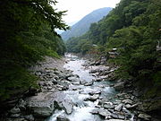 View of Iya Valley, Miyoshi
 View of Mount Tsurugi
 Onaruto-bridge and Naruto whirlpools


