County in Yunnan, People's Republic of China
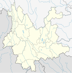
Wuding County (Chinese: 武定县; pinyin: Wǔdìng Xiàn; Chuxiong Yi script:  , IPA: /lo33 di33 bu33/) is under the administration of the Chuxiong Yi Autonomous Prefecture, in the north-central part of Yunnan province, China, bordering Sichuan province to the north. Wuding's county seat is located only 5 km from the seat of Luquan Yi and Miao Autonomous County.[1] It is a centre for titanium production.[2]
History
Wuding was historically more important, being the center of a Zhou, equivalent to a prefecture-level division. The prefecture was established in 1567. In 1953 the administrative seat of the division moved to Chuxiong.[1][2]
Administrative divisions
Wuding County has 7 towns, 3 townships and 1 ethnic township.[3]
- 7 towns
- Shishan (狮山镇)
- Gaoqiao (高桥镇)
- Maojie (猫街镇)
- Chadian (插甸镇)
|
- Bailu (白路镇)
- Wande (万德镇)
- Jiyi (己衣镇)
|
- 3 townships
- Tianxin (田心乡)
- Fawo (发窝乡)
- Huanzhou (环州乡)
- 1 ethnic township
Ethnic groups
Yi
The Wuding County Gazetteer (1990) lists the following Yi subgroups.
- Nasu 纳苏 / Black Yi 黑彝
- Naluo 纳罗 / Gan Yi 甘彝
- Naisu 乃苏 / Red Yi 红彝
- Miqie 密切 / Micha 密岔
- Luoluo 罗罗 / White Yi 白彝
- Sani 撒尼 / Minglang 明郎
Hani
In Wuding County, ethnic Hani are found in the following locations (Wuding County Gazetteer 1990:141).
- Chayiyang 扯衣咩村,[4] Ande Township 安得乡, Chadian District 插甸区
- Lower Village 下村[5] and Azhemi 阿者咪村[6] of Dacun Township 大村乡
- Zhong 中村,[7] Xia 下村, Yangliuhe 杨柳河,[8] and Aozi 凹子[9] of Huaqiao Township 花乔乡
- Shedian Village 赊甸村,[10][11][12] Laotao Township 老滔乡
According to the Chuxiong Prefecture Gazetteer (1993:411), the Luomian 罗缅, a Hani subgroup, are located in Nigagu 尼嘎古.[13]
Languages
Gao (2017)[14] lists the following languages of Wuding County. Gao (2017) classifies Geipo of Wuding County as closely related to Miqie, and is not the same as the Northern Loloish language Gepo.
| Group |
Autonym |
Language classification |
Population
|
| Nasu |
na³³su³³ pʰo³³ |
Ngwi, Northern |
28,000
|
| Aluo |
a⁵⁵lu³³ pʰu⁵⁵ |
Ngwi, Northern |
13,500
|
| Naisu |
ne⁵⁵su³³ pʰo⁵⁵ |
Ngwi, Northern |
6,000
|
| Lipo |
li³³ pʰo²¹ |
Ngwi, Central |
31,000
|
| Miqie |
mi⁵⁵tɕʰi³¹ pʰo³¹ |
Ngwi, Central |
9,000
|
| Lolo |
lo³³lo³³ pʰo²¹ |
Ngwi, Central |
8,500
|
| Geipo |
ke⁵⁵ pʰo³¹ |
Ngwi, Central |
350
|
| Hani |
xo²¹ȵi²¹ pʰɑ²¹ |
Ngwi, Southern |
800
|
| Ahmao |
a³⁵hmo³³ kləu³¹ |
Hmong, Chuanqiandian Dongdianbei |
21,000
|
| Hmong |
mɛŋ⁴⁴ kləu⁵³ |
Hmong, Chuanqiandian proper |
3,000
|
| Tai |
tai⁵⁵ |
Tai Hongjin, Yongwu |
8,000
|
![]() , IPA: /lo33 di33 bu33/) is under the administration of the Chuxiong Yi Autonomous Prefecture, in the north-central part of Yunnan province, China, bordering Sichuan province to the north. Wuding's county seat is located only 5 km from the seat of Luquan Yi and Miao Autonomous County.[1] It is a centre for titanium production.[2]
, IPA: /lo33 di33 bu33/) is under the administration of the Chuxiong Yi Autonomous Prefecture, in the north-central part of Yunnan province, China, bordering Sichuan province to the north. Wuding's county seat is located only 5 km from the seat of Luquan Yi and Miao Autonomous County.[1] It is a centre for titanium production.[2]
