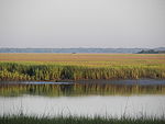
Chain of barrier islands along the coast of South Carolina, Georgia and Florida
Sea Islands Map of the Sea islands |
|
|
| Location | Atlantic Ocean |
|---|
| Total islands | Over 100 |
|---|
|
United States |
The Sea Islands are a chain of over a hundred tidal and barrier islands on the Atlantic Ocean coast of the Southeastern United States, between the mouths of the Santee and St. Johns rivers along South Carolina, Georgia and Florida. The largest is Johns Island, South Carolina. Sapelo Island is home to the Gullah people and all islands are acutely threatened by sea level rise due to climate change.[1]
History
Settled by indigenous cultures thousands of years ago, the islands were selected by Spanish colonists as sites for founding of colonial missions. Historically the Spanish influenced the Guale and Mocama chiefdoms by establishing Christian missions in their major settlements, from St. Catherine's Island south to Fort George Island (at present-day Jacksonville, Florida).[2] The area was home to multiple plantations; in 1863 Fanny Kemble published Journal of a Residence on a Georgian Plantation in 1838–1839 about her experience on her husband's plantations in St. Simon's Island and Butler Island.[3]
The Sea Islands were known historically for the production of Sea Island cotton.
After President Abraham Lincoln's Emancipation Proclamation became effective on January 1, 1863, more than 5,000 slaves on Union-occupied islands obtained their freedom.[4]
In 1893, a deadly major hurricane struck the Sea Islands.


